<< Text Pages >> Rains Cave - Cave or Rock Shelter in England in Derbyshire
Submitted by vicky on Sunday, 18 May 2003 Page Views: 6183
Natural PlacesSite Name: Rains CaveCountry: England
NOTE: This site is 0.72 km away from the location you searched for.
County: Derbyshire Type: Cave or Rock Shelter
Map Ref: SK226553 Landranger Map Number: 119
Latitude: 53.094433N Longitude: 1.663967W
Condition:
| 5 | Perfect |
| 4 | Almost Perfect |
| 3 | Reasonable but with some damage |
| 2 | Ruined but still recognisable as an ancient site |
| 1 | Pretty much destroyed, possibly visible as crop marks |
| 0 | No data. |
| -1 | Completely destroyed |
| 5 | Superb |
| 4 | Good |
| 3 | Ordinary |
| 2 | Not Good |
| 1 | Awful |
| 0 | No data. |
| 5 | Can be driven to, probably with disabled access |
| 4 | Short walk on a footpath |
| 3 | Requiring a bit more of a walk |
| 2 | A long walk |
| 1 | In the middle of nowhere, a nightmare to find |
| 0 | No data. |
| 5 | co-ordinates taken by GPS or official recorded co-ordinates |
| 4 | co-ordinates scaled from a detailed map |
| 3 | co-ordinates scaled from a bad map |
| 2 | co-ordinates of the nearest village |
| 1 | co-ordinates of the nearest town |
| 0 | no data |
Be the first person to rate this site - see the 'Contribute!' box in the right hand menu.
Internal Links:
External Links:
Cave or Rock Shelter in Derbyshire
Have you visited this site? Please add a comment below.
You may be viewing yesterday's version of this page. To see the most up to date information please register for a free account.
")
")
Do not use the above information on other web sites or publications without permission of the contributor.
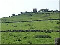
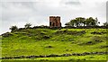
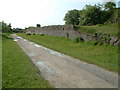
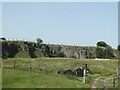
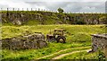
Nearby Images from Geograph Britain and Ireland:
©2023(licence)
©2023(licence)
©2005(licence)
©2023(licence)
©2023(licence)
The above images may not be of the site on this page, they are loaded from Geograph.
Please Submit an Image of this site or go out and take one for us!
Click here to see more info for this site
Nearby sites
Key: Red: member's photo, Blue: 3rd party photo, Yellow: other image, Green: no photo - please go there and take one, Grey: site destroyed
Download sites to:
KML (Google Earth)
GPX (GPS waypoints)
CSV (Garmin/Navman)
CSV (Excel)
To unlock full downloads you need to sign up as a Contributory Member. Otherwise downloads are limited to 50 sites.
Turn off the page maps and other distractions
Nearby sites listing. In the following links * = Image available
639m SW 219° Rainster Rocks* Ancient Village or Settlement (SK222548)
1.2km NE 49° Curzon Lodge Ancient Village or Settlement (SK235561)
1.3km ESE 107° Round Low (Brassington)* Round Barrow(s) (SK2388854905)
1.4km SSE 163° Brassington Moor Stone Circle (SK230540)
1.4km NNW 327° Galley Low* Round Barrow(s) (SK218565)
1.6km E 94° Harborough Cave* Cave or Rock Shelter (SK242552)
1.7km E 94° Harborough Rocks* Ancient Village or Settlement (SK2427455185)
1.8km NE 47° Moot Lowe Round Barrow(s) (SK23935656)
2.2km SE 137° Carsington Pasture* Cave or Rock Shelter (SK24155368)
2.4km NNW 331° Rockhurst Long Barrow (SK214574)
2.5km WNW 299° Roystone Grange 2 Round Barrow(s) (SK204565)
2.6km NW 320° Minning Low* Round Cairn (SK2093557290)
2.6km NNW 344° Stoney Low* Chambered Cairn (SK21855784)
2.8km NNE 13° Green Low (Aldwark)* Chambered Cairn (SK232580)
2.8km NW 310° Roystone Grange 1 Round Barrow(s) (SK204571)
2.9km SW 217° Bradbourne Stone* Standing Stone (Menhir) (SK209530)
3.1km E 88° Round Low (Hopton) Round Barrow(s) (SK2572955426)
3.1km SSE 166° The Stoup* Standing Stone (Menhir) (SK2335852257)
3.2km SW 214° All Saints (Bradbourne)* Ancient Cross (SK2082052660)
3.5km ESE 105° Ivet Low* Round Barrow(s) (SK2596254396)
4.3km SSE 157° Stones Island* Modern Stone Circle etc (SK243514)
4.4km W 273° Foufinside stones* Standing Stones (SK1818655507)
4.4km SSW 209° Wigber Low* Round Barrow(s) (SK205514)
4.6km SSW 196° Stand Low Kniveton* Round Barrow(s) (SK21335085)
4.7km NE 46° Horsedale Standing Stone* Standing Stone (Menhir) (SK2601558596)
View more nearby sites and additional images


 We would like to know more about this location. Please feel free to add a brief description and any relevant information in your own language.
 Wir möchten mehr über diese Stätte erfahren. Bitte zögern Sie nicht, eine kurze Beschreibung und relevante Informationen in Deutsch hinzuzufügen.
 Nous aimerions en savoir encore un peu sur les lieux. S'il vous plaît n'hesitez pas à ajouter une courte description et tous les renseignements pertinents dans votre propre langue.
 Quisieramos informarnos un poco más de las lugares. No dude en añadir una breve descripción y otros datos relevantes en su propio idioma.