<< Other Photo Pages >> North Sunderland Cists - Cist in England in Northumberland
Submitted by durhamnature on Friday, 05 October 2012 Page Views: 2142
Neolithic and Bronze AgeSite Name: North Sunderland Cists Alternative Name: ERA-681; Beckensall 359Country: England County: Northumberland Type: Cist
Nearest Town: Seahouses Nearest Village: North Sunderland
Map Ref: NU21603202
Latitude: 55.581356N Longitude: 1.658931W
Condition:
| 5 | Perfect |
| 4 | Almost Perfect |
| 3 | Reasonable but with some damage |
| 2 | Ruined but still recognisable as an ancient site |
| 1 | Pretty much destroyed, possibly visible as crop marks |
| 0 | No data. |
| -1 | Completely destroyed |
| 5 | Superb |
| 4 | Good |
| 3 | Ordinary |
| 2 | Not Good |
| 1 | Awful |
| 0 | No data. |
| 5 | Can be driven to, probably with disabled access |
| 4 | Short walk on a footpath |
| 3 | Requiring a bit more of a walk |
| 2 | A long walk |
| 1 | In the middle of nowhere, a nightmare to find |
| 0 | No data. |
| 5 | co-ordinates taken by GPS or official recorded co-ordinates |
| 4 | co-ordinates scaled from a detailed map |
| 3 | co-ordinates scaled from a bad map |
| 2 | co-ordinates of the nearest village |
| 1 | co-ordinates of the nearest town |
| 0 | no data |
Internal Links:
External Links:
")
Pastscape site number 8326
For basic information on the rock art panel, see England's Rock Art entry for ERA-681 Seafield Farm, Seahouses, which contains Beckensall's Archive Notes.
The original Beckensall record can be found at Internet Archive: Beckensall 359 Seafield Farm, Seahouses, which records: "In 1905/06: A stone, having four concentric circles incised on it, was found buried near the tombs. It is now at Seafield Farm House. The original length was about 4'6". The markings are very rough, and the stone partly broken ….. The whereabouts of the stone are not know, but there have been heard rumours that there is a rock with motifs in a garden in Seahouses, but no more than that is known."
You may be viewing yesterday's version of this page. To see the most up to date information please register for a free account.
")
Do not use the above information on other web sites or publications without permission of the contributor.
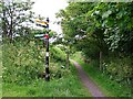
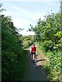
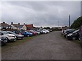
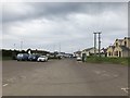
Nearby Images from Geograph Britain and Ireland:
©2011(licence)
©2017(licence)
©2015(licence)

©2012(licence)
©2018(licence)
The above images may not be of the site on this page, they are loaded from Geograph.
Please Submit an Image of this site or go out and take one for us!
Click here to see more info for this site
Nearby sites
Key: Red: member's photo, Blue: 3rd party photo, Yellow: other image, Green: no photo - please go there and take one, Grey: site destroyed
Download sites to:
KML (Google Earth)
GPX (GPS waypoints)
CSV (Garmin/Navman)
CSV (Excel)
To unlock full downloads you need to sign up as a Contributory Member. Otherwise downloads are limited to 50 sites.
Turn off the page maps and other distractions
Nearby sites listing. In the following links * = Image available
731m SW 235° North Sunderland (Seahouses) Rock Art (NU2100031600)
2.5km SSE 147° Beadnell Caravan Park Rock Art (NU2300029900)
3.8km SE 146° Benthall Round Cairn* Cairn (NU2371528908)
4.0km NW 312° Bamburgh Barrow 2* Round Barrow(s) (NU18633464)
4.0km N 3° St. Cuthbert's Well (Farne Islands)* Holy Well or Sacred Spring (NU21783599)
4.0km NW 308° Bamburgh Barrow 1* Round Barrow(s) (NU1841634486)
4.1km SE 145° St Ebba's Chapel* Ancient Cross (NU2396428707)
4.4km NW 314° Bamburgh Castle* Sculptured Stone (NU1837335053)
4.5km NW 308° Leper's Well (Bamburgh)* Holy Well or Sacred Spring (NU18053475)
4.5km S 180° Long Nanny* Standing Stone (Menhir) (NU21632748)
4.6km NW 309° St Aidan's Well (Bamburgh)* Holy Well or Sacred Spring (NU1803234914)
4.8km NW 308° St Aidan's Church (Bamburgh)* Early Christian Sculptured Stone (NU1784334964)
5.5km S 183° Tughall Chapel* Ancient Cross (NU2132026540)
6.0km WSW 249° Bradford Kaims Ancient Mine, Quarry or other Industry (NU16022980)
6.5km WSW 255° St Hilda's Church (Lucker)* Ancient Cross (NU15303033)
6.7km WNW 287° Spindlestone Hill Fort* Hillfort (NU152339)
7.7km SSW 213° St Maurice's Well (Ellingham)* Holy Well or Sacred Spring (NU17452553)
7.8km SW 217° Ellingham a & d Rock Art (NU1691025790)
7.8km SW 217° Ellingham b & c Rock Art (NU1686025750)
9.3km WSW 242° Isabella's Mount Camp Hillfort (NU13372757)
10.4km SW 229° Wandylaw G Rock Art (NU1380125116)
10.4km SW 229° Wandylaw D Rock Art (NU1379325112)
10.4km SW 229° Wandylaw B Rock Art (NU1379525109)
10.4km SW 229° Wandylaw E* Rock Art (NU1379425109)
10.4km SW 229° Wandylaw F* Rock Art (NU1380325081)
View more nearby sites and additional images


 We would like to know more about this location. Please feel free to add a brief description and any relevant information in your own language.
 Wir möchten mehr über diese Stätte erfahren. Bitte zögern Sie nicht, eine kurze Beschreibung und relevante Informationen in Deutsch hinzuzufügen.
 Nous aimerions en savoir encore un peu sur les lieux. S'il vous plaît n'hesitez pas à ajouter une courte description et tous les renseignements pertinents dans votre propre langue.
 Quisieramos informarnos un poco más de las lugares. No dude en añadir una breve descripción y otros datos relevantes en su propio idioma.