<< Text Pages >> Ravensworth enclosure - Ancient Village or Settlement in England in Tyne and Wear
Submitted by durhamnature on Sunday, 19 August 2012 Page Views: 2941
Multi-periodSite Name: Ravensworth enclosureCountry: England
NOTE: This site is 1.614 km away from the location you searched for.
County: Tyne and Wear Type: Ancient Village or Settlement
Nearest Town: Gateshead Nearest Village: Ravensworth
Map Ref: NZ232590
Latitude: 54.925154N Longitude: 1.639535W
Condition:
| 5 | Perfect |
| 4 | Almost Perfect |
| 3 | Reasonable but with some damage |
| 2 | Ruined but still recognisable as an ancient site |
| 1 | Pretty much destroyed, possibly visible as crop marks |
| 0 | No data. |
| -1 | Completely destroyed |
| 5 | Superb |
| 4 | Good |
| 3 | Ordinary |
| 2 | Not Good |
| 1 | Awful |
| 0 | No data. |
| 5 | Can be driven to, probably with disabled access |
| 4 | Short walk on a footpath |
| 3 | Requiring a bit more of a walk |
| 2 | A long walk |
| 1 | In the middle of nowhere, a nightmare to find |
| 0 | No data. |
| 5 | co-ordinates taken by GPS or official recorded co-ordinates |
| 4 | co-ordinates scaled from a detailed map |
| 3 | co-ordinates scaled from a bad map |
| 2 | co-ordinates of the nearest village |
| 1 | co-ordinates of the nearest town |
| 0 | no data |
Internal Links:
External Links:
Ancient Village or Settlement in Tyne and Wear
Tyne and Wear HER 339
Crop mark of a ditched enclosure with three internal circular structures and internal and external tracks.
In field south of castle ruin, no public access. Visible on most aerial photos.
You may be viewing yesterday's version of this page. To see the most up to date information please register for a free account.
Do not use the above information on other web sites or publications without permission of the contributor.
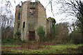
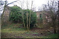
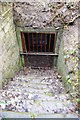
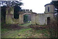
Nearby Images from Geograph Britain and Ireland:
©2011(licence)
©2011(licence)
©2011(licence)
©2011(licence)
©2011(licence)
The above images may not be of the site on this page, they are loaded from Geograph.
Please Submit an Image of this site or go out and take one for us!
Click here to see more info for this site
Nearby sites
Key: Red: member's photo, Blue: 3rd party photo, Yellow: other image, Green: no photo - please go there and take one, Grey: site destroyed
Download sites to:
KML (Google Earth)
GPX (GPS waypoints)
CSV (Garmin/Navman)
CSV (Excel)
To unlock full downloads you need to sign up as a Contributory Member. Otherwise downloads are limited to 50 sites.
Turn off the page maps and other distractions
Nearby sites listing. In the following links * = Image available
2.2km WNW 303° Marshall Lands enclosure Ancient Village or Settlement (NZ213602)
4.5km WNW 298° Dam Head enclosure Ancient Village or Settlement (NZ192611)
4.5km WNW 283° Hollinside Farm 1 Rock Art (NZ1875260003)
4.9km NW 306° Axwell Park Barrow* Round Barrow(s) (NZ19196188)
4.9km N 352° Elswick Road Cist Cist (NZ225639)
5.0km NNE 20° White Friar Tower Cist Cist (NZ24876368)
5.0km WNW 289° Copers Wood earthwork, Winlaton Mill* Ancient Village or Settlement (NZ18456061)
5.1km ESE 107° Sheddons Hill and Spring* Holy Well or Sacred Spring (NZ28125755)
5.3km NNE 22° Cale Cross (Newcastle)* Ancient Cross (NZ25206392)
5.3km NNE 20° St Nicholas's Cathedral (Newcastle)* Ancient Cross (NZ2498664008)
5.4km NNE 15° White Cross (Newcastle)* Ancient Cross (NZ24586426)
5.6km NNE 14° St Andrew's Church (Gallowgate)* Early Christian Sculptured Stone (NZ2453564409)
5.6km W 270° Lady Well, Gibside* Holy Well or Sacred Spring (NZ17575895)
5.7km W 268° Gibside Mound* Artificial Mound (NZ17515877)
6.3km NNE 13° The Museum of Antiquities* Museum (NZ246651)
6.4km NNE 15° Great North Museum (Anglo Saxon Stones)* Museum (NZ2485065160)
6.4km NNE 15° Great North Museum (Rock Art)* Museum (NZ2485365162)
6.4km NNE 15° Great North Museum* Museum (NZ2485565168)
6.4km NNE 15° The Ponteland Boulder* Rock Art (NZ24816518)
6.8km NNE 13° Exhibition Park Circle* Modern Stone Circle etc (NZ2476265651)
7.1km NW 309° Summerhill Cists* Cist (NZ176634)
7.2km NNE 23° Villa Reale cist, Jesmond* Cist (NZ26006562)
7.4km SE 140° North Lodge Cursus Cursus (NZ280533)
8.0km NNE 20° St. Mary's Well (Jesmond)* Holy Well or Sacred Spring (NZ2584366508)
8.0km NW 307° Stella enclosure Ancient Village or Settlement (NZ168638)
View more nearby sites and additional images


 We would like to know more about this location. Please feel free to add a brief description and any relevant information in your own language.
 Wir möchten mehr über diese Stätte erfahren. Bitte zögern Sie nicht, eine kurze Beschreibung und relevante Informationen in Deutsch hinzuzufügen.
 Nous aimerions en savoir encore un peu sur les lieux. S'il vous plaît n'hesitez pas à ajouter une courte description et tous les renseignements pertinents dans votre propre langue.
 Quisieramos informarnos un poco más de las lugares. No dude en añadir una breve descripción y otros datos relevantes en su propio idioma.