<< Our Photo Pages >> Plaitford Barrow - Round Barrow(s) in England in Hampshire
Submitted by weeblewobble on Saturday, 20 March 2010 Page Views: 4460
Neolithic and Bronze AgeSite Name: Plaitford BarrowCountry: England County: Hampshire Type: Round Barrow(s)
Map Ref: SU27901852
Latitude: 50.965430N Longitude: 1.604071W
Condition:
| 5 | Perfect |
| 4 | Almost Perfect |
| 3 | Reasonable but with some damage |
| 2 | Ruined but still recognisable as an ancient site |
| 1 | Pretty much destroyed, possibly visible as crop marks |
| 0 | No data. |
| -1 | Completely destroyed |
| 5 | Superb |
| 4 | Good |
| 3 | Ordinary |
| 2 | Not Good |
| 1 | Awful |
| 0 | No data. |
| 5 | Can be driven to, probably with disabled access |
| 4 | Short walk on a footpath |
| 3 | Requiring a bit more of a walk |
| 2 | A long walk |
| 1 | In the middle of nowhere, a nightmare to find |
| 0 | No data. |
| 5 | co-ordinates taken by GPS or official recorded co-ordinates |
| 4 | co-ordinates scaled from a detailed map |
| 3 | co-ordinates scaled from a bad map |
| 2 | co-ordinates of the nearest village |
| 1 | co-ordinates of the nearest town |
| 0 | no data |
Internal Links:
External Links:
I have visited· I would like to visit
weeblewobble visited on 1st Jan 2000 - their rating: Cond: 3 Amb: 4 Access: 3
weeblewobble visited - their rating: Cond: 3 Amb: 4 Access: 3
Average ratings for this site from all visit loggers: Condition: 3 Ambience: 4 Access: 3
")
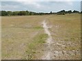
Bowl barrow on Plaitford Common, excavated in 1929 and found to have two Deverel-Rimbury urns. The barrow has a shallow ditch of 0.3m wide and diameter of 10.67m. The height of the barrow is 1.52m. The barrow has been ruined by rabbits.
You may be viewing yesterday's version of this page. To see the most up to date information please register for a free account.
")
Do not use the above information on other web sites or publications without permission of the contributor.
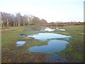
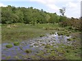
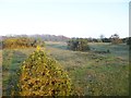
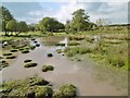
Nearby Images from Geograph Britain and Ireland:
©2014(licence)
©2007(licence)
©2014(licence)
©2015(licence)
©2015(licence)
The above images may not be of the site on this page, they are loaded from Geograph.
Please Submit an Image of this site or go out and take one for us!
Click here to see more info for this site
Nearby sites
Key: Red: member's photo, Blue: 3rd party photo, Yellow: other image, Green: no photo - please go there and take one, Grey: site destroyed
Download sites to:
KML (Google Earth)
GPX (GPS waypoints)
CSV (Garmin/Navman)
CSV (Excel)
To unlock full downloads you need to sign up as a Contributory Member. Otherwise downloads are limited to 50 sites.
Turn off the page maps and other distractions
Nearby sites listing. In the following links * = Image available
1.9km W 276° Landford Common Tumulus* Round Barrow(s) (SU260187)
2.6km SSE 167° Stagbury Hill* Barrow Cemetery (SU285160)
3.1km W 264° Hamptworth Common Tumulus* Round Barrow(s) (SU248182)
4.2km SW 228° Black Bush Plain* Barrow Cemetery (SU248157)
5.2km SE 132° Money Hills Barrow Cemetery (SU31771505)
5.6km NE 37° Dunwood Camp Hillfort (SU313230)
5.9km SW 217° Fritham Butt* Round Barrow(s) (SU244138)
6.2km SW 233° Irons Well (Eyeworth)* Holy Well or Sacred Spring (SU22931476)
6.4km S 181° Malwood Castle Hillfort (SU278121)
6.5km SE 129° Tatchbury Mount Hillfort (SU330144)
6.6km W 265° Jacob's Barrow* Round Barrow(s) (SU21321793)
7.1km WSW 246° The Butts (Godshill)* Round Barrow(s) (SU21391565)
7.2km ESE 115° Testwood Lakes* Museum (SU344155)
7.2km SW 229° Hiscocks Hill barrow* Round Barrow(s) (SU22481371)
7.8km NNE 19° Lockerley Camp* Hillfort (SU304259)
7.9km NNW 341° Whiteparish 3 Bowl Barrow Round Barrow(s) (SU25312597)
8.4km WSW 240° Ashley Cross tumuli* Round Barrow(s) (SU20641431)
8.4km WNW 294° Templeman's Tumulus* Artificial Mound (SU202219)
9.0km WSW 241° Ashley Walk mound* Artificial Mound (SU20041413)
10.2km E 90° Toothill Camp* Hillfort (SU38151865)
10.6km S 169° New Forest Museum* Museum (SU30020813)
11.5km SSE 151° Ashurst Lodge Earthworks* Misc. Earthwork (SU336085)
11.7km WSW 254° Frankenbury* Hillfort (SU167152)
11.8km SSE 151° Matley Heath* Round Barrow(s) (SU336082)
12.1km NE 44° Stubb's Copse Round Barrow(s) (SU36362722)
View more nearby sites and additional images


 We would like to know more about this location. Please feel free to add a brief description and any relevant information in your own language.
 Wir möchten mehr über diese Stätte erfahren. Bitte zögern Sie nicht, eine kurze Beschreibung und relevante Informationen in Deutsch hinzuzufügen.
 Nous aimerions en savoir encore un peu sur les lieux. S'il vous plaît n'hesitez pas à ajouter une courte description et tous les renseignements pertinents dans votre propre langue.
 Quisieramos informarnos un poco más de las lugares. No dude en añadir una breve descripción y otros datos relevantes en su propio idioma.