<< Text Pages >> Scorton Cursus - Cursus in England in Yorkshire (North)
Submitted by EssexMan on Wednesday, 07 April 2010 Page Views: 3776
Neolithic and Bronze AgeSite Name: Scorton CursusCountry: England
NOTE: This site is 5.726 km away from the location you searched for.
County: Yorkshire (North) Type: Cursus
Nearest Town: Richmond Nearest Village: Scorton
Map Ref: SE2480499698 Landranger Map Number: 81
Latitude: 54.392162N Longitude: 1.619517W
Condition:
| 5 | Perfect |
| 4 | Almost Perfect |
| 3 | Reasonable but with some damage |
| 2 | Ruined but still recognisable as an ancient site |
| 1 | Pretty much destroyed, possibly visible as crop marks |
| 0 | No data. |
| -1 | Completely destroyed |
| 5 | Superb |
| 4 | Good |
| 3 | Ordinary |
| 2 | Not Good |
| 1 | Awful |
| 0 | No data. |
| 5 | Can be driven to, probably with disabled access |
| 4 | Short walk on a footpath |
| 3 | Requiring a bit more of a walk |
| 2 | A long walk |
| 1 | In the middle of nowhere, a nightmare to find |
| 0 | No data. |
| 5 | co-ordinates taken by GPS or official recorded co-ordinates |
| 4 | co-ordinates scaled from a detailed map |
| 3 | co-ordinates scaled from a bad map |
| 2 | co-ordinates of the nearest village |
| 1 | co-ordinates of the nearest town |
| 0 | no data |
Internal Links:
External Links:
Major Cursus in N. Yorkshire
Status: Certain
NMR No. NZ 20 SW 11
Extent: 2000mx32m
Terminal type: Square
Note: This location marks the southern terminal (end) of a cursus monument. The location of the other terminal can be found in the Nearby Site list below.
Most of this cursus has been destroyed by quarrying.
More information at the Brigantes Nation website.
You may be viewing yesterday's version of this page. To see the most up to date information please register for a free account.
Do not use the above information on other web sites or publications without permission of the contributor.
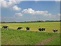
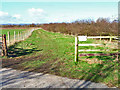
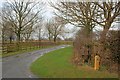
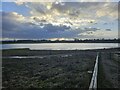
Nearby Images from Geograph Britain and Ireland:
©2009(licence)
©2006(licence)
©2011(licence)
©2024(licence)
©2012(licence)
The above images may not be of the site on this page, they are loaded from Geograph.
Please Submit an Image of this site or go out and take one for us!
Click here to see more info for this site
Nearby sites
Key: Red: member's photo, Blue: 3rd party photo, Yellow: other image, Green: no photo - please go there and take one, Grey: site destroyed
Download sites to:
KML (Google Earth)
GPX (GPS waypoints)
CSV (Garmin/Navman)
CSV (Excel)
To unlock full downloads you need to sign up as a Contributory Member. Otherwise downloads are limited to 50 sites.
Turn off the page maps and other distractions
Nearby sites listing. In the following links * = Image available
1.8km NW 313° Scorton Cursus Cursus (NZ235009)
2.1km WSW 237° Catterick henge Henge (SE23049854)
6.6km WNW 282° Scots Dyke (Easby)* Misc. Earthwork (NZ18360104)
6.9km NNW 345° Five Hills round barrow* Round Barrow(s) (NZ2293006325)
6.9km WNW 300° Scots Dyke (Olliver)* Misc. Earthwork (NZ18720309)
10.0km SW 233° St Oswald (East Hauxwell)* Ancient Cross (SE168937)
10.3km WNW 287° Coalsgarth Edge* Rock Art (NZ149027)
10.9km NNE 22° St Peter's Church (Croft-on-Tees)* Ancient Cross (NZ2887909849)
11.3km S 171° St Gregory's Church (Bedale)* Early Christian Sculptured Stone (SE266885)
12.3km NE 53° The Grey Stone (Sockburn) Marker Stone (NZ34660708)
12.6km NE 54° Conyer's Chapel Crosses* Ancient Cross (NZ34980711)
12.9km NW 313° Mainsgill Farm* Modern Stone Circle etc (NZ154085)
13.0km ESE 105° St Thomas (Brompton)* Ancient Cross (SE37379636)
13.1km ESE 115° All Saints (Northallerton)* Ancient Cross (SE36729420)
13.2km E 88° Sentry Circle* Modern Stone Circle etc (NZ3807100141)
13.7km NNW 334° Kirkbridge Farmhouse Barrow* Round Barrow(s) (NZ187120)
13.7km WNW 295° Feldom Ranges 17b* Rock Art (NZ1229205448)
13.8km NNW 333° Stanwick Crosses* Ancient Cross (NZ18511198)
13.9km WNW 294° Gayles Moor Slab Rock Art (NZ1200005300)
14.4km NNW 331° Stanwick Hillfort* Hillfort (NZ17831229)
14.5km WNW 295° Feldom Ranges 5a* Rock Art (NZ1164405835)
14.5km S 186° St Mary (Thornton Watlass)* Ancient Cross (SE2324585265)
14.6km WNW 296° Feldom Ranges 6c* Rock Art (NZ1166906063)
14.6km NNE 16° South park Stone* Natural Stone / Erratic / Other Natural Feature (NZ28851371)
14.6km NNW 331° St Cuthbert (Forcett)* Ancient Cross (NZ177125)
View more nearby sites and additional images


 We would like to know more about this location. Please feel free to add a brief description and any relevant information in your own language.
 Wir möchten mehr über diese Stätte erfahren. Bitte zögern Sie nicht, eine kurze Beschreibung und relevante Informationen in Deutsch hinzuzufügen.
 Nous aimerions en savoir encore un peu sur les lieux. S'il vous plaît n'hesitez pas à ajouter une courte description et tous les renseignements pertinents dans votre propre langue.
 Quisieramos informarnos un poco más de las lugares. No dude en añadir una breve descripción y otros datos relevantes en su propio idioma.