<< Text Pages >> Bede's Well - Holy Well or Sacred Spring in England in Northumberland
Submitted by Anne T on Wednesday, 26 April 2017 Page Views: 1874
Springs and Holy WellsSite Name: Bede's WellCountry: England
NOTE: This site is 1.796 km away from the location you searched for.
County: Northumberland Type: Holy Well or Sacred Spring
Map Ref: NZ31986415
Latitude: 54.970948N Longitude: 1.501972W
Condition:
| 5 | Perfect |
| 4 | Almost Perfect |
| 3 | Reasonable but with some damage |
| 2 | Ruined but still recognisable as an ancient site |
| 1 | Pretty much destroyed, possibly visible as crop marks |
| 0 | No data. |
| -1 | Completely destroyed |
| 5 | Superb |
| 4 | Good |
| 3 | Ordinary |
| 2 | Not Good |
| 1 | Awful |
| 0 | No data. |
| 5 | Can be driven to, probably with disabled access |
| 4 | Short walk on a footpath |
| 3 | Requiring a bit more of a walk |
| 2 | A long walk |
| 1 | In the middle of nowhere, a nightmare to find |
| 0 | No data. |
| 5 | co-ordinates taken by GPS or official recorded co-ordinates |
| 4 | co-ordinates scaled from a detailed map |
| 3 | co-ordinates scaled from a bad map |
| 2 | co-ordinates of the nearest village |
| 1 | co-ordinates of the nearest town |
| 0 | no data |
Be the first person to rate this site - see the 'Contribute!' box in the right hand menu.
Internal Links:
External Links:
Holy Well in Northumberland
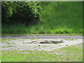
Bede's Well in Jarrow is listed on Pastscape Monument No. 26594, and is described in their 1975 report as "a holy well at Monkton known as Bede's Well where children troubled with disease or infirmity were customarily dipped. A midsummer fair was also held here. The well has been recently enclosed. Bede's Well is situated in a marshy area and no portion is visible above ground level. Only the iron railings, which have been placed around the well for protection, are visible."
Interestingly, the Pastscape information for a 1952 field investigation recorded: "the enclosure ('A' at NZ 319885 641573), which ...... surrounds Bede's Well in 1952, has been completely destroyed and the site is now covered by rubble and partly used as an unofficial rubbish tip. There is no trace of the well or even any water. At 'B' NZ 319945641643 is a brick structure (1.0m high, 2.5m E-W and 2.0m N-S) partly covered on its NE side by slopes. A manhole cover in the top of this structure reveals piped flowing water about 2.0m below. Local people say this is "Bede's Well" but it would appear to be no more than the piped drain from "Bede's Burn" which sinks in marshy ground about 50.0m to the W. As there is some 10.0m difference between this structure 'B' and the iron railing site 'A' and it is on the opposite side of the old course of "Bede's Burn" it is very doubtful if the locals are correct. Site only - no remains."
The Northern Antiquarian (TNA) record details for this holy well, see their page for Bede's Well, Hebburn, Jarrow, County Durham (although please note, Jarrow as from 1974 is now in Tyne and Wear, not County Durham). TNA give the grid reference as NZ 3214 6413, which is some 160 metres east of the official reference which is in the middle of Campbell Park. TNA give directions on how to reach the site, together with photographs and related folklore.
Note: Have you visited this site? Can you confirm the grid reference? Do you have any photographs or images you can add?
You may be viewing yesterday's version of this page. To see the most up to date information please register for a free account.
Do not use the above information on other web sites or publications without permission of the contributor.
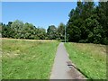
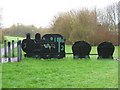
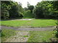
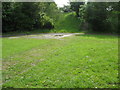
Nearby Images from Geograph Britain and Ireland:
©2021(licence)
©2010(licence)
©2009(licence)
©2009(licence)
©2009(licence)
The above images may not be of the site on this page, they are loaded from Geograph.
Please Submit an Image of this site or go out and take one for us!
Click here to see more info for this site
Nearby sites
Key: Red: member's photo, Blue: 3rd party photo, Yellow: other image, Green: no photo - please go there and take one, Grey: site destroyed
Download sites to:
KML (Google Earth)
GPX (GPS waypoints)
CSV (Garmin/Navman)
CSV (Excel)
To unlock full downloads you need to sign up as a Contributory Member. Otherwise downloads are limited to 50 sites.
Turn off the page maps and other distractions
Nearby sites listing. In the following links * = Image available
2.2km ENE 61° Jarrow* Ancient Cross (NZ3387965216)
2.2km NE 55° Bede's World (Jarrow)* Ancient Cross (NZ33756542)
6.1km WNW 284° Villa Reale cist, Jesmond* Cist (NZ26006562)
6.6km WNW 291° St. Mary's Well (Jesmond)* Holy Well or Sacred Spring (NZ2584366508)
6.8km NNW 345° Holy Stone (North Tyneside)* Ancient Cross (NZ30137066)
6.8km W 268° Cale Cross (Newcastle)* Ancient Cross (NZ25206392)
7.0km W 269° St Nicholas's Cathedral (Newcastle)* Ancient Cross (NZ2498664008)
7.1km W 267° White Friar Tower Cist Cist (NZ24876368)
7.2km W 279° Great North Museum* Museum (NZ2485565168)
7.2km W 279° Great North Museum (Rock Art)* Museum (NZ2485365162)
7.2km W 278° Great North Museum (Anglo Saxon Stones)* Museum (NZ2485065160)
7.2km W 279° The Ponteland Boulder* Rock Art (NZ24816518)
7.4km WNW 282° Exhibition Park Circle* Modern Stone Circle etc (NZ2476265651)
7.4km W 271° White Cross (Newcastle)* Ancient Cross (NZ24586426)
7.4km W 278° The Museum of Antiquities* Museum (NZ246651)
7.4km W 272° St Andrew's Church (Gallowgate)* Early Christian Sculptured Stone (NZ2453564409)
7.6km SSW 211° Sheddons Hill and Spring* Holy Well or Sacred Spring (NZ28125755)
8.3km E 89° Whitburn Lizards Cave Cave or Rock Shelter (NZ403644)
9.5km W 269° Elswick Road Cist Cist (NZ225639)
10.2km WSW 240° Ravensworth enclosure Ancient Village or Settlement (NZ232590)
10.3km SSE 162° Hasting Hill* Round Barrow(s) (NZ353544)
10.4km SE 128° St Peter's Church (Monkwearmouth)* Early Christian Sculptured Stone (NZ4016857783)
10.5km S 187° Fatfield Barrow* Round Barrow(s) (NZ30735374)
10.7km SE 134° Sunderland Museum and Winter Gardens* Museum (NZ398568)
10.8km SSE 161° Offerton Cursus Cursus (NZ356540)
View more nearby sites and additional images


 We would like to know more about this location. Please feel free to add a brief description and any relevant information in your own language.
 Wir möchten mehr über diese Stätte erfahren. Bitte zögern Sie nicht, eine kurze Beschreibung und relevante Informationen in Deutsch hinzuzufügen.
 Nous aimerions en savoir encore un peu sur les lieux. S'il vous plaît n'hesitez pas à ajouter une courte description et tous les renseignements pertinents dans votre propre langue.
 Quisieramos informarnos un poco más de las lugares. No dude en añadir una breve descripción y otros datos relevantes en su propio idioma.