<< Our Photo Pages >> The Lady's Well (Oxfordshire) - Holy Well or Sacred Spring in England in Oxfordshire
Submitted by DavidCWoods on Monday, 05 July 2004 Page Views: 12218
Springs and Holy WellsSite Name: The Lady's Well (Oxfordshire)Country: England County: Oxfordshire Type: Holy Well or Sacred Spring
Nearest Town: Finstock Nearest Village: Wilcote
Map Ref: SP374148 Landranger Map Number: 164
Latitude: 51.830569N Longitude: 1.458677W
Condition:
| 5 | Perfect |
| 4 | Almost Perfect |
| 3 | Reasonable but with some damage |
| 2 | Ruined but still recognisable as an ancient site |
| 1 | Pretty much destroyed, possibly visible as crop marks |
| 0 | No data. |
| -1 | Completely destroyed |
| 5 | Superb |
| 4 | Good |
| 3 | Ordinary |
| 2 | Not Good |
| 1 | Awful |
| 0 | No data. |
| 5 | Can be driven to, probably with disabled access |
| 4 | Short walk on a footpath |
| 3 | Requiring a bit more of a walk |
| 2 | A long walk |
| 1 | In the middle of nowhere, a nightmare to find |
| 0 | No data. |
| 5 | co-ordinates taken by GPS or official recorded co-ordinates |
| 4 | co-ordinates scaled from a detailed map |
| 3 | co-ordinates scaled from a bad map |
| 2 | co-ordinates of the nearest village |
| 1 | co-ordinates of the nearest town |
| 0 | no data |
Internal Links:
External Links:
I have visited· I would like to visit
CarolineWeston would like to visit
 (PID:8015)")
.
You may be viewing yesterday's version of this page. To see the most up to date information please register for a free account.
 (PID:8017)")
Do not use the above information on other web sites or publications without permission of the contributor.
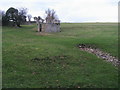
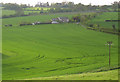
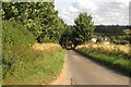
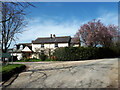
Nearby Images from Geograph Britain and Ireland:
©2012(licence)
©2005(licence)
©2013(licence)
©2021(licence)
©2019(licence)
The above images may not be of the site on this page, they are loaded from Geograph.
Please Submit an Image of this site or go out and take one for us!
Click here to see more info for this site
Nearby sites
Key: Red: member's photo, Blue: 3rd party photo, Yellow: other image, Green: no photo - please go there and take one, Grey: site destroyed
Download sites to:
KML (Google Earth)
GPX (GPS waypoints)
CSV (Garmin/Navman)
CSV (Excel)
To unlock full downloads you need to sign up as a Contributory Member. Otherwise downloads are limited to 50 sites.
Turn off the page maps and other distractions
Nearby sites listing. In the following links * = Image available
2.4km ENE 74° North Leigh Roman Villa* Ancient Village or Settlement (SP39661547)
3.9km SSE 151° Eynsham Park Camp Hillfort (SP393114)
4.4km NNW 343° Sturt Henge* Modern Stone Circle etc (SP36111899)
4.5km NNW 333° Cornbury Park Round Barrow(s) (SP35311878)
4.7km WNW 296° Churchill Copse* Long Barrow (SP33161685)
4.8km WNW 291° Slatepits Copse* Chambered Tomb (SP329165)
5.1km SW 227° Churchill Plain Chambered Tomb (SP33711129)
6.2km N 9° Model Farm Ancient Village or Settlement (SP383209)
6.2km WNW 296° High Lodge Tumuli Round Barrow(s) (SP318175)
6.3km ENE 57° Blenheim Great Park Ancient Village or Settlement (SP427183)
6.4km ENE 76° Fair Rosamund's Well* Holy Well or Sacred Spring (SP43651646)
6.9km NE 45° Glympton Farm Ancient Village or Settlement (SP423197)
7.0km WNW 302° Smallstones Farm Long Barrow (SP31411852)
7.1km NNE 33° Out Wood & Berrings Wood Ancient Village or Settlement (SP413208)
7.2km N 349° Thorsbrook Spring* Holy Well or Sacred Spring (SP360219)
7.3km NNE 23° Home Farm Ancient Village or Settlement (SP402215)
7.4km N 349° Thor Stone* Standing Stone (Menhir) (SP35932208)
7.7km NNE 32° Grimsdyke Farm Ancient Village or Settlement (SP41402141)
8.0km WNW 291° Ascott under Wychwood* Chambered Tomb (SP299176)
8.0km SE 141° Eynsham Timber Circle Timber Circle (SP425086)
8.1km WNW 290° Coldwell Bridge Long Barrow 2* Long Barrow (SP29751745)
8.1km W 264° Ladihame* Long Barrow (SP293139)
8.4km SE 145° Deadman's Burial 1 Misc. Earthwork (SP42350795)
8.5km SE 143° Deadman's Burial 2 Henge (SP42610807)
9.0km N 3° Hoar Stone at Enstone* Chambered Tomb (SP37792375)
View more nearby sites and additional images


 We would like to know more about this location. Please feel free to add a brief description and any relevant information in your own language.
 Wir möchten mehr über diese Stätte erfahren. Bitte zögern Sie nicht, eine kurze Beschreibung und relevante Informationen in Deutsch hinzuzufügen.
 Nous aimerions en savoir encore un peu sur les lieux. S'il vous plaît n'hesitez pas à ajouter une courte description et tous les renseignements pertinents dans votre propre langue.
 Quisieramos informarnos un poco más de las lugares. No dude en añadir una breve descripción y otros datos relevantes en su propio idioma.