<< Our Photo Pages >> Madmarston Hill - Hillfort in England in Oxfordshire
Submitted by SolarMegalith on Friday, 02 March 2012 Page Views: 6710
Iron Age and Later PrehistorySite Name: Madmarston HillCountry: England
NOTE: This site is 3.856 km away from the location you searched for.
County: Oxfordshire Type: Hillfort
Map Ref: SP38653890
Latitude: 52.047152N Longitude: 1.437838W
Condition:
| 5 | Perfect |
| 4 | Almost Perfect |
| 3 | Reasonable but with some damage |
| 2 | Ruined but still recognisable as an ancient site |
| 1 | Pretty much destroyed, possibly visible as crop marks |
| 0 | No data. |
| -1 | Completely destroyed |
| 5 | Superb |
| 4 | Good |
| 3 | Ordinary |
| 2 | Not Good |
| 1 | Awful |
| 0 | No data. |
| 5 | Can be driven to, probably with disabled access |
| 4 | Short walk on a footpath |
| 3 | Requiring a bit more of a walk |
| 2 | A long walk |
| 1 | In the middle of nowhere, a nightmare to find |
| 0 | No data. |
| 5 | co-ordinates taken by GPS or official recorded co-ordinates |
| 4 | co-ordinates scaled from a detailed map |
| 3 | co-ordinates scaled from a bad map |
| 2 | co-ordinates of the nearest village |
| 1 | co-ordinates of the nearest town |
| 0 | no data |
Internal Links:
External Links:
")
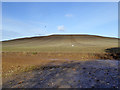
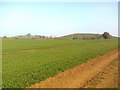
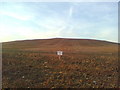
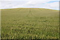
Remains of an Iron Age hillfort, heavily destroyed by ploughing. It has been excavated in 1957-58, which revealed that it was occupied between 2nd century BC and 1st century AD.
Read More at Pastscape.
You may be viewing yesterday's version of this page. To see the most up to date information please register for a free account.
Do not use the above information on other web sites or publications without permission of the contributor.
Nearby Images from Geograph Britain and Ireland:
©2016(licence)
©2012(licence)
©2011(licence)
©2012(licence)
©2012(licence)
The above images may not be of the site on this page, they are loaded from Geograph.
Please Submit an Image of this site or go out and take one for us!
Click here to see more info for this site
Nearby sites
Key: Red: member's photo, Blue: 3rd party photo, Yellow: other image, Green: no photo - please go there and take one, Grey: site destroyed
Download sites to:
KML (Google Earth)
GPX (GPS waypoints)
CSV (Garmin/Navman)
CSV (Excel)
To unlock full downloads you need to sign up as a Contributory Member. Otherwise downloads are limited to 50 sites.
Turn off the page maps and other distractions
Nearby sites listing. In the following links * = Image available
1.9km S 170° Tadmarton Holy Well* Holy Well or Sacred Spring (SP3937)
3.2km S 178° Tadmarton Camp* Hillfort (SP38783568)
6.8km NNW 332° Red Horse of Tysoe Hill Figure or Geoglyph (SP3539844833)
8.6km E 99° Bodicote Cursus Cursus (SP472376)
9.3km N 3° Nadbury Camp* Hillfort (SP390482)
9.8km SSE 149° Ilbury Camp* Hillfort (SP438305)
11.0km NE 46° Cup and Saucer Stone* Ancient Cross (SP466466)
11.2km NE 48° Ringstone (Cropredy) Stone Circle (SP470464)
11.9km SW 228° Whispering Knights* Portal Tomb (SP29933084)
12.0km SW 229° King Stone Round Cairn* Cairn (SP2961430968)
12.0km SW 229° King Stone at the Rollrights* Standing Stone (Menhir) (SP29623095)
12.1km SW 229° Rollright Stones* Stone Circle (SP29583087)
12.1km SSW 210° Druids Barrow Round Barrow(s) (SP32612835)
12.2km SW 229° Gough's Barrow (Long Compton) Cairn (SP29463090)
12.2km ESE 103° Astrop Well* Holy Well or Sacred Spring (SP50603624)
12.3km ESE 102° St Rumbald's Well* Holy Well or Sacred Spring (SP50783651)
12.6km N 6° Holy Well (Burton Dassett)* Holy Well or Sacred Spring (SP398515)
13.7km N 358° Burton Dassett Tumuli Round Barrow(s) (SP380526)
14.0km SSW 212° New Street Stone* Holed Stone (SP312270)
14.1km SSW 213° Serpent's Well (Chipping Norton) Holy Well or Sacred Spring (SP310270)
14.5km NE 48° Arbury Camp* Hillfort (SP494486)
14.5km ESE 107° Rainsborough Camp* Hillfort (SP526348)
14.7km SW 223° Salford Cross Cup Marks (Salford) Ancient Cross (SP2864428058)
15.2km S 184° Hoar Stone at Enstone* Chambered Tomb (SP37792375)
15.7km NW 316° Ettington Cursus Cursus (SP277502)
View more nearby sites and additional images


 We would like to know more about this location. Please feel free to add a brief description and any relevant information in your own language.
 Wir möchten mehr über diese Stätte erfahren. Bitte zögern Sie nicht, eine kurze Beschreibung und relevante Informationen in Deutsch hinzuzufügen.
 Nous aimerions en savoir encore un peu sur les lieux. S'il vous plaît n'hesitez pas à ajouter une courte description et tous les renseignements pertinents dans votre propre langue.
 Quisieramos informarnos un poco más de las lugares. No dude en añadir una breve descripción y otros datos relevantes en su propio idioma.