<< Other Photo Pages >> Musée Archéologique des Landes - Museum in France in Aquitaine:Landes (40)
Submitted by TheCaptain on Saturday, 16 April 2005 Page Views: 3627
MuseumsSite Name: Musée Archéologique des LandesCountry: France
NOTE: This site is 20.055 km away from the location you searched for.
Département: Aquitaine:Landes (40) Type: Museum
Nearest Town: Dax Nearest Village: Hastingues
Latitude: 43.527277N Longitude: 1.121706W
Condition:
| 5 | Perfect |
| 4 | Almost Perfect |
| 3 | Reasonable but with some damage |
| 2 | Ruined but still recognisable as an ancient site |
| 1 | Pretty much destroyed, possibly visible as crop marks |
| 0 | No data. |
| -1 | Completely destroyed |
| 5 | Superb |
| 4 | Good |
| 3 | Ordinary |
| 2 | Not Good |
| 1 | Awful |
| 0 | No data. |
| 5 | Can be driven to, probably with disabled access |
| 4 | Short walk on a footpath |
| 3 | Requiring a bit more of a walk |
| 2 | A long walk |
| 1 | In the middle of nowhere, a nightmare to find |
| 0 | No data. |
| 5 | co-ordinates taken by GPS or official recorded co-ordinates |
| 4 | co-ordinates scaled from a detailed map |
| 3 | co-ordinates scaled from a bad map |
| 2 | co-ordinates of the nearest village |
| 1 | co-ordinates of the nearest town |
| 0 | no data |
Internal Links:
External Links:
Museum in Landes
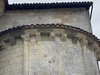
Located in the Abbaye d'Arthous.
Website: Musée de l’Abbaye d’Arthous
You may be viewing yesterday's version of this page. To see the most up to date information please register for a free account.
Do not use the above information on other web sites or publications without permission of the contributor.
davidmorgan has found this location on Google Street View:
Nearby Images from Flickr
The above images may not be of the site on this page, but were taken nearby. They are loaded from Flickr so please click on them for image credits.
Click here to see more info for this site
Nearby sites
Click here to view sites on an interactive map of the areaKey: Red: member's photo, Blue: 3rd party photo, Yellow: other image, Green: no photo - please go there and take one, Grey: site destroyed
Download sites to:
KML (Google Earth)
GPX (GPS waypoints)
CSV (Garmin/Navman)
CSV (Excel)
To unlock full downloads you need to sign up as a Contributory Member. Otherwise downloads are limited to 50 sites.
Turn off the page maps and other distractions
Nearby sites listing. In the following links * = Image available
7.7km E 99° Grotte Duruthy* Cave or Rock Shelter
20.5km SSW 199° Grottes d'Isturitz et d'Otsozelaia* Cave or Rock Shelter
26.5km SW 220° Urtsuia Cromlech* Stone Circle
27.3km SSE 167° Soyarza Tumulus 4 Round Barrow(s)
27.5km SSE 167° Soyarza Tumulus 3 Round Barrow(s)
27.5km SSE 167° Soyarza Tumulus 2 Round Barrow(s)
27.6km SSE 167° Soyarza Tumulus 1 Round Barrow(s)
28.8km S 182° Unarraita Dolmen* Burial Chamber or Dolmen
29.2km SSW 208° Erregelu Cromlechs* Stone Circle
29.3km SSW 204° Behorsaro Barrow Cemetery Barrow Cemetery
29.7km SSW 208° Mendizabal Cromlechs* Stone Circle
29.8km SSW 208° Apanize Barrow Cemetery Barrow Cemetery
29.9km SSW 209° Baigura Menhir* Standing Stone (Menhir)
30.0km SW 216° Beheitako Erreka Chromlech Stone Circle
30.1km SSW 209° Chancho Barrow Cemetery Barrow Cemetery
31.0km S 186° Laparzale Dolmen Burial Chamber or Dolmen
31.2km SSW 207° Laina Tumulus 3 Round Barrow(s)
31.8km SW 227° Cromlech d'Arluxatta Stone Circle
31.9km SW 223° Arrokagaray Burial Chamber or Dolmen
32.0km SSW 208° Orgeletegi Tumulus* Burial Chamber or Dolmen
32.2km SSW 208° Orgeletegi Cromlech 1* Stone Circle
32.3km SSE 165° Gaztelu Zahar Hillfort
33.1km SW 226° Atharri Cromlech Stone Circle
33.4km SSW 207° Horza Chromlech 1-6 Stone Circle
33.5km SSW 207° Horza Chromlech 7 Stone Circle
View more nearby sites and additional images


 We would like to know more about this location. Please feel free to add a brief description and any relevant information in your own language.
 Wir möchten mehr über diese Stätte erfahren. Bitte zögern Sie nicht, eine kurze Beschreibung und relevante Informationen in Deutsch hinzuzufügen.
 Nous aimerions en savoir encore un peu sur les lieux. S'il vous plaît n'hesitez pas à ajouter une courte description et tous les renseignements pertinents dans votre propre langue.
 Quisieramos informarnos un poco más de las lugares. No dude en añadir una breve descripción y otros datos relevantes en su propio idioma.