<< Text Pages >> Thorpe Thewles settlement - Ancient Village or Settlement in England in Cleveland
Submitted by durhamnature on Thursday, 04 October 2012 Page Views: 1854
Multi-periodSite Name: Thorpe Thewles settlementCountry: England
NOTE: This site is 1.803 km away from the location you searched for.
County: Cleveland Type: Ancient Village or Settlement
Nearest Town: Stockton Nearest Village: Thorpe Thewles
Map Ref: NZ39672445
Latitude: 54.613656N Longitude: 1.38727W
Condition:
| 5 | Perfect |
| 4 | Almost Perfect |
| 3 | Reasonable but with some damage |
| 2 | Ruined but still recognisable as an ancient site |
| 1 | Pretty much destroyed, possibly visible as crop marks |
| 0 | No data. |
| -1 | Completely destroyed |
| 5 | Superb |
| 4 | Good |
| 3 | Ordinary |
| 2 | Not Good |
| 1 | Awful |
| 0 | No data. |
| 5 | Can be driven to, probably with disabled access |
| 4 | Short walk on a footpath |
| 3 | Requiring a bit more of a walk |
| 2 | A long walk |
| 1 | In the middle of nowhere, a nightmare to find |
| 0 | No data. |
| 5 | co-ordinates taken by GPS or official recorded co-ordinates |
| 4 | co-ordinates scaled from a detailed map |
| 3 | co-ordinates scaled from a bad map |
| 2 | co-ordinates of the nearest village |
| 1 | co-ordinates of the nearest town |
| 0 | no data |
Be the first person to rate this site - see the 'Contribute!' box in the right hand menu.
Internal Links:
External Links:
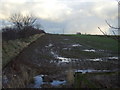
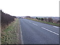
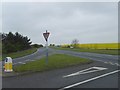
Excavated Iron Age enclosed settlement, formerly visible as low earthworks and cropmarks. Close to the A177 road from Stockton to Sedgefield, which is thought to be an ancient route.
Pastscape site number 25814
A major excavation has been carried out by Tees Archaeology. A full report can be downloaded from their website.
Read More at Thorpe-Thewles.org.uk.
You may be viewing yesterday's version of this page. To see the most up to date information please register for a free account.
Do not use the above information on other web sites or publications without permission of the contributor.
Nearby Images from Geograph Britain and Ireland:
©2013(licence)
©2013(licence)
©2007(licence)
©2007(licence)

©2007(licence)
The above images may not be of the site on this page, they are loaded from Geograph.
Please Submit an Image of this site or go out and take one for us!
Click here to see more info for this site
Nearby sites
Key: Red: member's photo, Blue: 3rd party photo, Yellow: other image, Green: no photo - please go there and take one, Grey: site destroyed
Download sites to:
KML (Google Earth)
GPX (GPS waypoints)
CSV (Garmin/Navman)
CSV (Excel)
To unlock full downloads you need to sign up as a Contributory Member. Otherwise downloads are limited to 50 sites.
Turn off the page maps and other distractions
Nearby sites listing. In the following links * = Image available
1.4km NNW 336° Thorpe Thewles cropmark Ancient Village or Settlement (NZ391257)
4.5km SW 225° St Peter's Church (Bishopton)* Ancient Cross (NZ3649721242)
4.6km SW 221° Castle Hill (Bishopton)* Misc. Earthwork (NZ3667020898)
5.1km ESE 117° St Mary (Stockton on Tees) Ancient Cross (NZ44272213)
6.4km ESE 110° St Cuthbert's Church (Billingham)* Ancient Cross (NZ4577722342)
6.7km SSW 192° Larberry Pastures settlement Ancient Village or Settlement (NZ38321790)
9.3km SSE 160° Preston Park Museum (Stockton on Tees)* Museum (NZ4297515796)
9.4km SW 217° Sadberge Village Erratic* Natural Stone / Erratic / Other Natural Feature (NZ34151688)
9.6km SSE 146° Thornaby Green earthwork Ancient Village or Settlement (NZ45051650)
10.0km NW 320° Bishop Middleham Cave Cave or Rock Shelter (NZ33223209)
10.2km SSE 157° Quarry Farm settlement Ancient Village or Settlement (NZ437151)
11.5km WNW 303° Great Chilton Ancient Village or Settlement (NZ2995430684)
11.6km W 259° St Andrew's Church (Aycliffe)* Ancient Cross (NZ2830622162)
11.7km NE 53° Catcote settlement Ancient Village or Settlement (NZ490315)
12.0km SSE 164° Round Hill (Ingleby Barwick)* Artificial Mound (NZ43171293)
12.3km SW 226° Haughton le Skerne Ancient Cross* Ancient Cross (NZ30801588)
12.8km NE 36° Hart Village Erratic* Natural Stone / Erratic / Other Natural Feature (NZ47103495)
12.9km NE 35° St Mary Magdalene (Hart)* Early Christian Sculptured Stone (NZ4704835105)
13.1km N 354° Old Wingate Long Barrow* Long Barrow (NZ38143745)
13.2km N 354° Old Wingate Round Barrow* Round Barrow(s) (NZ3815937568)
14.1km SSW 201° Low Dinsdale Cross* Ancient Cross (NZ34621126)
14.2km SW 229° The Bulmer Stone* Natural Stone / Erratic / Other Natural Feature (NZ29021496)
14.5km SW 227° St Cuthbert's Church (Darlington)* Ancient Cross (NZ2910814448)
15.0km SSE 167° St Martin's Church (Kirklevington)* Early Christian Sculptured Stone (NZ4317309860)
15.2km SW 226° South park Stone* Natural Stone / Erratic / Other Natural Feature (NZ28851371)
View more nearby sites and additional images


 We would like to know more about this location. Please feel free to add a brief description and any relevant information in your own language.
 Wir möchten mehr über diese Stätte erfahren. Bitte zögern Sie nicht, eine kurze Beschreibung und relevante Informationen in Deutsch hinzuzufügen.
 Nous aimerions en savoir encore un peu sur les lieux. S'il vous plaît n'hesitez pas à ajouter une courte description et tous les renseignements pertinents dans votre propre langue.
 Quisieramos informarnos un poco más de las lugares. No dude en añadir una breve descripción y otros datos relevantes en su propio idioma.