

<< Our Photo Pages >> Kepwick Long Barrow - Long Barrow in England in Yorkshire (North)
Submitted by vicky on Sunday, 21 July 2002 Page Views: 6876
Neolithic and Bronze AgeSite Name: Kepwick Long Barrow Alternative Name: Over Silton; Greenwell's BarrowCountry: England County: Yorkshire (North) Type: Long Barrow
Nearest Town: Thirsk Nearest Village: Knayton
Map Ref: SE4915590333 Landranger Map Number: 100
Latitude: 54.306242N Longitude: 1.246072W
Condition:
| 5 | Perfect |
| 4 | Almost Perfect |
| 3 | Reasonable but with some damage |
| 2 | Ruined but still recognisable as an ancient site |
| 1 | Pretty much destroyed, possibly visible as crop marks |
| 0 | No data. |
| -1 | Completely destroyed |
| 5 | Superb |
| 4 | Good |
| 3 | Ordinary |
| 2 | Not Good |
| 1 | Awful |
| 0 | No data. |
| 5 | Can be driven to, probably with disabled access |
| 4 | Short walk on a footpath |
| 3 | Requiring a bit more of a walk |
| 2 | A long walk |
| 1 | In the middle of nowhere, a nightmare to find |
| 0 | No data. |
| 5 | co-ordinates taken by GPS or official recorded co-ordinates |
| 4 | co-ordinates scaled from a detailed map |
| 3 | co-ordinates scaled from a bad map |
| 2 | co-ordinates of the nearest village |
| 1 | co-ordinates of the nearest town |
| 0 | no data |
Internal Links:
External Links:
")
For more information on this particular barrow, see Pastscape Monument No. 55713 which records this as being on Kepwick Moor, North-East Group, site 20: "A neolithic long barrow is visible as an earthwork on air photographs, centred at SE 4915 9033. The barrow measures approximately 34m x15m, and a central pit is visible and probably the result of previous excavation. The barrow appears extant on the latest 2009 vertical photography." The add: "known as Over Silton Long Barrow to Greenwell when its situation now in Kepwick Parish, was originally in Over Silton."
For the scheduling information, please see Historic England List Entry 1008574 which adds: "The monument includes a long barrow orientated north west to south east situated on the west edge of Arden Little Moor. It lies in close proximity to a group of round barrows and a series of prehistoric linear earthworks. The barrow has a large well defined elongated earth and stone mound standing 1.3m high. It is 31m long, 10m wide at the south east end but tapering to 6m at the west end. Excavations carried out by Canon Greenwell in 1877 revealed five human burials and several flint artefacts. The remains of this excavation can still be seen as a trench cutting across the barrow 5m from the south east end. The mound was flanked by a ditch up to 3m wide which has become filled in over the years and is no longer visible as an earthwork."
For more information see the comment from johndhunter, 31st October 2017 - thanks john!
You may be viewing yesterday's version of this page. To see the most up to date information please register for a free account.
")
Do not use the above information on other web sites or publications without permission of the contributor.
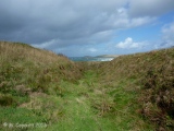
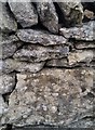
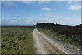
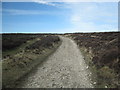
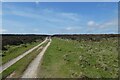
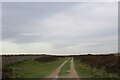
Nearby Images from Geograph Britain and Ireland:
©2017(licence)
©2023(licence)
©2010(licence)
©2023(licence)
©2023(licence)
The above images may not be of the site on this page, they are loaded from Geograph.
Please Submit an Image of this site or go out and take one for us!
Click here to see more info for this site
Nearby sites
Key: Red: member's photo, Blue: 3rd party photo, Yellow: other image, Green: no photo - please go there and take one, Grey: site destroyed
Download sites to:
KML (Google Earth)
GPX (GPS waypoints)
CSV (Garmin/Navman)
CSV (Excel)
To unlock full downloads you need to sign up as a Contributory Member. Otherwise downloads are limited to 50 sites.
Turn off the page maps and other distractions
Nearby sites listing. In the following links * = Image available
391m ESE 118° Steeple Cross (Arden Little Moor)* Ancient Cross (SE4950490155)
556m SW 221° Friar's Cross (Kepwick)* Ancient Cross (SE4879589908)
1.1km WSW 244° Gallow Hill Tumuli (Cowesby Moor)* Round Barrow(s) (SE4819789858)
1.7km W 268° Penhill Gate Tumuli* Barrow Cemetery (SE4745390251)
2.0km NE 37° Harker Yates Ridge (Arden Great Moor)* Round Barrow(s) (SE5032691940)
2.8km N 1° Whitestones (Arden Great Moor)* Round Barrow(s) (SE4916393116)
3.3km NE 43° Sun Bank (Arden Great Moor)* Round Barrow(s) (SE5136892782)
3.4km NE 47° Sun Burnt Nab (Arden Great Moor)* Round Barrow(s) (SE5160292649)
4.0km NNW 345° Black Hambleton* Round Barrow(s) (SE4808994185)
4.5km E 99° All Saints Church, Hawnby* Ancient Cross (SE53658967)
4.8km SSE 163° Boltby Scar Camp Hillfort (SE506857)
4.9km ENE 59° Hazel Head Wood (Hawnby Moor) RB1* Round Barrow(s) (SE5333592868)
4.9km NNE 31° Cow Ridge South West RB1* Round Barrow(s) (SE5167594565)
5.1km ENE 68° Long Hill (Hawnby Moor) RB1* Round Barrow(s) (SE5386292307)
5.3km ENE 67° Long Hill (Hawnby Moor) MS1* Marker Stone (SE5400192446)
5.3km N 354° Robinsons Cross* Ancient Cross (SE4854895631)
5.3km NNW 338° Thimbleby Nine Stones* Standing Stones (SE47099527)
5.4km SSE 160° Hambleton Down North* Round Barrow(s) (SE5102885301)
5.5km NNW 348° Cray Hall Stone* Marker Stone (SE4797895674)
5.7km NW 314° Hanging Stone (Thimbleby Bank)* Rock Outcrop (SE4501694270)
5.8km W 274° St Mary (Leake)* Ancient Cross (SE43329063)
5.9km NNW 339° Thimbleby Moor 4* Rock Art (SE4700895837)
5.9km ENE 57° Round Hill (Hawnby Moor)* Round Barrow(s) (SE5410093616)
6.1km N 357° Miley Pike* Round Barrow(s) (SE48769642)
6.2km NNW 335° Thimbleby Moor 2* Rock Art (SE4652595928)
View more nearby sites and additional images


 We would like to know more about this location. Please feel free to add a brief description and any relevant information in your own language.
 Wir möchten mehr über diese Stätte erfahren. Bitte zögern Sie nicht, eine kurze Beschreibung und relevante Informationen in Deutsch hinzuzufügen.
 Nous aimerions en savoir encore un peu sur les lieux. S'il vous plaît n'hesitez pas à ajouter une courte description et tous les renseignements pertinents dans votre propre langue.
 Quisieramos informarnos un poco más de las lugares. No dude en añadir una breve descripción y otros datos relevantes en su propio idioma.