


<< Our Photo Pages >> Holy Well, Braunston - Holy Well or Sacred Spring in England in Northamptonshire
Submitted by jamesrattue on Sunday, 25 June 2006 Page Views: 6218
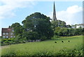
Springs and Holy WellsSite Name: Holy Well, BraunstonCountry: England County: Northamptonshire Type: Holy Well or Sacred Spring
Nearest Town: Daventry Nearest Village: Braunston
Map Ref: SP537662
Latitude: 52.291317N Longitude: 1.214095W
Condition:
| 5 | Perfect |
| 4 | Almost Perfect |
| 3 | Reasonable but with some damage |
| 2 | Ruined but still recognisable as an ancient site |
| 1 | Pretty much destroyed, possibly visible as crop marks |
| 0 | No data. |
| -1 | Completely destroyed |
| 5 | Superb |
| 4 | Good |
| 3 | Ordinary |
| 2 | Not Good |
| 1 | Awful |
| 0 | No data. |
| 5 | Can be driven to, probably with disabled access |
| 4 | Short walk on a footpath |
| 3 | Requiring a bit more of a walk |
| 2 | A long walk |
| 1 | In the middle of nowhere, a nightmare to find |
| 0 | No data. |
| 5 | co-ordinates taken by GPS or official recorded co-ordinates |
| 4 | co-ordinates scaled from a detailed map |
| 3 | co-ordinates scaled from a bad map |
| 2 | co-ordinates of the nearest village |
| 1 | co-ordinates of the nearest town |
| 0 | no data |
Internal Links:
External Links:
")
The whole structure seems to be brick, with a limestone (?) block topping it off, built into the face of the churchyard wall. Access to the well is barred by a locked iron gate. The water seeps from a low brick arch at the back. The fabric of the well is fine, but it seems very ill-regarded and cared-for, and was full of crisp packets, banana skins, and other detritus when we saw it. It isn't recorded anywhere as far as I know - I just assume it's a holy well because of its proximity to this ancient church.
You may be viewing yesterday's version of this page. To see the most up to date information please register for a free account.
Do not use the above information on other web sites or publications without permission of the contributor.
coldrum has found this location on Google Street View:
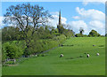
Nearby Images from Geograph Britain and Ireland:
©2015(licence)
©2009(licence)
©2009(licence)
©2015(licence)
©2015(licence)
The above images may not be of the site on this page, they are loaded from Geograph.
Please Submit an Image of this site or go out and take one for us!
Click here to see more info for this site
Nearby sites
Key: Red: member's photo, Blue: 3rd party photo, Yellow: other image, Green: no photo - please go there and take one, Grey: site destroyed
Download sites to:
KML (Google Earth)
GPX (GPS waypoints)
CSV (Garmin/Navman)
CSV (Excel)
To unlock full downloads you need to sign up as a Contributory Member. Otherwise downloads are limited to 50 sites.
Turn off the page maps and other distractions
Nearby sites listing. In the following links * = Image available
6.2km SE 126° Borough Hill (Daventry)* Hillfort (SP588626)
7.5km S 178° Arbury hill Hillfort (SP540587)
9.2km NNW 339° The Island (Rugby School)* Round Barrow(s) (SP50367477)
11.7km ENE 64° Oster Hill (West Haddon) Cairn (SP64157145)
12.9km WSW 249° Holy Well (Southam)* Holy Well or Sacred Spring (SP417615)
13.0km E 95° Great Brington Medieval Cross Ancient Cross (SP6667765176)
13.2km S 190° Byfield Cross Plinth Ancient Cross (SP516532)
13.3km N 351° Churchover Bowl Barrow* Round Barrow(s) (SP51457929)
13.5km SE 135° The Larches Ancient Village or Settlement (SP633567)
15.1km WNW 300° Knightlow barrow* Round Barrow(s) (SP405737)
15.6km WNW 302° Ryton on Dunsmore Cursus Cursus (SP404744)
16.3km WNW 282° Wappenbury* Hillfort (SP377693)
16.6km NW 324° Brinklow Tumulus* Artificial Mound (SP43877957)
18.1km SSW 194° Arbury Camp* Hillfort (SP494486)
19.0km NNE 12° Tower Farm Long Barrow Long Barrow (SP575848)
19.0km NNE 12° Misterton and Walcote Cursus Cursus (SP576848)
19.1km NNE 33° Husbands Bosworth Causewayed Enclosure* Causewayed Enclosure (SP64018235)
19.9km ESE 112° Upton Bowl Barrow Barrow Cemetery (SP72355909)
20.2km SW 224° Holy Well (Burton Dassett)* Holy Well or Sacred Spring (SP398515)
20.7km SW 230° Burton Dassett Tumuli Round Barrow(s) (SP380526)
20.8km SSW 200° Cup and Saucer Stone* Ancient Cross (SP466466)
20.9km SSW 199° Ringstone (Cropredy) Stone Circle (SP470464)
20.9km E 91° Boughton bowl barrow* Round Barrow(s) (SP74706589)
21.4km E 87° Longmans Hill Long Barrow* Long Barrow (SP751677)
21.5km ESE 112° Hunsbury* Hillfort (SP738584)
View more nearby sites and additional images


 We would like to know more about this location. Please feel free to add a brief description and any relevant information in your own language.
 Wir möchten mehr über diese Stätte erfahren. Bitte zögern Sie nicht, eine kurze Beschreibung und relevante Informationen in Deutsch hinzuzufügen.
 Nous aimerions en savoir encore un peu sur les lieux. S'il vous plaît n'hesitez pas à ajouter une courte description et tous les renseignements pertinents dans votre propre langue.
 Quisieramos informarnos un poco más de las lugares. No dude en añadir una breve descripción y otros datos relevantes en su propio idioma.