


<< Our Photo Pages >> Western Park (Leicester) - Misc. Earthwork in England in Leicestershire and Rutland
Submitted by Andy B on Saturday, 14 August 2004 Page Views: 7041
Modern SitesSite Name: Western Park (Leicester)Country: England
NOTE: This site is 0.867 km away from the location you searched for.
County: Leicestershire and Rutland Type: Misc. Earthwork
Map Ref: SK555043
Latitude: 52.633622N Longitude: 1.181381W
Condition:
| 5 | Perfect |
| 4 | Almost Perfect |
| 3 | Reasonable but with some damage |
| 2 | Ruined but still recognisable as an ancient site |
| 1 | Pretty much destroyed, possibly visible as crop marks |
| 0 | No data. |
| -1 | Completely destroyed |
| 5 | Superb |
| 4 | Good |
| 3 | Ordinary |
| 2 | Not Good |
| 1 | Awful |
| 0 | No data. |
| 5 | Can be driven to, probably with disabled access |
| 4 | Short walk on a footpath |
| 3 | Requiring a bit more of a walk |
| 2 | A long walk |
| 1 | In the middle of nowhere, a nightmare to find |
| 0 | No data. |
| 5 | co-ordinates taken by GPS or official recorded co-ordinates |
| 4 | co-ordinates scaled from a detailed map |
| 3 | co-ordinates scaled from a bad map |
| 2 | co-ordinates of the nearest village |
| 1 | co-ordinates of the nearest town |
| 0 | no data |
Be the first person to rate this site - see the 'Contribute!' box in the right hand menu.
Internal Links:
External Links:
 (PID:221481)")
The details of the battery are recorded on the city council’s Heritage Environment Record and these can be seen by clicking on the link. Many thanks for the above correction from the Leicester City Archaeologist.
Previous text by enkidu41 claimed it as a possible henge, which it isn't: "Grass marks show a complex of 6 interrupted marks. The largest at SK 5545 0530 has an internal diameter of about 65' and is interrupted to the SE, possibly for an entrance. The ring ditch at SK 5550 0427 has an internal diameter of 62' and is interrupted in the W sector. The ring ditch at SK 5545 0426 has an internal diameter of 32' and is interrupted to the SW. The ring ditches at SK 5549 0425 and SK 5552 0425 each has an internal diameter of 59' and are interrupted to the NW. The ring ditch at SK 5552 0423 has an internal diameter of 36'."
You may be viewing yesterday's version of this page. To see the most up to date information please register for a free account.
Do not use the above information on other web sites or publications without permission of the contributor.
Nearby Images from Geograph Britain and Ireland:
©2007(licence)

©2007(licence)
©2013(licence)
©2016(licence)
©2013(licence)
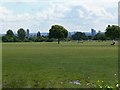
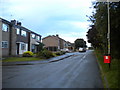
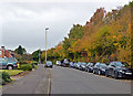
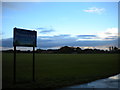
The above images may not be of the site on this page, they are loaded from Geograph.
Please Submit an Image of this site or go out and take one for us!
Click here to see more info for this site
Nearby sites
Key: Red: member's photo, Blue: 3rd party photo, Yellow: other image, Green: no photo - please go there and take one, Grey: site destroyed
Download sites to:
KML (Google Earth)
GPX (GPS waypoints)
CSV (Garmin/Navman)
CSV (Excel)
To unlock full downloads you need to sign up as a Contributory Member. Otherwise downloads are limited to 50 sites.
Turn off the page maps and other distractions
Nearby sites listing. In the following links * = Image available
1.4km S 181° Braunstone Church* Standing Stone (Menhir) (SK555029)
2.7km E 86° Jewry Wall Museum Museum (SK582045)
3.0km ENE 73° St. Margaret's Church* Holy Well or Sacred Spring (SK584052)
3.9km N 357° Anstey Stone* Standing Stone (Menhir) (SK55260820)
4.1km S 186° Enderby Henge (SK551002)
4.6km S 173° The Wethers* Standing Stones (SP56149972)
4.7km SW 224° Wishing Stone* Standing Stone (Menhir) (SK523009)
4.9km NNE 14° Beaumont Leys* Standing Stones (SK566091)
5.9km WNW 284° Bury Camp (Leicestershire) Hillfort (SK498057)
6.0km N 10° Thurcaston C and D Standing Stones (SK56431020)
6.1km N 10° Thurcaston B Standing Stone (Menhir) (SK56481030)
6.1km NE 43° St James (Birstall) Early Christian Sculptured Stone (SK59630884)
6.4km N 10° Thurcaston A* Standing Stone (Menhir) (SK56501060)
7.4km ENE 69° The Humber Stone* Standing Stone (Menhir) (SK6241607095)
7.7km SSW 204° Huncote Stone* Standing Stone (Menhir) (SP5246497256)
7.7km W 264° Desford Stone Standing Stone (Menhir) (SK478034)
7.9km NNW 338° Bradgate Hunt's Hill Stone* Standing Stone (Menhir) (SK5247111651)
8.3km N 2° Cross (near Swithland)* Ancient Cross (SK557126)
8.9km NNE 21° Rothley Cross* Ancient Cross (SK5861312637)
9.7km SW 229° Earl Shilton Bypass Round Barrow(s) (SP483978)
9.9km NNE 31° Cossington Bronze Age Barrows* Barrow Cemetery (SK605129)
11.2km NNW 338° Beacon Hill (Leicestershire)* Hillfort (SK512146)
11.2km ENE 70° Beeby Henge (SK660083)
11.2km NNW 330° Bawdon Monolith Standing Stone (Menhir) (SK49851400)
11.5km NE 55° Mowde Bush Stone* Standing Stone (Menhir) (SK649110)
View more nearby sites and additional images


 We would like to know more about this location. Please feel free to add a brief description and any relevant information in your own language.
 Wir möchten mehr über diese Stätte erfahren. Bitte zögern Sie nicht, eine kurze Beschreibung und relevante Informationen in Deutsch hinzuzufügen.
 Nous aimerions en savoir encore un peu sur les lieux. S'il vous plaît n'hesitez pas à ajouter une courte description et tous les renseignements pertinents dans votre propre langue.
 Quisieramos informarnos un poco más de las lugares. No dude en añadir una breve descripción y otros datos relevantes en su propio idioma.