<< Our Photo Pages >> St Catherine's Well (Westthorpe) - Holy Well or Sacred Spring in England in Nottinghamshire
Submitted by HOLYWELL on Sunday, 27 August 2006 Page Views: 6851
Springs and Holy WellsSite Name: St Catherine's Well (Westthorpe)Country: England
NOTE: This site is 1.37 km away from the location you searched for.
County: Nottinghamshire Type: Holy Well or Sacred Spring
Nearest Town: Southwell Nearest Village: Westthorpe
Map Ref: SK68565327
Latitude: 53.072274N Longitude: 0.978157W
Condition:
| 5 | Perfect |
| 4 | Almost Perfect |
| 3 | Reasonable but with some damage |
| 2 | Ruined but still recognisable as an ancient site |
| 1 | Pretty much destroyed, possibly visible as crop marks |
| 0 | No data. |
| -1 | Completely destroyed |
| 5 | Superb |
| 4 | Good |
| 3 | Ordinary |
| 2 | Not Good |
| 1 | Awful |
| 0 | No data. |
| 5 | Can be driven to, probably with disabled access |
| 4 | Short walk on a footpath |
| 3 | Requiring a bit more of a walk |
| 2 | A long walk |
| 1 | In the middle of nowhere, a nightmare to find |
| 0 | No data. |
| 5 | co-ordinates taken by GPS or official recorded co-ordinates |
| 4 | co-ordinates scaled from a detailed map |
| 3 | co-ordinates scaled from a bad map |
| 2 | co-ordinates of the nearest village |
| 1 | co-ordinates of the nearest town |
| 0 | no data |
Internal Links:
External Links:
 (PID:37782)")
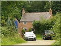
St Catherine's Well, is one of the few holy wells to remain around Southwell although it lies in the adjoining village of Westhorpe. It certainly dates back to medieval times. Its waters were thought of as healing and cured rheumatism, and in the 1700s an attempt was made to turn it into a spa. According to the owner of the land the cottage and barn are remains of this and that a plunge pool was nearby. The water is sluggish but high in calcium carbonate as it has encrusted the base of the well. To find it look for an unadopted lane called Bath Lane. You will soon come across a cottage on the left hand side just after a path. Ask here to see the well which has a stone tablet associated with it.
The well is recorded as Pastscape Monument No. 320265 which tells us: ""St Catherine's Well is at the extremity of Westhorp". Famous for rheumatic cures ...The well is named from a chapel contiguous to it which was dedicated to that saint. A house was built here circa 1720 for the accommodation of persons who came to bathe, and many additions were made to the well ... St Catherine's Well is no longer identifiable. The buildings now form a decrepit farm with no evidence of antiquity."
The Northern Antiquarian (TNA) also features a page for this holy well - see their entry for St. Catherine’s Well, Westhorpe, Southwell, Nottinghamshire, which gives directions for finding this site, together with photographs, a brief archaeology & history and local folklore.
You may be viewing yesterday's version of this page. To see the most up to date information please register for a free account.
 (PID:23563)")
Do not use the above information on other web sites or publications without permission of the contributor.
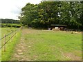
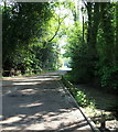
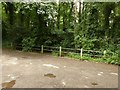
Nearby Images from Geograph Britain and Ireland:
©2020(licence)
©2020(licence)
©2013(licence)
©2020(licence)
©2013(licence)
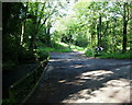
The above images may not be of the site on this page, they are loaded from Geograph.
Please Submit an Image of this site or go out and take one for us!
Click here to see more info for this site
Nearby sites
Key: Red: member's photo, Blue: 3rd party photo, Yellow: other image, Green: no photo - please go there and take one, Grey: site destroyed
Download sites to:
KML (Google Earth)
GPX (GPS waypoints)
CSV (Garmin/Navman)
CSV (Excel)
To unlock full downloads you need to sign up as a Contributory Member. Otherwise downloads are limited to 50 sites.
Turn off the page maps and other distractions
Nearby sites listing. In the following links * = Image available
1.7km ENE 73° Southwell Minster* Early Christian Sculptured Stone (SK70165378)
4.6km WNW 286° Hart's Well* Holy Well or Sacred Spring (SK6415254451)
5.0km W 270° Oldox Camp* Hillfort (SK635532)
5.7km E 99° Rolleston Cross* Ancient Cross (SK7418052489)
5.7km E 99° Holy Trinity (Rolleston)* Ancient Cross (SK7418552503)
5.7km WNW 290° Combs Camp Hillfort (SK63145512)
8.3km WSW 239° King's Well (Calverton) Holy Well or Sacred Spring (SK615489)
9.6km SE 130° Willow Rundle Spring* Holy Well or Sacred Spring (SK7602047230)
9.8km SW 216° The Lambley Spring* Holy Well or Sacred Spring (SK629452)
10.1km SSW 212° Burton Lodge Fort Hillfort (SK63364461)
10.1km WSW 243° Cockpit Hill Hillfort (SK59584850)
10.2km WNW 285° Ashwell (Blidworth) Holy Well or Sacred Spring (SK586558)
10.8km E 93° Farndon Fields* Natural Stone / Erratic / Other Natural Feature (SK794528)
11.2km WNW 285° The Druid Stone (Blidworth)* Natural Stone / Erratic / Other Natural Feature (SK577560)
11.3km ESE 110° Hawton Cursus Cursus (SK79294949)
11.6km S 176° Shelford and Newton Cursus Cursus (SK696417)
11.8km S 175° Old Wark Spring* Holy Well or Sacred Spring (SK698415)
12.3km WNW 288° Friar Tuck's Well* Holy Well or Sacred Spring (SK568569)
14.0km NNE 17° The Duck's Mouth* Holy Well or Sacred Spring (SK724667)
14.3km W 273° St Mary's Well (Newstead)* Holy Well or Sacred Spring (SK542537)
14.9km SW 221° St Ann's Well (Nottingham) Holy Well or Sacred Spring (SK58914191)
15.5km WSW 245° Bull's Well Holy Well or Sacred Spring (SK546464)
15.6km ENE 72° Langford, Brough and Glebe Farm sites on the A46* Ancient Village or Settlement (SK833584)
15.7km W 262° Linby Cross and Well* Ancient Cross (SK5351)
16.0km WNW 302° The Lady Well (Mansfield) Holy Well or Sacred Spring (SK548616)
View more nearby sites and additional images


 We would like to know more about this location. Please feel free to add a brief description and any relevant information in your own language.
 Wir möchten mehr über diese Stätte erfahren. Bitte zögern Sie nicht, eine kurze Beschreibung und relevante Informationen in Deutsch hinzuzufügen.
 Nous aimerions en savoir encore un peu sur les lieux. S'il vous plaît n'hesitez pas à ajouter une courte description et tous les renseignements pertinents dans votre propre langue.
 Quisieramos informarnos un poco más de las lugares. No dude en añadir una breve descripción y otros datos relevantes en su propio idioma.