<< Text Pages >> Binsted Cursus - Cursus in England in Hampshire
Submitted by EssexMan on Wednesday, 07 April 2010 Page Views: 4110
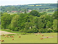
Neolithic and Bronze AgeSite Name: Binsted CursusCountry: England
NOTE: This site is 3.851 km away from the location you searched for.
County: Hampshire Type: Cursus
Nearest Town: Aldershot Nearest Village: Binsted
Map Ref: SU7842 Landranger Map Number: 186
Latitude: 51.171931N Longitude: 0.885677W
Condition:
| 5 | Perfect |
| 4 | Almost Perfect |
| 3 | Reasonable but with some damage |
| 2 | Ruined but still recognisable as an ancient site |
| 1 | Pretty much destroyed, possibly visible as crop marks |
| 0 | No data. |
| -1 | Completely destroyed |
| 5 | Superb |
| 4 | Good |
| 3 | Ordinary |
| 2 | Not Good |
| 1 | Awful |
| 0 | No data. |
| 5 | Can be driven to, probably with disabled access |
| 4 | Short walk on a footpath |
| 3 | Requiring a bit more of a walk |
| 2 | A long walk |
| 1 | In the middle of nowhere, a nightmare to find |
| 0 | No data. |
| 5 | co-ordinates taken by GPS or official recorded co-ordinates |
| 4 | co-ordinates scaled from a detailed map |
| 3 | co-ordinates scaled from a bad map |
| 2 | co-ordinates of the nearest village |
| 1 | co-ordinates of the nearest town |
| 0 | no data |
Internal Links:
External Links:
Cursus in Hampshire
Status: Doubtful
NMR No. SU 74 SE 29
You may be viewing yesterday's version of this page. To see the most up to date information please register for a free account.
Do not use the above information on other web sites or publications without permission of the contributor.
Nearby Images from Geograph Britain and Ireland:
©2006(licence)
©2010(licence)
©2022(licence)
©2022(licence)
©2010(licence)
The above images may not be of the site on this page, they are loaded from Geograph.
Please Submit an Image of this site or go out and take one for us!
Click here to see more info for this site
Nearby sites
Key: Red: member's photo, Blue: 3rd party photo, Yellow: other image, Green: no photo - please go there and take one, Grey: site destroyed
Download sites to:
KML (Google Earth)
GPX (GPS waypoints)
CSV (Garmin/Navman)
CSV (Excel)
To unlock full downloads you need to sign up as a Contributory Member. Otherwise downloads are limited to 50 sites.
Turn off the page maps and other distractions
Nearby sites listing. In the following links * = Image available
2.5km W 264° Binsted Holy Well* Holy Well or Sacred Spring (SU755417)
4.5km NW 321° Sheephouse Copse* Round Barrow(s) (SU751455)
4.9km W 261° Holybourne* Holy Well or Sacred Spring (SU732412)
7.4km E 101° Frensham Common Barrows* Barrow Cemetery (SU85334070)
8.5km NNE 30° Heath Brow Barrows* Barrow Cemetery (SU82184937)
9.7km ENE 68° St. Mary's Well (Compton)* Holy Well or Sacred Spring (SU870457)
9.8km NE 35° Caesar's Camp (Hampshire)* Hillfort (SU835501)
10.0km NE 55° Badshot Lea* Long Barrow (SU86084793)
10.4km ENE 67° Botany Hill Camp Hillfort (SU875462)
10.8km ENE 68° Soldier's Ring* Hillfort (SU880462)
10.9km SE 136° Wishing Well at Waggoners Wells* Holy Well or Sacred Spring (SU857342)
11.1km E 79° Tilford Barrows Barrow Cemetery (SU889443)
11.6km NE 36° Bat's Hogsty* Misc. Earthwork (SU84685152)
11.7km ENE 76° Crooksbury Common Barrows* Barrow Cemetery (SU893450)
11.7km ENE 73° Culverswell Barrow* Round Barrow(s) (SU892456)
12.0km SW 221° East Tisted Bowl Barrow Round Barrow(s) (SU70263281)
13.4km NW 320° Mapledurwell Bowl Barrow* Round Barrow(s) (SU691521)
13.9km ENE 71° Hillbury hillfort* Hillfort (SU911468)
14.4km NE 38° Barrow on Queen's Hotel roundabout* Round Barrow(s) (SU8682953432)
15.1km NW 305° Hackwood Park Barrows* Round Barrow(s) (SU6543050410)
15.4km SE 126° Haslemere Educational Museum* Museum (SU9061833107)
17.4km NNE 17° Hornley Common* Round Barrow(s) (SU8291758669)
17.5km S 187° St. Mary's Well (Sheet)* Holy Well or Sacred Spring (SU761246)
17.5km NNE 16° Ancient field boundaries near Blackwater Misc. Earthwork (SU8257058911)
17.6km NNE 18° Round Barrow near Blackwater Round Barrow(s) (SU8310158871)
View more nearby sites and additional images


 We would like to know more about this location. Please feel free to add a brief description and any relevant information in your own language.
 Wir möchten mehr über diese Stätte erfahren. Bitte zögern Sie nicht, eine kurze Beschreibung und relevante Informationen in Deutsch hinzuzufügen.
 Nous aimerions en savoir encore un peu sur les lieux. S'il vous plaît n'hesitez pas à ajouter une courte description et tous les renseignements pertinents dans votre propre langue.
 Quisieramos informarnos un poco más de las lugares. No dude en añadir una breve descripción y otros datos relevantes en su propio idioma.