<< Text Pages >> Kirby Underdale Cursus - Cursus in England in Yorkshire (East)
Submitted by EssexMan on Wednesday, 07 April 2010 Page Views: 3390
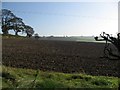
Neolithic and Bronze AgeSite Name: Kirby Underdale CursusCountry: England
NOTE: This site is 4.248 km away from the location you searched for.
County: Yorkshire (East) Type: Cursus
Nearest Town: York Nearest Village: Kirby Underdale
Map Ref: SE81355922 Landranger Map Number: 106
Latitude: 54.022578N Longitude: 0.759779W
Condition:
| 5 | Perfect |
| 4 | Almost Perfect |
| 3 | Reasonable but with some damage |
| 2 | Ruined but still recognisable as an ancient site |
| 1 | Pretty much destroyed, possibly visible as crop marks |
| 0 | No data. |
| -1 | Completely destroyed |
| 5 | Superb |
| 4 | Good |
| 3 | Ordinary |
| 2 | Not Good |
| 1 | Awful |
| 0 | No data. |
| 5 | Can be driven to, probably with disabled access |
| 4 | Short walk on a footpath |
| 3 | Requiring a bit more of a walk |
| 2 | A long walk |
| 1 | In the middle of nowhere, a nightmare to find |
| 0 | No data. |
| 5 | co-ordinates taken by GPS or official recorded co-ordinates |
| 4 | co-ordinates scaled from a detailed map |
| 3 | co-ordinates scaled from a bad map |
| 2 | co-ordinates of the nearest village |
| 1 | co-ordinates of the nearest town |
| 0 | no data |
Internal Links:
External Links:
Minor Cursus in Humberside
Status: Possible
NMR No. SE 85 NW 56
Extent: 800mx30m
You may be viewing yesterday's version of this page. To see the most up to date information please register for a free account.
Do not use the above information on other web sites or publications without permission of the contributor.
Nearby Images from Geograph Britain and Ireland:
©2021(licence)
©2006(licence)
©2017(licence)
©2006(licence)
©2006(licence)
The above images may not be of the site on this page, they are loaded from Geograph.
Please Submit an Image of this site or go out and take one for us!
Click here to see more info for this site
Nearby sites
Key: Red: member's photo, Blue: 3rd party photo, Yellow: other image, Green: no photo - please go there and take one, Grey: site destroyed
Download sites to:
KML (Google Earth)
GPX (GPS waypoints)
CSV (Garmin/Navman)
CSV (Excel)
To unlock full downloads you need to sign up as a Contributory Member. Otherwise downloads are limited to 50 sites.
Turn off the page maps and other distractions
Nearby sites listing. In the following links * = Image available
1.6km NNW 349° Hanging Grimstone Barrow Cemetery (SE810608)
2.4km SSE 161° Callis Wold Barrow Cemetery* Barrow Cemetery (SE8217857003)
2.7km NNW 337° Acklam Wold Cemetery* Barrow Cemetery (SE8027061693)
5.0km NNE 29° Wharram Percy Barrows Barrow Cemetery (SE837636)
7.0km NE 55° Fairy Stones* Natural Stone / Erratic / Other Natural Feature (SE8700363317)
7.2km ESE 104° Fridaythorpe Earthworks* Misc. Earthwork (SE88425753)
7.5km ENE 62° Towthorpe Plantation Barrow Cemetery Barrow Cemetery (SE879629)
7.8km NNW 339° Hedon Howe Long Barrow (SE7843166510)
8.0km ENE 57° High Street Barrow (Towthorpe) Cairn (SE88006373)
8.2km ENE 79° Fimber Cursus Cursus (SE894610)
8.8km SE 140° Dearsden Hill Hillfort (SE872526)
8.8km SSE 162° Newcote Round Barrow* Barrow Cemetery (SE84225085)
9.5km E 80° Fimber Cursus* Cursus (SE907610)
9.5km NNW 342° Whitegrounds Barrow Cairn (SE78256824)
9.8km SSE 167° Kilnwick Percy Hill - Barrow* Barrow Cemetery (SE8365149674)
10.1km NE 41° Duggleby Cursus Cursus (SE879669)
10.2km NE 42° Duggleby Howe* Round Barrow(s) (SE88046688)
10.9km WSW 239° Catton Cursus (SE721534)
11.0km NE 46° Duggleby Cursus Cursus (SE892670)
11.5km WSW 238° Catton Cursus (SE716530)
11.9km SSE 164° St James Church (Nunburnholme)* Ancient Cross (SE84774779)
13.8km NW 317° St Ann's Well (Castle Howard)* Holy Well or Sacred Spring (SE71786918)
13.9km NNW 330° Holy Well, Hildenley* Holy Well or Sacred Spring (SE741711)
14.9km SSE 159° All Saints (Londesborough)* Ancient Cross (SE86864538)
15.3km WSW 252° Holtby Timber Circle (SE668543)
View more nearby sites and additional images


 We would like to know more about this location. Please feel free to add a brief description and any relevant information in your own language.
 Wir möchten mehr über diese Stätte erfahren. Bitte zögern Sie nicht, eine kurze Beschreibung und relevante Informationen in Deutsch hinzuzufügen.
 Nous aimerions en savoir encore un peu sur les lieux. S'il vous plaît n'hesitez pas à ajouter une courte description et tous les renseignements pertinents dans votre propre langue.
 Quisieramos informarnos un poco más de las lugares. No dude en añadir una breve descripción y otros datos relevantes en su propio idioma.