<< Text Pages >> Bacombe Hill Bowl Barrow - Round Barrow(s) in England in Buckinghamshire
Submitted by coldrum on Monday, 30 August 2010 Page Views: 3872
Neolithic and Bronze AgeSite Name: Bacombe Hill Bowl BarrowCountry: England
NOTE: This site is 2.928 km away from the location you searched for.
County: Buckinghamshire Type: Round Barrow(s)
Map Ref: SP86130709
Latitude: 51.755887N Longitude: 0.753576W
Condition:
| 5 | Perfect |
| 4 | Almost Perfect |
| 3 | Reasonable but with some damage |
| 2 | Ruined but still recognisable as an ancient site |
| 1 | Pretty much destroyed, possibly visible as crop marks |
| 0 | No data. |
| -1 | Completely destroyed |
| 5 | Superb |
| 4 | Good |
| 3 | Ordinary |
| 2 | Not Good |
| 1 | Awful |
| 0 | No data. |
| 5 | Can be driven to, probably with disabled access |
| 4 | Short walk on a footpath |
| 3 | Requiring a bit more of a walk |
| 2 | A long walk |
| 1 | In the middle of nowhere, a nightmare to find |
| 0 | No data. |
| 5 | co-ordinates taken by GPS or official recorded co-ordinates |
| 4 | co-ordinates scaled from a detailed map |
| 3 | co-ordinates scaled from a bad map |
| 2 | co-ordinates of the nearest village |
| 1 | co-ordinates of the nearest town |
| 0 | no data |
Be the first person to rate this site - see the 'Contribute!' box in the right hand menu.
Internal Links:
External Links:
Round Barrow in Buckinghamshire
From Pastscape:
" A small Bowl Barrow located on Bacombe Hill. The circular mound measures 10m in diameter and 0.6m high. There is no evidence of a quarry ditch, and the mound is believed to be of 'scraped' construction, using turf and topsoil from the surrounding area. "
Pastscape
You may be viewing yesterday's version of this page. To see the most up to date information please register for a free account.
Do not use the above information on other web sites or publications without permission of the contributor.
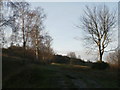
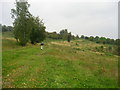
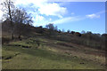
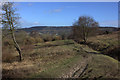
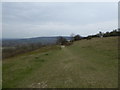
Nearby Images from Geograph Britain and Ireland:
©2011(licence)
©2007(licence)
©2018(licence)
©2018(licence)
©2019(licence)
The above images may not be of the site on this page, they are loaded from Geograph.
Please Submit an Image of this site or go out and take one for us!
Click here to see more info for this site
Nearby sites
Key: Red: member's photo, Blue: 3rd party photo, Yellow: other image, Green: no photo - please go there and take one, Grey: site destroyed
Download sites to:
KML (Google Earth)
GPX (GPS waypoints)
CSV (Garmin/Navman)
CSV (Excel)
To unlock full downloads you need to sign up as a Contributory Member. Otherwise downloads are limited to 50 sites.
Turn off the page maps and other distractions
Nearby sites listing. In the following links * = Image available
42m NE 46° Bacombe Hill Barrow Cemetery (SP86160712)
2.3km ENE 67° Boddington Camp* Hillfort (SP882080)
3.3km WSW 251° Ragpit Cross Dyke Misc. Earthwork (SP83020598)
3.5km WSW 253° Ragpit Hill Cross Dyke Misc. Earthwork (SP82750601)
3.5km WSW 253° Ragpit Cross Dykes Misc. Earthwork (SP82750600)
3.6km SW 235° Pulpit Hill* Hillfort (SP832050)
5.0km SW 232° Whiteleaf Barrows* Long Barrow (SP82220398)
5.1km S 186° Grim's Ditch Barrows Round Barrow(s) (SP857020)
6.3km SW 235° Princes Risborough Puddingstone* Natural Stone / Erratic / Other Natural Feature (SP80970338)
6.6km S 177° Stonygreen Puddingstone Natural Stone / Erratic / Other Natural Feature (SP866005)
6.9km E 90° Cholesbury Camp* Hillfort (SP930072)
7.3km S 184° Denner Hill Puddingstone Natural Stone / Erratic / Other Natural Feature (SU857998)
8.0km ENE 74° Grim’s Ditch (Hertfordshire) Misc. Earthwork (SP93850938)
8.3km SE 141° Great Missenden Puddingstone* Natural Stone / Erratic / Other Natural Feature (SP9142700686)
8.5km NNW 344° St. Osyth's Well (Bierton)* Holy Well or Sacred Spring (SP836152)
8.7km NW 310° Hartwell Springs* Holy Well or Sacred Spring (SP7939412589)
9.3km SSW 199° Chilterns Grims Ditch* Misc. Earthwork (SU833982)
9.6km WSW 241° The Lyde Spring* Holy Well or Sacred Spring (SP778022)
9.7km SW 225° Lodge Hill Round Barrow(s) (SP79400004)
9.8km SW 224° Lodge Hill Settlement Ancient Village or Settlement (SU79479990)
9.9km SW 228° Lodge Hill Barrows Round Barrow(s) (SP78840041)
10.0km SSW 208° Smalldean Round Barrow(s) (SU816982)
10.5km SSW 199° Bradenham Puddingstone* Natural Stone / Erratic / Other Natural Feature (SU828971)
10.6km WSW 237° The Cop (Chinnor) Round Barrow(s) (SP773011)
10.8km ENE 56° Aldbury Nowers Round Barrow(s) (SP95071324)
View more nearby sites and additional images


 We would like to know more about this location. Please feel free to add a brief description and any relevant information in your own language.
 Wir möchten mehr über diese Stätte erfahren. Bitte zögern Sie nicht, eine kurze Beschreibung und relevante Informationen in Deutsch hinzuzufügen.
 Nous aimerions en savoir encore un peu sur les lieux. S'il vous plaît n'hesitez pas à ajouter une courte description et tous les renseignements pertinents dans votre propre langue.
 Quisieramos informarnos un poco más de las lugares. No dude en añadir una breve descripción y otros datos relevantes en su propio idioma.