<< Our Photo Pages >> Salt Well - Holy Well or Sacred Spring in England in Lincolnshire
Submitted by HOLYWELL on Sunday, 27 August 2006 Page Views: 6915
Springs and Holy WellsSite Name: Salt Well Alternative Name: Holy WellCountry: England
NOTE: This site is 4.974 km away from the location you searched for.
County: Lincolnshire Type: Holy Well or Sacred Spring
Nearest Town: Grantham Nearest Village: Allington
Map Ref: SK853403
Latitude: 52.953306N Longitude: 0.731785W
Condition:
| 5 | Perfect |
| 4 | Almost Perfect |
| 3 | Reasonable but with some damage |
| 2 | Ruined but still recognisable as an ancient site |
| 1 | Pretty much destroyed, possibly visible as crop marks |
| 0 | No data. |
| -1 | Completely destroyed |
| 5 | Superb |
| 4 | Good |
| 3 | Ordinary |
| 2 | Not Good |
| 1 | Awful |
| 0 | No data. |
| 5 | Can be driven to, probably with disabled access |
| 4 | Short walk on a footpath |
| 3 | Requiring a bit more of a walk |
| 2 | A long walk |
| 1 | In the middle of nowhere, a nightmare to find |
| 0 | No data. |
| 5 | co-ordinates taken by GPS or official recorded co-ordinates |
| 4 | co-ordinates scaled from a detailed map |
| 3 | co-ordinates scaled from a bad map |
| 2 | co-ordinates of the nearest village |
| 1 | co-ordinates of the nearest town |
| 0 | no data |
Internal Links:
External Links:
I have visited· I would like to visit
Orcinus visited on 10th Mar 2022 - their rating: Cond: 4 Amb: 3 Access: 5 Right on the southern boundary of the village, I can't believe that I have driven past this numerous times. Lots of running water from the pipe.
")
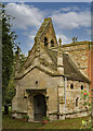
Found beside the road is the famed saltwell a chalybeate spring thought to have healing qualities, although recent analysis showed it lacked iron. It arises in a strange trunchated beehive shaped well. It was first noted in 1226 and has never known to run dry.
You may be viewing yesterday's version of this page. To see the most up to date information please register for a free account.
")
 (PID:206735)")
 (PID:206734)")
Do not use the above information on other web sites or publications without permission of the contributor.
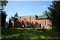
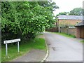
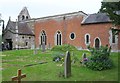
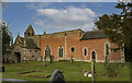
Nearby Images from Geograph Britain and Ireland:
©2006(licence)
©2018(licence)
©2018(licence)
©2021(licence)
©2021(licence)
The above images may not be of the site on this page, they are loaded from Geograph.
Please Submit an Image of this site or go out and take one for us!
Click here to see more info for this site
Nearby sites
Key: Red: member's photo, Blue: 3rd party photo, Yellow: other image, Green: no photo - please go there and take one, Grey: site destroyed
Download sites to:
KML (Google Earth)
GPX (GPS waypoints)
CSV (Garmin/Navman)
CSV (Excel)
To unlock full downloads you need to sign up as a Contributory Member. Otherwise downloads are limited to 50 sites.
Turn off the page maps and other distractions
Nearby sites listing. In the following links * = Image available
4.9km WSW 255° Bottesford Cross* Ancient Cross (SK8061638944)
7.3km SW 230° St Peter's Church (Redmile)* Early Christian Sculptured Stone (SK7971335528)
8.6km S 191° St Michael and All Angels (Harston)* Ancient Cross (SK8384031774)
10.3km E 79° Honington Camp* Hillfort (SK954424)
11.0km NNW 328° Hawton Cursus Cursus (SK79294949)
11.6km NW 308° Willow Rundle Spring* Holy Well or Sacred Spring (SK7602047230)
12.5km S 175° King Lud’s Intrenchments Misc. Earthwork (SK867279)
12.5km SE 127° Burgh Banks Hillfort (SK955330)
13.4km ENE 78° Lady Well (Ancaster)* Holy Well or Sacred Spring (SK98404332)
13.8km NNW 336° Farndon Fields* Natural Stone / Erratic / Other Natural Feature (SK794528)
15.1km SSE 165° Fish Well* Holy Well or Sacred Spring (SK89602578)
15.4km S 180° St Bartholomew (Sproxton)* Ancient Cross (SK8566624904)
15.5km W 275° Old Wark Spring* Holy Well or Sacred Spring (SK698415)
15.7km W 276° Shelford and Newton Cursus Cursus (SK696417)
16.5km NW 319° Rolleston Cross* Ancient Cross (SK7418052489)
16.5km NW 319° Holy Trinity (Rolleston)* Ancient Cross (SK7418552503)
16.8km SE 125° Round Hills Fort* Hillfort (SK992308)
18.2km N 355° Langford, Brough and Glebe Farm sites on the A46* Ancient Village or Settlement (SK833584)
18.3km W 261° Stragglethorpe Bronze Age ring ditch* Round Barrow(s) (SK6720037057)
18.5km SW 226° Long Clawson Stone* Standing Stone (Menhir) (SK722272)
18.9km SW 217° Hazeltongue Lodge Henge (SK74092509)
19.6km WSW 237° St Luke (Hickling)* Early Christian Sculptured Stone (SK691292)
20.2km E 83° Folk Moot* Round Barrow(s) (TF0536742981)
20.2km SW 223° Clawson Hose and Harby Cursus Cursus (SK718252)
20.2km NW 313° Southwell Minster* Early Christian Sculptured Stone (SK70165378)
View more nearby sites and additional images


 We would like to know more about this location. Please feel free to add a brief description and any relevant information in your own language.
 Wir möchten mehr über diese Stätte erfahren. Bitte zögern Sie nicht, eine kurze Beschreibung und relevante Informationen in Deutsch hinzuzufügen.
 Nous aimerions en savoir encore un peu sur les lieux. S'il vous plaît n'hesitez pas à ajouter une courte description et tous les renseignements pertinents dans votre propre langue.
 Quisieramos informarnos un poco más de las lugares. No dude en añadir una breve descripción y otros datos relevantes en su propio idioma.