


<< Text Pages >> West Heslerton Wold Dyke - Misc. Earthwork in England in Yorkshire (East)
Submitted by drolaf on Monday, 26 June 2017 Page Views: 1280
Multi-periodSite Name: West Heslerton Wold DykeCountry: England
NOTE: This site is 1.419 km away from the location you searched for.
County: Yorkshire (East) Type: Misc. Earthwork
Nearest Village: West Heslerton
Map Ref: SE913733
Latitude: 54.147423N Longitude: 0.603711W
Condition:
| 5 | Perfect |
| 4 | Almost Perfect |
| 3 | Reasonable but with some damage |
| 2 | Ruined but still recognisable as an ancient site |
| 1 | Pretty much destroyed, possibly visible as crop marks |
| 0 | No data. |
| -1 | Completely destroyed |
| 5 | Superb |
| 4 | Good |
| 3 | Ordinary |
| 2 | Not Good |
| 1 | Awful |
| 0 | No data. |
| 5 | Can be driven to, probably with disabled access |
| 4 | Short walk on a footpath |
| 3 | Requiring a bit more of a walk |
| 2 | A long walk |
| 1 | In the middle of nowhere, a nightmare to find |
| 0 | No data. |
| 5 | co-ordinates taken by GPS or official recorded co-ordinates |
| 4 | co-ordinates scaled from a detailed map |
| 3 | co-ordinates scaled from a bad map |
| 2 | co-ordinates of the nearest village |
| 1 | co-ordinates of the nearest town |
| 0 | no data |
Internal Links:
External Links:
Misc. Earthwork in Yorkshire (East)
The present dyke runs from 54.148 -0.6029 northwards for one mile from SE 913 733 to se 910 749. Access: on agricultural/road boundary, covered by hedge growth.
This dyke runs north-south alongside White gate. Parish and landscape boundaries at West Heslerton reflect those of 1000 BC, which were probably for stock and grazing control rather than territorial. The village name possibly derived from hazel, an important food from the Mesolithic to historic times. West Heslerton is a rare example of continuous occupation over millennia.
The trackway was built along in Roman times, and the Brit-Romanos/Romano-Brits also built a complex at a previous water spring shrine. A large early Anglo-Saxon settlement grew up as soon as the Roman economy collapsed in 400 AD. Many `grubenhaus' grain storage pits suggest a fairly large popuation. The cemetery re-used the site of the Neolithic henge and smaller Bronze Age barrows. DNA Analysis showed that assigning gender by grave goods was misleading as some of the burials with weapons may be females and others with brooches and beads may be male.
More information from The Landscape Research Centre.
Note: Have you visited this site? Do you have any photographs or further information you can add?
You may be viewing yesterday's version of this page. To see the most up to date information please register for a free account.
Do not use the above information on other web sites or publications without permission of the contributor.
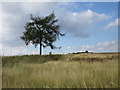
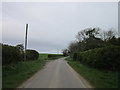
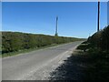
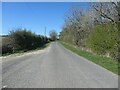
Nearby Images from Geograph Britain and Ireland:

©2021(licence)
©2016(licence)
©2012(licence)
©2021(licence)
©2021(licence)
The above images may not be of the site on this page, they are loaded from Geograph.
Please Submit an Image of this site or go out and take one for us!
Click here to see more info for this site
Nearby sites
Key: Red: member's photo, Blue: 3rd party photo, Yellow: other image, Green: no photo - please go there and take one, Grey: site destroyed
Download sites to:
KML (Google Earth)
GPX (GPS waypoints)
CSV (Garmin/Navman)
CSV (Excel)
To unlock full downloads you need to sign up as a Contributory Member. Otherwise downloads are limited to 50 sites.
Turn off the page maps and other distractions
Nearby sites listing. In the following links * = Image available
2.2km NW 318° Staple Howe Ancient Village or Settlement (SE898749)
2.5km WNW 298° Knapton Wold Dyke Misc. Earthwork (SE8908274415)
3.2km NE 54° Heslerton long barrow Long Barrow (SE93827523)
6.6km SSW 200° Duggleby Cursus Cursus (SE892670)
7.2km SSW 208° Duggleby Howe* Round Barrow(s) (SE88046688)
7.2km SSW 209° Duggleby Cursus Cursus (SE879669)
7.3km SE 138° Helperthorpe Long Barrow Long Barrow (SE963679)
8.5km SSE 146° Kemp Howe (Yorkshire) Long Barrow (SE96166628)
8.5km SSE 152° Willie Howe (Cowlam) Round Barrow(s) (SE95516586)
10.1km SSW 200° High Street Barrow (Towthorpe) Cairn (SE88006373)
10.6km ENE 75° Willerby Wold House* Round Barrow(s) (TA015763)
10.9km SSW 204° Fairy Stones* Natural Stone / Erratic / Other Natural Feature (SE8700363317)
10.9km SSW 199° Towthorpe Plantation Barrow Cemetery Barrow Cemetery (SE879629)
11.9km ENE 78° Willerby Wold Long Barrow Long Barrow (TA029761)
12.0km ESE 104° Paddock Hill* Henge (TA030707)
12.3km SW 219° Wharram Percy Barrows Barrow Cemetery (SE837636)
12.3km S 184° Fimber Cursus* Cursus (SE907610)
12.4km S 190° Fimber Cursus Cursus (SE894610)
12.5km NW 322° Market Cross (Thornton-le-Dale)* Ancient Cross (SE83418302)
12.7km N 357° Rob Howe Long Barrow Long Barrow (SE90308600)
13.0km N 352° Scamridge Long Barrow Long Barrow (SE892861)
13.0km NNW 328° St Hilda (Ellerburn)* Ancient Cross (SE84148422)
13.2km E 93° Wold Newton* Round Barrow(s) (TA04527287)
13.5km ENE 74° Elf Howe Round Barrow(s) (TA04227725)
13.5km E 94° Ba’l Hill* Round Barrow(s) (TA048726)
View more nearby sites and additional images


 We would like to know more about this location. Please feel free to add a brief description and any relevant information in your own language.
 Wir möchten mehr über diese Stätte erfahren. Bitte zögern Sie nicht, eine kurze Beschreibung und relevante Informationen in Deutsch hinzuzufügen.
 Nous aimerions en savoir encore un peu sur les lieux. S'il vous plaît n'hesitez pas à ajouter une courte description et tous les renseignements pertinents dans votre propre langue.
 Quisieramos informarnos un poco más de las lugares. No dude en añadir una breve descripción y otros datos relevantes en su propio idioma.