


<< Text Pages >> Arundel Park Ditched Bowl Barrow - Round Barrow(s) in England in West Sussex
Submitted by coldrum on Friday, 27 November 2020 Page Views: 379
Neolithic and Bronze AgeSite Name: Arundel Park Ditched Bowl BarrowCountry: England
NOTE: This site is 1.649 km away from the location you searched for.
County: West Sussex Type: Round Barrow(s)
Nearest Town: Arundel
Map Ref: TQ01260853
Latitude: 50.867416N Longitude: 0.562403W
Condition:
| 5 | Perfect |
| 4 | Almost Perfect |
| 3 | Reasonable but with some damage |
| 2 | Ruined but still recognisable as an ancient site |
| 1 | Pretty much destroyed, possibly visible as crop marks |
| 0 | No data. |
| -1 | Completely destroyed |
| 5 | Superb |
| 4 | Good |
| 3 | Ordinary |
| 2 | Not Good |
| 1 | Awful |
| 0 | No data. |
| 5 | Can be driven to, probably with disabled access |
| 4 | Short walk on a footpath |
| 3 | Requiring a bit more of a walk |
| 2 | A long walk |
| 1 | In the middle of nowhere, a nightmare to find |
| 0 | No data. |
| 5 | co-ordinates taken by GPS or official recorded co-ordinates |
| 4 | co-ordinates scaled from a detailed map |
| 3 | co-ordinates scaled from a bad map |
| 2 | co-ordinates of the nearest village |
| 1 | co-ordinates of the nearest town |
| 0 | no data |
Be the first person to rate this site - see the 'Contribute!' box in the right hand menu.
Internal Links:
External Links:
Round Barrow in West Sussex
From Heritage Gateway:
"A ditched bowl barrow 10 pades in diameter and 1ft high in Arundel Park. It appears to have been dug into at the centre.{1}{2} In 1971 it was 7.5m in diameter and 0.3m in height. The E. side had been reduced by the laying of a fence across it and the top of the mound was hummocky, possibly due to excavation. There were no traces of a ditch."
https://www.heritagegateway.org.uk/Gateway/Results_Single.aspx?uid=MWS2708&resourceID=1032
You may be viewing yesterday's version of this page. To see the most up to date information please register for a free account.
Do not use the above information on other web sites or publications without permission of the contributor.
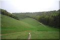
Nearby Images from Geograph Britain and Ireland:
©2009(licence)
©2012(licence)
©2012(licence)
©2012(licence)
©2012(licence)
The above images may not be of the site on this page, they are loaded from Geograph.
Please Submit an Image of this site or go out and take one for us!
Click here to see more info for this site
Nearby sites
Key: Red: member's photo, Blue: 3rd party photo, Yellow: other image, Green: no photo - please go there and take one, Grey: site destroyed
Download sites to:
KML (Google Earth)
GPX (GPS waypoints)
CSV (Garmin/Navman)
CSV (Excel)
To unlock full downloads you need to sign up as a Contributory Member. Otherwise downloads are limited to 50 sites.
Turn off the page maps and other distractions
Nearby sites listing. In the following links * = Image available
116m ENE 60° Arundel Barrow MWS2707 Round Barrow(s) (TQ01360859)
141m E 83° Arundel Park Enclosure Ancient Village or Settlement (TQ01400855)
473m N 355° Prehistoric and Roman Field System and Earthworks Misc. Earthwork (TQ01210900)
505m N 353° Arundel Park Barrow MWS6559 Round Barrow(s) (TQ01190903)
563m N 355° Arundel Barrow MWS14523 Round Barrow(s) (TQ01200909)
710m N 360° Arundel Park Barrow MWS14520 Round Barrow(s) (TQ01240924)
740m N 1° Arundel Park Barrow MWS14521 Round Barrow(s) (TQ01260927)
742m N 5° Arundel Park Barrow MWS14778 Round Barrow(s) (TQ01310927)
761m N 11° Arundel Park Settlements Ancient Village or Settlement (TQ01390928)
1.0km N 7° Arundel Park Barrow MWS14784 Round Barrow(s) (TQ01360957)
1.7km WNW 283° Late Prehistoric and Roman Field systems Misc. Earthwork (SU99640888)
2.0km NNW 330° War Dyke and Prehistoric Enclosure Misc. Earthwork (TQ00251020)
2.0km NNW 340° South Wood Cross Dyke Misc. Earthwork (TQ00541040)
2.7km E 91° Burpham Camp Hillfort (TQ03920854)
2.7km E 91° Burpham Camp Hillfort (TQ03920854)
2.7km NNW 338° Cross Dyke, Whiteways Misc. Earthwork (TQ00201101)
3.1km WSW 254° Goblestubbs Copse earthworks Ancient Village or Settlement (SU983076)
3.6km NNW 344° Bury Hill (West Sussex) Causewayed Enclosure (TQ002120)
4.1km WNW 293° Prehistoric to Roman Field System Misc. Earthwork (SU97391005)
4.4km E 80° Norfolk Clump Tumulus Round Barrow(s) (TQ056094)
4.7km NNE 34° Highdown Tumulus Round Barrow(s) (TQ038125)
4.9km NE 42° Amberley Mount Field System Misc. Earthwork (TQ045122)
4.9km NE 39° Amberley Mount Tumuli Barrow Cemetery (TQ043124)
5.1km NW 321° Barkhale Tumulus* Round Barrow(s) (SU980124)
5.1km ENE 74° Wepham Down Earthwork* Misc. Earthwork (TQ06141001)
View more nearby sites and additional images


 We would like to know more about this location. Please feel free to add a brief description and any relevant information in your own language.
 Wir möchten mehr über diese Stätte erfahren. Bitte zögern Sie nicht, eine kurze Beschreibung und relevante Informationen in Deutsch hinzuzufügen.
 Nous aimerions en savoir encore un peu sur les lieux. S'il vous plaît n'hesitez pas à ajouter une courte description et tous les renseignements pertinents dans votre propre langue.
 Quisieramos informarnos un poco más de las lugares. No dude en añadir una breve descripción y otros datos relevantes en su propio idioma.