<< Text Pages >> Beedings Early Upper Palaeolithic Site - Ancient Village or Settlement in England in West Sussex
Submitted by coldrum on Wednesday, 02 July 2008 Page Views: 6374
Mesolithic, Palaeolithic and EarlierSite Name: Beedings Early Upper Palaeolithic SiteCountry: England
NOTE: This site is 5.803 km away from the location you searched for.
County: West Sussex Type: Ancient Village or Settlement
Nearest Town: Pulborough Nearest Village: Nutbourne
Map Ref: TQ075202
Latitude: 50.971194N Longitude: 0.470326W
Condition:
| 5 | Perfect |
| 4 | Almost Perfect |
| 3 | Reasonable but with some damage |
| 2 | Ruined but still recognisable as an ancient site |
| 1 | Pretty much destroyed, possibly visible as crop marks |
| 0 | No data. |
| -1 | Completely destroyed |
| 5 | Superb |
| 4 | Good |
| 3 | Ordinary |
| 2 | Not Good |
| 1 | Awful |
| 0 | No data. |
| 5 | Can be driven to, probably with disabled access |
| 4 | Short walk on a footpath |
| 3 | Requiring a bit more of a walk |
| 2 | A long walk |
| 1 | In the middle of nowhere, a nightmare to find |
| 0 | No data. |
| 5 | co-ordinates taken by GPS or official recorded co-ordinates |
| 4 | co-ordinates scaled from a detailed map |
| 3 | co-ordinates scaled from a bad map |
| 2 | co-ordinates of the nearest village |
| 1 | co-ordinates of the nearest town |
| 0 | no data |
Internal Links:
External Links:
The Early Upper Palaeolithic site of Beedings is situated in West Sussex on the edge of the Lower Greensand scarp 4km north east of Pulborough. It is currently the site of Beedings Castle, a monumental late 19th century house built for the physician John Harley.
During the construction of the house a series of fissures were revealed within the underlying Rock. These contained a unique stone tool assemblage consisting of some 2,300 pieces. Through the work of Roger Jacobi (The British Museum) it is now thought that these tools are part of a distinctive group of old stone-age (Palaeolithic) tools. It is probable that these tools date to in excess of 35,000 years ago; an age which suggests either an early colonisation date for Britain by anatomically modern humans or occupation by technologically advanced and late surviving Neanderthals. Either scenario is exciting and of enormous significance for our understanding of the transition from Neanderthal to Modern Human populations in Northern Europe.
More details at the Project Home page and at English Heritage.
Note: Britain's last Neanderthals were more sophisticated than we thought, see latest comment
You may be viewing yesterday's version of this page. To see the most up to date information please register for a free account.
Do not use the above information on other web sites or publications without permission of the contributor.
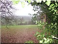
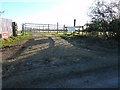
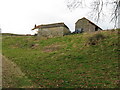
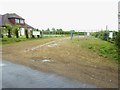
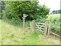
Nearby Images from Geograph Britain and Ireland:
©2006(licence)
©2011(licence)
©2009(licence)
©2015(licence)
©2015(licence)
The above images may not be of the site on this page, they are loaded from Geograph.
Please Submit an Image of this site or go out and take one for us!
Click here to see more info for this site
Nearby sites
Key: Red: member's photo, Blue: 3rd party photo, Yellow: other image, Green: no photo - please go there and take one, Grey: site destroyed
Download sites to:
KML (Google Earth)
GPX (GPS waypoints)
CSV (Garmin/Navman)
CSV (Excel)
To unlock full downloads you need to sign up as a Contributory Member. Otherwise downloads are limited to 50 sites.
Turn off the page maps and other distractions
Nearby sites listing. In the following links * = Image available
7.6km S 174° Chantry Hill Cross Dyke* Misc. Earthwork (TQ0850512712)
7.7km S 178° Kithurst Hill Tumuli* Barrow Cemetery (TQ07871254)
7.8km S 191° Springhead Hill Cross Dyke Misc. Earthwork (TQ062125)
7.8km S 187° Springhead Hill Tumuli Barrow Cemetery (TQ067124)
7.9km SSW 197° Rackham Hill Earthwork and Tumuli* Round Barrow(s) (TQ0529712589)
8.1km SSE 167° Sullington Hill Cross Dyke* Misc. Earthwork (TQ09451232)
8.2km SSW 199° Rackham Banks* Ancient Village or Settlement (TQ05001242)
8.3km S 173° Chantry Hill Tumuli* Barrow Cemetery (TQ08731197)
8.4km SSW 203° Amberley Mount Tumuli Barrow Cemetery (TQ043124)
8.5km SSW 207° Highdown Tumulus Round Barrow(s) (TQ038125)
8.5km SSW 202° Amberley Mount Field System Misc. Earthwork (TQ045122)
9.1km W 277° Virgin Mary Spring* Holy Well or Sacred Spring (SU9838721139)
9.5km S 172° Old Gray's Wood Bowl Barrow Round Barrow(s) (TQ09051078)
10.1km S 172° Harrow Hill Barrows Barrow Cemetery (TQ09141026)
10.1km SE 145° Chanctonbury Hill Cross Dyke* Misc. Earthwork (TQ13491205)
10.2km S 178° Harrow Hill enclosure* Ancient Village or Settlement (TQ08151000)
10.2km S 177° Harrow Hill Flint Mines* Ancient Mine, Quarry or other Industry (TQ082100)
10.3km S 172° Cock Hill Barrow* Round Barrow(s) (TQ09101007)
10.3km SE 144° Chanctonbury Hill Bowl Barrow 1* Round Barrow(s) (TQ13731202)
10.3km S 189° Wepham Down Earthwork* Misc. Earthwork (TQ06141001)
10.3km SE 143° Chanctonbury Ring* Hillfort (TQ139121)
10.4km S 186° Friday's Well Holy Well or Sacred Spring (TQ06620983)
10.5km SE 143° Chanctonbury Hill Saucer Barrows 2-4* Barrow Cemetery (TQ14031200)
10.6km S 173° Cock Hill Settlement Ancient Village or Settlement (TQ08920974)
10.6km S 181° Harrow Hill Tumulus Round Barrow(s) (TQ07610959)
View more nearby sites and additional images


 We would like to know more about this location. Please feel free to add a brief description and any relevant information in your own language.
 Wir möchten mehr über diese Stätte erfahren. Bitte zögern Sie nicht, eine kurze Beschreibung und relevante Informationen in Deutsch hinzuzufügen.
 Nous aimerions en savoir encore un peu sur les lieux. S'il vous plaît n'hesitez pas à ajouter une courte description et tous les renseignements pertinents dans votre propre langue.
 Quisieramos informarnos un poco más de las lugares. No dude en añadir una breve descripción y otros datos relevantes en su propio idioma.