<< Text Pages >> Church Hill Bowl Barrow - Round Barrow(s) in England in West Sussex
Submitted by coldrum on Thursday, 26 November 2020 Page Views: 422
Neolithic and Bronze AgeSite Name: Church Hill Bowl BarrowCountry: England County: West Sussex Type: Round Barrow(s)
Nearest Town: Worthing Nearest Village: Findon
Map Ref: TQ11430826
Latitude: 50.863121N Longitude: 0.41802W
Condition:
| 5 | Perfect |
| 4 | Almost Perfect |
| 3 | Reasonable but with some damage |
| 2 | Ruined but still recognisable as an ancient site |
| 1 | Pretty much destroyed, possibly visible as crop marks |
| 0 | No data. |
| -1 | Completely destroyed |
| 5 | Superb |
| 4 | Good |
| 3 | Ordinary |
| 2 | Not Good |
| 1 | Awful |
| 0 | No data. |
| 5 | Can be driven to, probably with disabled access |
| 4 | Short walk on a footpath |
| 3 | Requiring a bit more of a walk |
| 2 | A long walk |
| 1 | In the middle of nowhere, a nightmare to find |
| 0 | No data. |
| 5 | co-ordinates taken by GPS or official recorded co-ordinates |
| 4 | co-ordinates scaled from a detailed map |
| 3 | co-ordinates scaled from a bad map |
| 2 | co-ordinates of the nearest village |
| 1 | co-ordinates of the nearest town |
| 0 | no data |
Be the first person to rate this site - see the 'Contribute!' box in the right hand menu.
Internal Links:
External Links:
Round Barrow(s) in West Sussex. Bowl Barrow near prehistoric flint mines.
https://www.heritagegateway.org.uk/Gateway/Results_Single.aspx?uid=MWS5087&resourceID=1032
You may be viewing yesterday's version of this page. To see the most up to date information please register for a free account.
Do not use the above information on other web sites or publications without permission of the contributor.
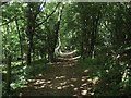
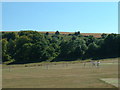
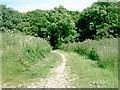
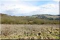
Nearby Images from Geograph Britain and Ireland:
©2013(licence)
©2005(licence)
©2008(licence)
©2020(licence)
©2013(licence)
The above images may not be of the site on this page, they are loaded from Geograph.
Please Submit an Image of this site or go out and take one for us!
Click here to see more info for this site
Nearby sites
Key: Red: member's photo, Blue: 3rd party photo, Yellow: other image, Green: no photo - please go there and take one, Grey: site destroyed
Download sites to:
KML (Google Earth)
GPX (GPS waypoints)
CSV (Garmin/Navman)
CSV (Excel)
To unlock full downloads you need to sign up as a Contributory Member. Otherwise downloads are limited to 50 sites.
Turn off the page maps and other distractions
Nearby sites listing. In the following links * = Image available
50m NW 324° Church Hill Flint Mines Ancient Mine, Quarry or other Industry (TQ114083)
1.3km NNW 336° Muntham Court Iron Age/Romano British Settlement/Shrine/Well Ancient Village or Settlement (TQ109094)
1.5km WNW 289° Blackpatch Hill Bowl Barrow Round Barrow(s) (TQ10010872)
2.1km WNW 292° Blackpatch Mounds Barrow Cemetery (TQ09500900)
2.1km WNW 286° Blackpatch Flint Mines* Ancient Mine, Quarry or other Industry (TQ094088)
2.3km NW 308° Blackpatch Hill Bowl Barrow* Round Barrow(s) (TQ09540966)
2.4km WNW 291° Blackpatch Settlement Ancient Village or Settlement (TQ09150908)
2.5km E 97° Cissbury Ring* Hillfort (TQ13910803)
2.9km WNW 302° Cock Hill Settlement Ancient Village or Settlement (TQ08920974)
2.9km NW 309° Cock Hill Barrow* Round Barrow(s) (TQ09101007)
3.0km NW 312° Harrow Hill Barrows Barrow Cemetery (TQ09141026)
3.1km WNW 289° New Barn Down Ancient Village or Settlement (TQ08460922)
3.2km WNW 290° New Barn Down Barrows Barrow Cemetery (TQ08430926)
3.5km NW 318° Old Gray's Wood Bowl Barrow Round Barrow(s) (TQ09051078)
3.7km WNW 300° Harrow Hill Flint Mines* Ancient Mine, Quarry or other Industry (TQ082100)
3.7km WNW 299° Harrow Hill enclosure* Ancient Village or Settlement (TQ08151000)
4.0km WNW 290° Harrow Hill Tumulus Round Barrow(s) (TQ07610959)
4.3km NNE 30° Chanctonbury Hill Cross Dyke* Misc. Earthwork (TQ13491205)
4.4km NNE 33° Chanctonbury Hill Bowl Barrow 1* Round Barrow(s) (TQ13731202)
4.4km SSW 210° Highdown Hill* Hillfort (TQ093044)
4.5km NE 40° Chanctonbury Hill Bowl Barrow 6* Round Barrow(s) (TQ14231174)
4.5km NE 39° Chanctonbury Hill Bowl Barrow 5* Round Barrow(s) (TQ14211180)
4.5km NNW 335° Sullington Hill Cross Dyke* Misc. Earthwork (TQ09451232)
4.5km NE 36° Chanctonbury Hill Saucer Barrows 2-4* Barrow Cemetery (TQ14031200)
4.6km NE 34° Chanctonbury Ring* Hillfort (TQ139121)
View more nearby sites and additional images


 We would like to know more about this location. Please feel free to add a brief description and any relevant information in your own language.
 Wir möchten mehr über diese Stätte erfahren. Bitte zögern Sie nicht, eine kurze Beschreibung und relevante Informationen in Deutsch hinzuzufügen.
 Nous aimerions en savoir encore un peu sur les lieux. S'il vous plaît n'hesitez pas à ajouter une courte description et tous les renseignements pertinents dans votre propre langue.
 Quisieramos informarnos un poco más de las lugares. No dude en añadir una breve descripción y otros datos relevantes en su propio idioma.