<< Text Pages >> Horsenden Hill - Hillfort in England in Greater London
Submitted by vicky on Thursday, 25 March 2004 Page Views: 23546
Iron Age and Later PrehistorySite Name: Horsenden HillCountry: England
NOTE: This site is 2.12 km away from the location you searched for.
County: Greater London Type: Hillfort
Nearest Town: Ealing Nearest Village: Perivale
Map Ref: TQ1618684366 Landranger Map Number: 176
Latitude: 51.546236N Longitude: 0.325851W
Condition:
| 5 | Perfect |
| 4 | Almost Perfect |
| 3 | Reasonable but with some damage |
| 2 | Ruined but still recognisable as an ancient site |
| 1 | Pretty much destroyed, possibly visible as crop marks |
| 0 | No data. |
| -1 | Completely destroyed |
| 5 | Superb |
| 4 | Good |
| 3 | Ordinary |
| 2 | Not Good |
| 1 | Awful |
| 0 | No data. |
| 5 | Can be driven to, probably with disabled access |
| 4 | Short walk on a footpath |
| 3 | Requiring a bit more of a walk |
| 2 | A long walk |
| 1 | In the middle of nowhere, a nightmare to find |
| 0 | No data. |
| 5 | co-ordinates taken by GPS or official recorded co-ordinates |
| 4 | co-ordinates scaled from a detailed map |
| 3 | co-ordinates scaled from a bad map |
| 2 | co-ordinates of the nearest village |
| 1 | co-ordinates of the nearest town |
| 0 | no data |
Internal Links:
External Links:
Hillfort in Greater London
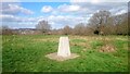
The slight earthwork remains of this possible Iron Age hillfort are recorded as Pastscape Monument No. 398121 and scheduled as Historic England List ID 1001970.
You may be viewing yesterday's version of this page. To see the most up to date information please register for a free account.
Do not use the above information on other web sites or publications without permission of the contributor.
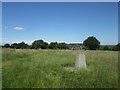
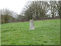
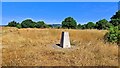
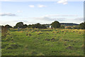
Nearby Images from Geograph Britain and Ireland:
©2017(licence)
©2019(licence)
©2022(licence)
©2012(licence)
©2022(licence)
The above images may not be of the site on this page, they are loaded from Geograph.
Please Submit an Image of this site or go out and take one for us!
Click here to see more info for this site
Nearby sites
Key: Red: member's photo, Blue: 3rd party photo, Yellow: other image, Green: no photo - please go there and take one, Grey: site destroyed
Download sites to:
KML (Google Earth)
GPX (GPS waypoints)
CSV (Garmin/Navman)
CSV (Excel)
To unlock full downloads you need to sign up as a Contributory Member. Otherwise downloads are limited to 50 sites.
Turn off the page maps and other distractions
Nearby sites listing. In the following links * = Image available
4.9km S 184° Elthorne Park Sarsen* Natural Stone / Erratic / Other Natural Feature (TQ15927947)
5.2km E 91° St Mary's Well (London)* Holy Well or Sacred Spring (TQ214844)
5.5km NE 49° Kingsbury erratic* Natural Stone / Erratic / Other Natural Feature (TQ2025488084)
6.5km N 352° Weald Stone* Standing Stone (Menhir) (TQ1508890825)
7.4km ESE 107° Kensal Green* Modern Stone Circle etc (TQ233824)
7.5km NW 326° Waxwell* Holy Well or Sacred Spring (TQ118905)
8.4km NNW 342° Grim's Ditch (Greater London) Ancient Village or Settlement (TQ134923)
9.4km N 359° Stanmore common barrows Misc. Earthwork (TQ15869381)
9.8km S 172° Museum of Richmond* Museum (TQ1774374697)
10.6km E 82° Chalybeate Well* Holy Well or Sacred Spring (TQ2671986055)
10.8km ESE 116° St Govor's Well* Holy Well or Sacred Spring (TQ2605079887)
11.4km E 80° Hampstead Heath Barrow* Round Barrow(s) (TQ2738286518)
11.5km S 169° King Henry's Mound* Artificial Mound (TQ18607315)
11.6km ESE 118° London Natural History Museum* Museum (TQ266792)
12.6km S 169° Richmond Park Long Barrow Artificial Mound (TQ189721)
13.1km ESE 118° Tutankhamun: Treasures of the Golden Pharaoh exhibition, Saatchi Gallery* Museum (TQ279784)
13.2km SSE 151° Putney Heath Round Barrow(s) (TQ22797295)
13.3km ESE 103° The One and The Many* Modern Stone Circle etc (TQ2926981650)
13.5km WSW 242° Stanwell Cursus* Cursus (TQ044777)
13.6km E 101° Petrie Museum of Egyptian Archaeology* Museum (TQ2962882172)
13.7km SW 221° Bedfont Cursus (TQ075738)
13.8km ENE 67° Mus Well (Muswell Hill) Holy Well or Sacred Spring (TQ28869001)
14.0km SSE 168° King Clump Artificial Mound (TQ195708)
14.0km S 181° Barrow Hill (Teddington)* Round Barrow(s) (TQ16287037)
14.0km ESE 103° British Museum* Museum (TQ300816)
View more nearby sites and additional images


 We would like to know more about this location. Please feel free to add a brief description and any relevant information in your own language.
 Wir möchten mehr über diese Stätte erfahren. Bitte zögern Sie nicht, eine kurze Beschreibung und relevante Informationen in Deutsch hinzuzufügen.
 Nous aimerions en savoir encore un peu sur les lieux. S'il vous plaît n'hesitez pas à ajouter une courte description et tous les renseignements pertinents dans votre propre langue.
 Quisieramos informarnos un poco más de las lugares. No dude en añadir una breve descripción y otros datos relevantes en su propio idioma.