


<< Text Pages >> Yarborough Camp - Hillfort in England in Lincolnshire
Submitted by Bladup on Friday, 09 November 2012 Page Views: 5602
Iron Age and Later PrehistorySite Name: Yarborough CampCountry: England
NOTE: This site is 2.33 km away from the location you searched for.
County: Lincolnshire Type: Hillfort
Map Ref: TA081120
Latitude: 53.593438N Longitude: 0.368195W
Condition:
| 5 | Perfect |
| 4 | Almost Perfect |
| 3 | Reasonable but with some damage |
| 2 | Ruined but still recognisable as an ancient site |
| 1 | Pretty much destroyed, possibly visible as crop marks |
| 0 | No data. |
| -1 | Completely destroyed |
| 5 | Superb |
| 4 | Good |
| 3 | Ordinary |
| 2 | Not Good |
| 1 | Awful |
| 0 | No data. |
| 5 | Can be driven to, probably with disabled access |
| 4 | Short walk on a footpath |
| 3 | Requiring a bit more of a walk |
| 2 | A long walk |
| 1 | In the middle of nowhere, a nightmare to find |
| 0 | No data. |
| 5 | co-ordinates taken by GPS or official recorded co-ordinates |
| 4 | co-ordinates scaled from a detailed map |
| 3 | co-ordinates scaled from a bad map |
| 2 | co-ordinates of the nearest village |
| 1 | co-ordinates of the nearest town |
| 0 | no data |
Internal Links:
External Links:
I have visited· I would like to visit
Bladup has visited here
A possible Iron Age earthwork with single bank and ditch. A hoard of Roman coins from 4th century AD was discovered here.
You may be viewing yesterday's version of this page. To see the most up to date information please register for a free account.
")
Do not use the above information on other web sites or publications without permission of the contributor.
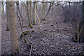
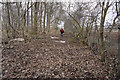
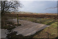
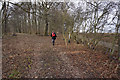
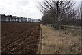
Nearby Images from Geograph Britain and Ireland:
©2010(licence)
©2018(licence)
©2018(licence)
©2018(licence)
©2018(licence)
The above images may not be of the site on this page, they are loaded from Geograph.
Please Submit an Image of this site or go out and take one for us!
Click here to see more info for this site
Nearby sites
Key: Red: member's photo, Blue: 3rd party photo, Yellow: other image, Green: no photo - please go there and take one, Grey: site destroyed
Download sites to:
KML (Google Earth)
GPX (GPS waypoints)
CSV (Garmin/Navman)
CSV (Excel)
To unlock full downloads you need to sign up as a Contributory Member. Otherwise downloads are limited to 50 sites.
Turn off the page maps and other distractions
Nearby sites listing. In the following links * = Image available
3.1km N 353° Howe Hill (Lincolnshire) Round Barrow(s) (TA07631510)
6.0km S 172° Holy Wells (Barnetby le Wold) Holy Well or Sacred Spring (TA091061)
6.1km ESE 122° Brocklesby Park (Great Limber) Cairn (TA1332708902)
7.9km WSW 239° St. Helen's Well (Wrawby) Holy Well or Sacred Spring (TA0137907720)
9.7km SSE 156° Fonaby Stone* Standing Stones (TA123033)
11.0km SSW 199° Maiden Well (Maidenwell) Holy Well or Sacred Spring (TA047015)
11.1km SSW 200° The Maiden-Well Holy Well or Sacred Spring (TA045015)
11.4km SSE 163° Holy Well (Caistor) Holy Well or Sacred Spring (TA1172501229)
11.4km SSE 163° Syfer Spring Holy Well or Sacred Spring (TA117012)
12.0km ESE 103° Ragged Spring (Healing) Holy Well or Sacred Spring (TA199096)
12.5km WSW 256° Broughton Cross* Ancient Cross (SE960086)
13.6km E 99° Toot Hill Bowl Barrow Round Barrow(s) (TA21601011)
14.1km W 264° Gokwell Priory (Broughton) Misc. Earthwork (SE94081028)
14.8km WNW 294° Holy Well (Winterton) Holy Well or Sacred Spring (SE944178)
15.4km SE 136° Ash Holt Long Barrow* Long Barrow (TA1898001112)
16.4km SSE 163° Hills Brough* Long Barrow (TF1337396415)
16.7km N 8° Hull and East Riding Museum* Museum (TA101286)
16.9km ESE 102° Toot Hill Round Barrow* Round Barrow(s) (TA24800888)
17.7km W 278° Dragonby* Natural Stone / Erratic / Other Natural Feature (SE905142)
18.7km W 272° Crosby Stone Natural Stone / Erratic / Other Natural Feature (SE893121)
19.8km SW 228° Ashwell* Holy Well or Sacred Spring (SK936985)
20.4km SE 143° Ash Hill Long Barrow* Long Barrow (TF20889612)
20.4km SSE 165° Walesby All Saints church carvings* Sculptured Stone (TF1382892388)
20.6km SSE 154° Lud well (Stainton-Le-Vale)* Holy Well or Sacred Spring (TF17629376)
21.4km SE 143° Hoe Hill Long Barrow* Long Barrow (TF215953)
View more nearby sites and additional images


 We would like to know more about this location. Please feel free to add a brief description and any relevant information in your own language.
 Wir möchten mehr über diese Stätte erfahren. Bitte zögern Sie nicht, eine kurze Beschreibung und relevante Informationen in Deutsch hinzuzufügen.
 Nous aimerions en savoir encore un peu sur les lieux. S'il vous plaît n'hesitez pas à ajouter une courte description et tous les renseignements pertinents dans votre propre langue.
 Quisieramos informarnos un poco más de las lugares. No dude en añadir una breve descripción y otros datos relevantes en su propio idioma.