<< Our Photo Pages >> Normandy Well (Horsham) - Holy Well or Sacred Spring in England in West Sussex
Submitted by baruc on Tuesday, 05 June 2012 Page Views: 4389
Springs and Holy WellsSite Name: Normandy Well (Horsham)Country: England
NOTE: This site is 3.235 km away from the location you searched for.
County: West Sussex Type: Holy Well or Sacred Spring
Map Ref: TQ1710130224
Latitude: 51.059424N Longitude: 0.330412W
Condition:
| 5 | Perfect |
| 4 | Almost Perfect |
| 3 | Reasonable but with some damage |
| 2 | Ruined but still recognisable as an ancient site |
| 1 | Pretty much destroyed, possibly visible as crop marks |
| 0 | No data. |
| -1 | Completely destroyed |
| 5 | Superb |
| 4 | Good |
| 3 | Ordinary |
| 2 | Not Good |
| 1 | Awful |
| 0 | No data. |
| 5 | Can be driven to, probably with disabled access |
| 4 | Short walk on a footpath |
| 3 | Requiring a bit more of a walk |
| 2 | A long walk |
| 1 | In the middle of nowhere, a nightmare to find |
| 0 | No data. |
| 5 | co-ordinates taken by GPS or official recorded co-ordinates |
| 4 | co-ordinates scaled from a detailed map |
| 3 | co-ordinates scaled from a bad map |
| 2 | co-ordinates of the nearest village |
| 1 | co-ordinates of the nearest town |
| 0 | no data |
Internal Links:
External Links:
I have visited· I would like to visit
Baruc visited on 3rd Jun 2012 - their rating: Cond: -1 Amb: 3 Access: 5
graemefield visited on 1st Jan 2012 - their rating: Cond: -1 Amb: 3 Access: 5
Average ratings for this site from all visit loggers: Condition: -1 Ambience: 3 Access: 5
 (PID:89804)")
Described as an open well, it ran partly under one of the houses and was about four foot in depth. It was reputed never to run dry, even in the longest drought.
The water from the well was used for baptisms in the church.
The area where the Priests House used to be located is now a private car park.
You may be viewing yesterday's version of this page. To see the most up to date information please register for a free account.
Do not use the above information on other web sites or publications without permission of the contributor.
davidmorgan has found this location on Google Street View:
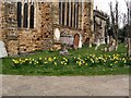
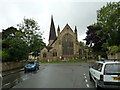
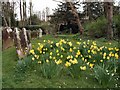
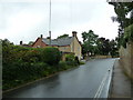
Nearby Images from Geograph Britain and Ireland:
©2011(licence)
©2010(licence)
©2011(licence)
©2010(licence)

©2010(licence)
The above images may not be of the site on this page, they are loaded from Geograph.
Please Submit an Image of this site or go out and take one for us!
Click here to see more info for this site
Nearby sites
Key: Red: member's photo, Blue: 3rd party photo, Yellow: other image, Green: no photo - please go there and take one, Grey: site destroyed
Download sites to:
KML (Google Earth)
GPX (GPS waypoints)
CSV (Garmin/Navman)
CSV (Excel)
To unlock full downloads you need to sign up as a Contributory Member. Otherwise downloads are limited to 50 sites.
Turn off the page maps and other distractions
Nearby sites listing. In the following links * = Image available
2.2km W 281° Wickhurst Green* Ancient Village or Settlement (TQ14953060)
3.3km SSE 165° The Nun's Well (West Sussex) Holy Well or Sacred Spring (TQ1802227076)
7.4km ENE 68° Shepherdsfield Barrow Round Barrow(s) (TQ239332)
7.8km ENE 70° Blackhill Barrow Round Barrow(s) (TQ244330)
10.3km E 95° Mesolithic settlement near Pulpit Rock* Ancient Village or Settlement (TQ27362955)
12.7km NNW 344° Leith Hill Place* Natural Stone / Erratic / Other Natural Feature (TQ1324542344)
13.9km SW 225° Beedings Early Upper Palaeolithic Site Ancient Village or Settlement (TQ075202)
13.9km N 354° Anstiebury Camp* Hillfort (TQ1534244008)
14.4km NNW 334° Holmbury Camp Hillfort (TQ105430)
15.5km N 352° Mag's Well (Abinger Forest)* Holy Well or Sacred Spring (TQ145455)
15.5km ENE 77° Ashdown Forest - Horsham ridgeway Ancient Trackway (TQ32153416)
15.8km NNW 338° Felday* Hillfort (TQ10824475)
16.6km NNW 341° Abinger Manor* Ancient Village or Settlement (TQ112458)
17.7km E 86° Big on Little* Rock Outcrop (TQ348320)
17.8km E 85° Philpots Promontory Camp* Hillfort (TQ348323)
17.8km E 85° Philpots Camp Mesolithic Rock Shelters Cave or Rock Shelter (TQ34873212)
18.0km WNW 299° The Dragonstones Modern Stone Circle etc (TQ0105038489)
18.3km N 1° Glory Wood Bowl Barrow* Round Barrow(s) (TQ1712248542)
18.4km WNW 291° St Mary the Virgin's Well* Holy Well or Sacred Spring (SU997363)
18.4km SSW 191° Chanctonbury Ring* Hillfort (TQ139121)
18.5km S 191° Chanctonbury Hill Saucer Barrows 2-4* Barrow Cemetery (TQ14031200)
18.5km SSW 192° Chanctonbury Hill Bowl Barrow 1* Round Barrow(s) (TQ13731202)
18.5km SSW 193° Chanctonbury Hill Cross Dyke* Misc. Earthwork (TQ13491205)
18.5km NNW 345° Deerleap Wood* Round Barrow(s) (TQ118480)
18.6km WNW 298° Hascombe Hill* Hillfort (TQ004386)
View more nearby sites and additional images


 We would like to know more about this location. Please feel free to add a brief description and any relevant information in your own language.
 Wir möchten mehr über diese Stätte erfahren. Bitte zögern Sie nicht, eine kurze Beschreibung und relevante Informationen in Deutsch hinzuzufügen.
 Nous aimerions en savoir encore un peu sur les lieux. S'il vous plaît n'hesitez pas à ajouter une courte description et tous les renseignements pertinents dans votre propre langue.
 Quisieramos informarnos un poco más de las lugares. No dude en añadir una breve descripción y otros datos relevantes en su propio idioma.