<< Text Pages >> Caythorpe - Misc. Earthwork in England in Yorkshire (East)
Submitted by Andy B on Saturday, 16 January 2010 Page Views: 7571
Multi-periodSite Name: CaythorpeCountry: England
NOTE: This site is 4.28 km away from the location you searched for.
County: Yorkshire (East) Type: Misc. Earthwork
Nearest Town: Bridlington Nearest Village: Boynton
Map Ref: TA125678
Latitude: 54.093815N Longitude: 0.281335W
Condition:
| 5 | Perfect |
| 4 | Almost Perfect |
| 3 | Reasonable but with some damage |
| 2 | Ruined but still recognisable as an ancient site |
| 1 | Pretty much destroyed, possibly visible as crop marks |
| 0 | No data. |
| -1 | Completely destroyed |
| 5 | Superb |
| 4 | Good |
| 3 | Ordinary |
| 2 | Not Good |
| 1 | Awful |
| 0 | No data. |
| 5 | Can be driven to, probably with disabled access |
| 4 | Short walk on a footpath |
| 3 | Requiring a bit more of a walk |
| 2 | A long walk |
| 1 | In the middle of nowhere, a nightmare to find |
| 0 | No data. |
| 5 | co-ordinates taken by GPS or official recorded co-ordinates |
| 4 | co-ordinates scaled from a detailed map |
| 3 | co-ordinates scaled from a bad map |
| 2 | co-ordinates of the nearest village |
| 1 | co-ordinates of the nearest town |
| 0 | no data |
Internal Links:
External Links:
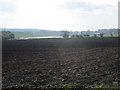
A substantial circular monument 16m in diameter, possibly from the Neolithic Period. Defined by a ditch around 2m wide and 1m deep, within which large pits were recorded which appeared to have held upright timber posts.
This may have been associated with religious ceremonies and burial rites with pits nearby containing evidence of ritual feasting, including numerous animal bones and burnt material.
Note: East Yorkshire gas storage facility making historic discoveries - Iron Age sword found at Centrica site, Caythorpe, see comment
You may be viewing yesterday's version of this page. To see the most up to date information please register for a free account.
Do not use the above information on other web sites or publications without permission of the contributor.
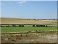
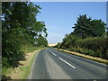
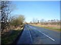
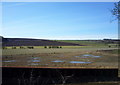
Nearby Images from Geograph Britain and Ireland:
©2014(licence)
©2014(licence)
©2016(licence)
©2016(licence)
©2018(licence)
The above images may not be of the site on this page, they are loaded from Geograph.
Please Submit an Image of this site or go out and take one for us!
Click here to see more info for this site
Nearby sites
Key: Red: member's photo, Blue: 3rd party photo, Yellow: other image, Green: no photo - please go there and take one, Grey: site destroyed
Download sites to:
KML (Google Earth)
GPX (GPS waypoints)
CSV (Garmin/Navman)
CSV (Excel)
To unlock full downloads you need to sign up as a Contributory Member. Otherwise downloads are limited to 50 sites.
Turn off the page maps and other distractions
Nearby sites listing. In the following links * = Image available
1.2km WNW 302° Greenland Fort Hillfort (TA115684)
2.1km WSW 237° Southside Mount* Round Barrow(s)
2.3km WNW 287° Rudston A Cursus Cursus (TA103684)
2.3km W 276° Rudston C Cursus Cursus (TA102680)
2.7km W 270° Rudston Monolith* Standing Stone (Menhir) (TA0980367743)
2.8km W 271° Rudston D Cursus Cursus (TA097678)
3.1km W 266° Rudston B Cursus Cursus (TA094675)
3.3km SW 234° Rudston Cult Centre* Ancient Village or Settlement (TA099658)
3.3km W 264° Rudston Cursus Group Cursus (TA092674)
3.3km SW 232° Rudston A Cursus* Cursus (TA099657)
3.6km N 6° Keld Spring* Holy Well or Sacred Spring (TA128714)
3.7km W 278° Rudston C Cursus Cursus (TA088682)
3.7km SW 236° Rudston Beacon Round Barrow* Round Barrow(s) (TA0945365617)
4.0km NW 316° Maidens Grave* Henge (TA09677063)
4.5km W 260° Rudston B Cursus Cursus (TA081669)
4.7km NNW 332° Rudston D Cursus Cursus (TA102719)
4.9km W 271° Rudstone Long Barrow Long Barrow (TA07586779)
6.8km SSW 208° St John's Well (Harpham)* Holy Well or Sacred Spring (TA095617)
6.9km W 267° Kilham Long Barrow Long Barrow (TA056673)
7.4km N 8° Knox Well* Holy Well or Sacred Spring (TA134752)
7.6km NE 56° Bempton Stones* Marker Stone (TA18737226)
7.8km NW 307° Willy Howe* Round Barrow(s) (TA06167235)
7.8km SW 220° Fox Hill Tumulus* Round Barrow(s) (TA07606167)
8.7km WSW 244° Gallows Hill Barrow Round Barrow(s) (TA04776379)
9.0km ENE 79° Gell Spring* Holy Well or Sacred Spring (TA213698)
View more nearby sites and additional images


 We would like to know more about this location. Please feel free to add a brief description and any relevant information in your own language.
 Wir möchten mehr über diese Stätte erfahren. Bitte zögern Sie nicht, eine kurze Beschreibung und relevante Informationen in Deutsch hinzuzufügen.
 Nous aimerions en savoir encore un peu sur les lieux. S'il vous plaît n'hesitez pas à ajouter une courte description et tous les renseignements pertinents dans votre propre langue.
 Quisieramos informarnos un poco más de las lugares. No dude en añadir una breve descripción y otros datos relevantes en su propio idioma.