<< Text Pages >> Oliver Cromwell's Hill (Eye) - Cairn in England in Cambridgeshire
Submitted by Anne T on Thursday, 07 December 2017 Page Views: 1257
Neolithic and Bronze AgeSite Name: Oliver Cromwell''s Hill (Eye) Alternative Name: Cromwell's Hill (Eye)Country: England
NOTE: This site is 1.222 km away from the location you searched for.
County: Cambridgeshire Type: Cairn
Nearest Town: Peterborough Nearest Village: Eye
Map Ref: TF232018
Latitude: 52.600031N Longitude: 0.182391W
Condition:
| 5 | Perfect |
| 4 | Almost Perfect |
| 3 | Reasonable but with some damage |
| 2 | Ruined but still recognisable as an ancient site |
| 1 | Pretty much destroyed, possibly visible as crop marks |
| 0 | No data. |
| -1 | Completely destroyed |
| 5 | Superb |
| 4 | Good |
| 3 | Ordinary |
| 2 | Not Good |
| 1 | Awful |
| 0 | No data. |
| 5 | Can be driven to, probably with disabled access |
| 4 | Short walk on a footpath |
| 3 | Requiring a bit more of a walk |
| 2 | A long walk |
| 1 | In the middle of nowhere, a nightmare to find |
| 0 | No data. |
| 5 | co-ordinates taken by GPS or official recorded co-ordinates |
| 4 | co-ordinates scaled from a detailed map |
| 3 | co-ordinates scaled from a bad map |
| 2 | co-ordinates of the nearest village |
| 1 | co-ordinates of the nearest town |
| 0 | no data |
Internal Links:
External Links:
Cairn in Cambridgeshire
The Northern Antiquarian (TNA) features a page for this now destroyed tumulus - see their entry for Oliver Cromwell’s Hill, Eye, Cambridgeshire.
TNA tells us that it was one of several nearby, and a local historian named E. Thurnam Leeds wrote a letter describing this particular cairn and the finds it contained, saying: "The small pot of a late Bronze Age type and the other sherds exhibited were found in a tumulus known as Oliver Cromwell’s Hill, at Eyebury, near Peterborough. As only a portion of the tumulus has been examined as yet, it is proposed to defer a full account of the excavations until further progres has been made. The tumulus is of the round type, about 40 yards in diameter and 5 feet high at the centre. On three sides traces of a ditch were met with, containing soil which had evidently been burnt. Close to the gravel in the centre of the tumulus there were two distinct layers of charcoal, and in two places apparently remains of hearths. The small pot was found only 1½ feet down on the south-eastern side of the mound, 39 feet from the centre. In the centre itself at various depths were found sherds, some of Bronze Age forms; but a pice of a rimmed vase found at a depth of 3 feet 6 inches, about 6 inches above the first charcoal layer, appears to be of Roman date, in which case the centre of the tumulus must have been disturbed in those times, though the charcoal floors were never pierced. Bones of various animals, including sheep, pig, dog and hare, and a large flint flake were also found."
Note: Have you visited this location? Are there any traces of this tumulus left? Does anyone know what happened to the pot it contained?
You may be viewing yesterday's version of this page. To see the most up to date information please register for a free account.
Do not use the above information on other web sites or publications without permission of the contributor.
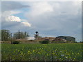
Nearby Images from Geograph Britain and Ireland:
©2012(licence)
©2012(licence)
©2012(licence)
©2007(licence)
©2012(licence)
The above images may not be of the site on this page, they are loaded from Geograph.
Please Submit an Image of this site or go out and take one for us!
Click here to see more info for this site
Nearby sites
Key: Red: member's photo, Blue: 3rd party photo, Yellow: other image, Green: no photo - please go there and take one, Grey: site destroyed
Download sites to:
KML (Google Earth)
GPX (GPS waypoints)
CSV (Garmin/Navman)
CSV (Excel)
To unlock full downloads you need to sign up as a Contributory Member. Otherwise downloads are limited to 50 sites.
Turn off the page maps and other distractions
Nearby sites listing. In the following links * = Image available
2.9km S 191° Flag Fen Visitors Centre* Museum (TL227989)
3.5km ENE 59° Pode Hole Farm Round Barrow(s) (TF262037)
4.2km S 175° Must Farm* Ancient Village or Settlement (TL237976)
4.9km SW 232° Hedda Stone* Early Christian Sculptured Stone (TL194987)
5.3km SW 233° Peterborough Stone* Standing Stone (Menhir) (TL190985)
5.4km SW 234° Peterborough Museum* Museum (TL189985)
5.8km SW 217° Fletton Cross* Ancient Cross (TL198971)
6.8km NW 325° Borough Fen* Hillfort (TF19080727)
7.4km WSW 242° St. Cloud's Well (Longthorpe)* Holy Well or Sacred Spring (TL16789815)
9.2km NNE 13° Crowland Henge* Henge (TF25061086)
9.7km SW 219° Stone Circle, James' Pond* Modern Stone Circle etc (TL17309405)
9.8km WSW 251° Robin Hood and Little John* Standing Stones (TL1395098389)
10.2km NW 313° Northborough Causewayed Enclosure Causewayed Enclosure (TF155085)
11.2km WNW 302° Etton Causewayed Enclosure* Causewayed Enclosure (TF135075)
11.3km WNW 301° Maxey Cursus Cursus (TF133074)
11.6km WNW 290° St Botolph (Helpston) Ancient Cross (TF12200552)
12.1km WNW 301° Maxey Henge Henge (TF12600772)
12.2km WNW 300° Maxey Pit Circle A Timber Circle (TF125077)
12.2km WNW 301° Maxey Pit Circle A Timber Circle (TF125078)
12.6km WSW 252° Water Newton Mill Bowl Barrow* Round Barrow(s) (TL11269770)
12.8km NNW 335° Deeping St Nicholas Round Barrow(s) (TF174132)
12.8km NNW 335° Deeping St Nicholas 28 Timber Circle (TF174132)
13.1km WNW 301° Maxey Cursus Cursus (TF118083)
13.1km WNW 301° Maxey Cursus Cursus (TF11800830)
13.7km W 266° Upton Causewayed Enclosure Causewayed Enclosure (TF095005)
View more nearby sites and additional images


 We would like to know more about this location. Please feel free to add a brief description and any relevant information in your own language.
 Wir möchten mehr über diese Stätte erfahren. Bitte zögern Sie nicht, eine kurze Beschreibung und relevante Informationen in Deutsch hinzuzufügen.
 Nous aimerions en savoir encore un peu sur les lieux. S'il vous plaît n'hesitez pas à ajouter une courte description et tous les renseignements pertinents dans votre propre langue.
 Quisieramos informarnos un poco más de las lugares. No dude en añadir una breve descripción y otros datos relevantes en su propio idioma.