
, Aubrey Burl")
<< Other Photo Pages >> Billingborough Wells - Holy Well or Sacred Spring in England in Lincolnshire
Submitted by HOLYWELL on Saturday, 16 February 2008 Page Views: 9767
Springs and Holy WellsSite Name: Billingborough Wells Alternative Name: five springsCountry: England
NOTE: This site is 17.178 km away from the location you searched for.
County: Lincolnshire Type: Holy Well or Sacred Spring
Nearest Village: Billingborough
Map Ref: TF11703420
Latitude: 52.893654N Longitude: 0.341085W
Condition:
| 5 | Perfect |
| 4 | Almost Perfect |
| 3 | Reasonable but with some damage |
| 2 | Ruined but still recognisable as an ancient site |
| 1 | Pretty much destroyed, possibly visible as crop marks |
| 0 | No data. |
| -1 | Completely destroyed |
| 5 | Superb |
| 4 | Good |
| 3 | Ordinary |
| 2 | Not Good |
| 1 | Awful |
| 0 | No data. |
| 5 | Can be driven to, probably with disabled access |
| 4 | Short walk on a footpath |
| 3 | Requiring a bit more of a walk |
| 2 | A long walk |
| 1 | In the middle of nowhere, a nightmare to find |
| 0 | No data. |
| 5 | co-ordinates taken by GPS or official recorded co-ordinates |
| 4 | co-ordinates scaled from a detailed map |
| 3 | co-ordinates scaled from a bad map |
| 2 | co-ordinates of the nearest village |
| 1 | co-ordinates of the nearest town |
| 0 | no data |
Internal Links:
External Links:
")
You may be viewing yesterday's version of this page. To see the most up to date information please register for a free account.
")
Do not use the above information on other web sites or publications without permission of the contributor.
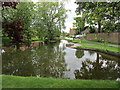
Nearby Images from Geograph Britain and Ireland:
©2013(licence)
©2015(licence)
©2015(licence)
©2007(licence)
©2019(licence)
The above images may not be of the site on this page, they are loaded from Geograph.
Please Submit an Image of this site or go out and take one for us!
Click here to see more info for this site
Nearby sites
Key: Red: member's photo, Blue: 3rd party photo, Yellow: other image, Green: no photo - please go there and take one, Grey: site destroyed
Download sites to:
KML (Google Earth)
GPX (GPS waypoints)
CSV (Garmin/Navman)
CSV (Excel)
To unlock full downloads you need to sign up as a Contributory Member. Otherwise downloads are limited to 50 sites.
Turn off the page maps and other distractions
Nearby sites listing. In the following links * = Image available
1.1km N 7° Horbling Spring Well* Holy Well or Sacred Spring (TF11813528)
1.7km SW 218° Holy Well (Sempringham)* Holy Well or Sacred Spring (TF10673282)
10.8km NW 326° Butt Mound* Round Barrow(s) (TF055430)
10.8km NW 326° Folk Moot* Round Barrow(s) (TF0536742981)
12.9km WSW 256° Round Hills Fort* Hillfort (SK992308)
16.1km NW 306° Lady Well (Ancaster)* Holy Well or Sacred Spring (SK98404332)
16.2km W 267° Burgh Banks Hillfort (SK955330)
16.4km N 0° Anwick Drake Stones* Natural Stone / Erratic / Other Natural Feature (TF114506)
18.2km WNW 298° Honington Camp* Hillfort (SK954424)
20.0km SSW 204° Careby Camp* Hillfort (TF040157)
21.6km SW 214° Holy Well (Careby and Aunby) Holy Well or Sacred Spring (TF00031598)
21.7km SSE 166° Deeping St Nicholas Round Barrow(s) (TF174132)
21.7km SSE 166° Deeping St Nicholas 28 Timber Circle (TF174132)
23.6km WSW 250° Fish Well* Holy Well or Sacred Spring (SK89602578)
23.9km S 189° Barholm Causewayed Enclosure Causewayed Enclosure (TF085105)
24.9km SSW 206° Walk Farm Enclosure Ancient Village or Settlement (TF012116)
25.7km WSW 257° King Lud’s Intrenchments Misc. Earthwork (SK867279)
25.9km S 181° Maxey Cursus Cursus (TF118083)
25.9km S 181° Maxey Cursus Cursus (TF11800830)
26.0km S 173° Northborough Causewayed Enclosure Causewayed Enclosure (TF155085)
26.4km S 180° Maxey Pit Circle A Timber Circle (TF125078)
26.5km S 179° Maxey Henge Henge (TF12600772)
26.5km S 180° Maxey Pit Circle A Timber Circle (TF125077)
26.7km S 177° Etton Causewayed Enclosure* Causewayed Enclosure (TF135075)
26.8km S 178° Maxey Cursus Cursus (TF133074)
View more nearby sites and additional images


 We would like to know more about this location. Please feel free to add a brief description and any relevant information in your own language.
 Wir möchten mehr über diese Stätte erfahren. Bitte zögern Sie nicht, eine kurze Beschreibung und relevante Informationen in Deutsch hinzuzufügen.
 Nous aimerions en savoir encore un peu sur les lieux. S'il vous plaît n'hesitez pas à ajouter une courte description et tous les renseignements pertinents dans votre propre langue.
 Quisieramos informarnos un poco más de las lugares. No dude en añadir una breve descripción y otros datos relevantes en su propio idioma.