<< Text Pages >> Ashdown Forest - Horsham ridgeway - Ancient Trackway in England in West Sussex
Submitted by coldrum on Tuesday, 11 August 2009 Page Views: 6366
Multi-periodSite Name: Ashdown Forest - Horsham ridgewayCountry: England
NOTE: This site is 0.299 km away from the location you searched for.
County: West Sussex Type: Ancient Trackway
Map Ref: TQ32153416
Latitude: 51.091535N Longitude: 0.114352W
Condition:
| 5 | Perfect |
| 4 | Almost Perfect |
| 3 | Reasonable but with some damage |
| 2 | Ruined but still recognisable as an ancient site |
| 1 | Pretty much destroyed, possibly visible as crop marks |
| 0 | No data. |
| -1 | Completely destroyed |
| 5 | Superb |
| 4 | Good |
| 3 | Ordinary |
| 2 | Not Good |
| 1 | Awful |
| 0 | No data. |
| 5 | Can be driven to, probably with disabled access |
| 4 | Short walk on a footpath |
| 3 | Requiring a bit more of a walk |
| 2 | A long walk |
| 1 | In the middle of nowhere, a nightmare to find |
| 0 | No data. |
| 5 | co-ordinates taken by GPS or official recorded co-ordinates |
| 4 | co-ordinates scaled from a detailed map |
| 3 | co-ordinates scaled from a bad map |
| 2 | co-ordinates of the nearest village |
| 1 | co-ordinates of the nearest town |
| 0 | no data |
Be the first person to rate this site - see the 'Contribute!' box in the right hand menu.
Internal Links:
External Links:
Ancient Trackway in West Sussex
Trackway, probably of Prehistoric or Roman date.
Pastscape:
http://www.pastscape.org.uk/hob.aspx?hob_id=1043195
You may be viewing yesterday's version of this page. To see the most up to date information please register for a free account.
Do not use the above information on other web sites or publications without permission of the contributor.
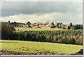
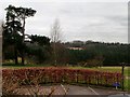
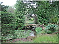
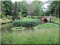
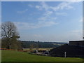
Nearby Images from Geograph Britain and Ireland:
©2013(licence)
©2013(licence)
©2017(licence)
©2017(licence)
©2015(licence)
The above images may not be of the site on this page, they are loaded from Geograph.
Please Submit an Image of this site or go out and take one for us!
Click here to see more info for this site
Nearby sites
Key: Red: member's photo, Blue: 3rd party photo, Yellow: other image, Green: no photo - please go there and take one, Grey: site destroyed
Download sites to:
KML (Google Earth)
GPX (GPS waypoints)
CSV (Garmin/Navman)
CSV (Excel)
To unlock full downloads you need to sign up as a Contributory Member. Otherwise downloads are limited to 50 sites.
Turn off the page maps and other distractions
Nearby sites listing. In the following links * = Image available
3.2km SE 127° Philpots Promontory Camp* Hillfort (TQ348323)
3.4km SE 128° Philpots Camp Mesolithic Rock Shelters Cave or Rock Shelter (TQ34873212)
3.4km SE 131° Big on Little* Rock Outcrop (TQ348320)
5.0km ENE 76° Cinder Mead and Furnace Mead Ancient Mine, Quarry or other Industry (TQ37003552)
5.3km ENE 72° Ridge Hill Rock Shelter Cave or Rock Shelter (TQ37203590)
5.9km ESE 110° St Mary's Rocks Cave or Rock Shelter (TQ37773226)
6.0km E 86° Stone Rocks West Sussex Cave or Rock Shelter (TQ381347)
6.6km SW 227° Mesolithic settlement near Pulpit Rock* Ancient Village or Settlement (TQ27362955)
7.8km W 263° Blackhill Barrow Round Barrow(s) (TQ244330)
8.3km W 265° Shepherdsfield Barrow Round Barrow(s) (TQ239332)
8.4km ENE 64° East Grinstead Museum* Museum (TQ3960338031)
9.3km ENE 76° Blunds Hole Cave or Rock Shelter (TQ41103670)
9.7km ESE 111° The Danes Churchyard Ancient Village or Settlement (TQ41343089)
11.2km E 101° Ashdown Forest Centre* Museum (TQ432323)
12.1km NNE 34° St. Margaret's Well (Lingfield)* Holy Well or Sacred Spring (TQ386444)
12.4km ESE 102° The Park Fort (Ashdown Forest) Hillfort (TQ44373195)
12.9km ESE 103° Birch Wood Ironworks Ancient Mine, Quarry or other Industry (TQ448316)
13.2km ESE 114° Millbrook Barrow Round Barrow(s) (TQ444291)
13.3km ENE 57° Dry Hill Fort* Hillfort (TQ432417)
14.8km E 99° A.A.Milne & E.H.Shephard Memorial* Modern Stone Circle etc (TQ468321)
14.9km ESE 103° Peat Lump Hill* Round Barrow(s) (TQ46773120)
15.0km NNW 347° Royal Earlswood Stones* Modern Stone Circle etc (TQ283487)
15.3km ESE 114° Duddleswell Round Barrow(s) (TQ463282)
15.4km E 97° Lone Oak Spring Holy Well or Sacred Spring (TQ475328)
15.4km ESE 102° Greenwood Gate Clump Enclosure Ancient Village or Settlement (TQ47373127)
View more nearby sites and additional images


 We would like to know more about this location. Please feel free to add a brief description and any relevant information in your own language.
 Wir möchten mehr über diese Stätte erfahren. Bitte zögern Sie nicht, eine kurze Beschreibung und relevante Informationen in Deutsch hinzuzufügen.
 Nous aimerions en savoir encore un peu sur les lieux. S'il vous plaît n'hesitez pas à ajouter une courte description et tous les renseignements pertinents dans votre propre langue.
 Quisieramos informarnos un poco más de las lugares. No dude en añadir una breve descripción y otros datos relevantes en su propio idioma.