

<< Text Pages >> Trois Menhirs de Bayle-Bernicaze - Standing Stone (Menhir) in France in Midi:Hautes-Pyrénées (65)
Submitted by TheCaptain on Thursday, 10 February 2005 Page Views: 3298
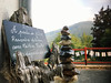
Neolithic and Bronze AgeSite Name: Trois Menhirs de Bayle-Bernicaze Alternative Name: menhirs d'ArrasCountry: France
NOTE: This site is 5.648 km away from the location you searched for.
Département: Midi:Hautes-Pyrénées (65) Type: Standing Stone (Menhir)
Nearest Town: Lourdes Nearest Village: Arras en Lavedan
Latitude: 43.003637N Longitude: 0.133549W
Condition:
| 5 | Perfect |
| 4 | Almost Perfect |
| 3 | Reasonable but with some damage |
| 2 | Ruined but still recognisable as an ancient site |
| 1 | Pretty much destroyed, possibly visible as crop marks |
| 0 | No data. |
| -1 | Completely destroyed |
| 5 | Superb |
| 4 | Good |
| 3 | Ordinary |
| 2 | Not Good |
| 1 | Awful |
| 0 | No data. |
| 5 | Can be driven to, probably with disabled access |
| 4 | Short walk on a footpath |
| 3 | Requiring a bit more of a walk |
| 2 | A long walk |
| 1 | In the middle of nowhere, a nightmare to find |
| 0 | No data. |
| 5 | co-ordinates taken by GPS or official recorded co-ordinates |
| 4 | co-ordinates scaled from a detailed map |
| 3 | co-ordinates scaled from a bad map |
| 2 | co-ordinates of the nearest village |
| 1 | co-ordinates of the nearest town |
| 0 | no data |
Be the first person to rate this site - see the 'Contribute!' box in the right hand menu.
Internal Links:
External Links:
Menhir in Hautes-Pyrénées
Found between Bayle and Bernicaze, near the Col du Farouche
Loc 1: 43.002481 -0.132960
Loc 2: 43.000076 -0.132936
Loc 3: 43.003637 -0.133549
Location Source: T4T35
Information and Pictures:
orange.fr
You may be viewing yesterday's version of this page. To see the most up to date information please register for a free account.
Do not use the above information on other web sites or publications without permission of the contributor.
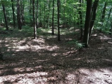
Nearby Images from Flickr
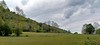


The above images may not be of the site on this page, but were taken nearby. They are loaded from Flickr so please click on them for image credits.
Click here to see more info for this site
Nearby sites
Click here to view sites on an interactive map of the areaKey: Red: member's photo, Blue: 3rd party photo, Yellow: other image, Green: no photo - please go there and take one, Grey: site destroyed
Download sites to:
KML (Google Earth)
GPX (GPS waypoints)
CSV (Garmin/Navman)
CSV (Excel)
To unlock full downloads you need to sign up as a Contributory Member. Otherwise downloads are limited to 50 sites.
Turn off the page maps and other distractions
Nearby sites listing. In the following links * = Image available
3.6km NNW 327° Col d'Andorre Cromlechs* Cairn
5.7km NE 52° Menhir dit Calhaou de Nageou Standing Stone (Menhir)
6.2km NE 48° Pibeste Cromlech* Stone Circle
8.7km NNE 32° Trois menhirs de Ségus Standing Stones
9.8km NNE 25° Caverne des Espelugues* Cave or Rock Shelter
9.9km NNE 31° Pierres Dressées de Bescuns Standing Stone (Menhir)
10.6km NNE 32° Le Rocher Mystérieux* Natural Stone / Erratic / Other Natural Feature
11.3km WSW 245° Menhir de Soulor Standing Stone (Menhir)
12.8km NNE 24° Peyre-Crabère* Standing Stone (Menhir)
13.7km NNE 14° Peyrasse menhir* Standing Stone (Menhir)
14.3km NNE 20° Poueyferré Tumulus* Chambered Tomb
14.5km N 10° Dolmen du Peyre-Dusets* Burial Chamber or Dolmen
15.3km NNE 17° Oppidum de Peyrehicade Hillfort
15.3km NE 45° Lézignan-Bourréac menhir Standing Stone (Menhir)
15.4km NNE 24° Peyre Hicadé (Bartrès)* Standing Stone (Menhir)
15.9km NNE 23° Sarrails tumulus Chambered Tomb
16.3km NNE 22° Pouey Casanières Chambered Tomb
16.7km NNE 21° Pouey Peyre Chambered Tomb
17.0km NNE 20° Pouey Pastadere 1 Chambered Tomb
17.1km NNE 20° La Halliade tumulus* Chambered Tomb
17.2km NNE 20° Pouey Pastadere 2 Chambered Tomb
17.3km NE 40° Oppidum de Julos Hillfort
17.8km NNE 18° Pouey-Mayou* Burial Chamber or Dolmen
18.1km NNE 16° Fontaine de Trois Seigneurs tumulus* Chambered Tomb
18.1km NE 55° Château de Lourdes Hillfort
View more nearby sites and additional images


 We would like to know more about this location. Please feel free to add a brief description and any relevant information in your own language.
 Wir möchten mehr über diese Stätte erfahren. Bitte zögern Sie nicht, eine kurze Beschreibung und relevante Informationen in Deutsch hinzuzufügen.
 Nous aimerions en savoir encore un peu sur les lieux. S'il vous plaît n'hesitez pas à ajouter une courte description et tous les renseignements pertinents dans votre propre langue.
 Quisieramos informarnos un poco más de las lugares. No dude en añadir una breve descripción y otros datos relevantes en su propio idioma.