<< Our Photo Pages >> Holywell (Cambridgeshire) - Holy Well or Sacred Spring in England in Cambridgeshire
Submitted by vicky on Tuesday, 01 June 2004 Page Views: 9683
Springs and Holy WellsSite Name: Holywell (Cambridgeshire)Country: England
NOTE: This site is 2.752 km away from the location you searched for.
County: Cambridgeshire Type: Holy Well or Sacred Spring
Nearest Town: St Ives
Map Ref: TL336707 Landranger Map Number: 154
Latitude: 52.318152N Longitude: 0.041371W
Condition:
| 5 | Perfect |
| 4 | Almost Perfect |
| 3 | Reasonable but with some damage |
| 2 | Ruined but still recognisable as an ancient site |
| 1 | Pretty much destroyed, possibly visible as crop marks |
| 0 | No data. |
| -1 | Completely destroyed |
| 5 | Superb |
| 4 | Good |
| 3 | Ordinary |
| 2 | Not Good |
| 1 | Awful |
| 0 | No data. |
| 5 | Can be driven to, probably with disabled access |
| 4 | Short walk on a footpath |
| 3 | Requiring a bit more of a walk |
| 2 | A long walk |
| 1 | In the middle of nowhere, a nightmare to find |
| 0 | No data. |
| 5 | co-ordinates taken by GPS or official recorded co-ordinates |
| 4 | co-ordinates scaled from a detailed map |
| 3 | co-ordinates scaled from a bad map |
| 2 | co-ordinates of the nearest village |
| 1 | co-ordinates of the nearest town |
| 0 | no data |
Internal Links:
External Links:
 (PID:7462)")
Have you visited this site? Please add a comment below.
You may be viewing yesterday's version of this page. To see the most up to date information please register for a free account.
 (PID:23560)")
 (PID:8627)")
Do not use the above information on other web sites or publications without permission of the contributor.
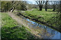
Nearby Images from Geograph Britain and Ireland:
©2012(licence)
©2021(licence)
©2021(licence)
©2017(licence)
©2017(licence)
The above images may not be of the site on this page, they are loaded from Geograph.
Please Submit an Image of this site or go out and take one for us!
Click here to see more info for this site
Nearby sites
Key: Red: member's photo, Blue: 3rd party photo, Yellow: other image, Green: no photo - please go there and take one, Grey: site destroyed
Download sites to:
KML (Google Earth)
GPX (GPS waypoints)
CSV (Garmin/Navman)
CSV (Excel)
To unlock full downloads you need to sign up as a Contributory Member. Otherwise downloads are limited to 50 sites.
Turn off the page maps and other distractions
Nearby sites listing. In the following links * = Image available
1.1km SSW 195° Low Hill Bowl Barrow, Fen Drayton RSPB Reserve* Round Barrow(s) (TL33336960)
2.1km SSW 211° Fenstanton Cursus Cursus (TL326689)
6.1km SW 226° Hilton (Cambridgeshire)* Turf Maze (TL293663)
7.7km S 180° Knapwell* Holy Well or Sacred Spring (TL33816300)
8.0km W 273° Godmanchester Cursus Cursus (TL25557092)
8.0km W 273° Godmanchester Cursus Cursus (TL25557092)
8.1km ENE 71° Haddenham Enclosure Causewayed Enclosure (TL412736)
8.3km SE 127° St Michael's Well (Cambridge)* Holy Well or Sacred Spring (TL40326584)
8.8km E 94° Belsar's Hill* Hillfort (TL424703)
9.7km W 279° Horse Common Spring* Holy Well or Sacred Spring (TL2472)
10.3km NE 56° Haddenham Long Barrow (TL420767)
10.7km SW 221° Nill Well* Holy Well or Sacred Spring (TL26786248)
13.1km WSW 252° Buckden A Cursus Cursus (TL212664)
13.2km W 275° Brampton Long Barrow (TL204715)
13.3km W 275° Brampton Cursus Cursus (TL203716)
13.5km NE 54° Sutton in the Isle Round Barrow Round Barrow(s) (TL443790)
13.9km WSW 254° Buckden B Cursus Cursus (TL20266659)
14.0km WSW 254° Buckden C Cursus Cursus (TL202664)
15.3km SSE 166° The Mazles Turf Maze (TL377559)
17.0km SE 139° Cambridge Museum of Archaeology & Anthropology* Museum (TL450581)
17.1km SE 140° Cambridge Fitzwilliam Museum* Museum (TL44955790)
17.3km NW 304° Monk's Hole Barrow Round Barrow(s) (TL1896479957)
18.1km NE 53° Wardy Hill* Hillfort (TL478820)
19.5km SW 232° Eynesbury Hardwicke B Cursus Cursus (TL184584)
19.8km SW 233° Eynesbury Hodwick 1 Long Barrow (TL180585)
View more nearby sites and additional images


 We would like to know more about this location. Please feel free to add a brief description and any relevant information in your own language.
 Wir möchten mehr über diese Stätte erfahren. Bitte zögern Sie nicht, eine kurze Beschreibung und relevante Informationen in Deutsch hinzuzufügen.
 Nous aimerions en savoir encore un peu sur les lieux. S'il vous plaît n'hesitez pas à ajouter une courte description et tous les renseignements pertinents dans votre propre langue.
 Quisieramos informarnos un poco más de las lugares. No dude en añadir una breve descripción y otros datos relevantes en su propio idioma.