<< Text Pages >> War Coppice Camp - Hillfort in England in Surrey
Submitted by Andy B on Wednesday, 31 August 2005 Page Views: 8380
Iron Age and Later PrehistorySite Name: War Coppice CampCountry: England County: Surrey Type: Hillfort
Nearest Town: Redhill Nearest Village: Bletchingley
Map Ref: TQ32985326
Latitude: 51.262995N Longitude: 0.095446W
Condition:
| 5 | Perfect |
| 4 | Almost Perfect |
| 3 | Reasonable but with some damage |
| 2 | Ruined but still recognisable as an ancient site |
| 1 | Pretty much destroyed, possibly visible as crop marks |
| 0 | No data. |
| -1 | Completely destroyed |
| 5 | Superb |
| 4 | Good |
| 3 | Ordinary |
| 2 | Not Good |
| 1 | Awful |
| 0 | No data. |
| 5 | Can be driven to, probably with disabled access |
| 4 | Short walk on a footpath |
| 3 | Requiring a bit more of a walk |
| 2 | A long walk |
| 1 | In the middle of nowhere, a nightmare to find |
| 0 | No data. |
| 5 | co-ordinates taken by GPS or official recorded co-ordinates |
| 4 | co-ordinates scaled from a detailed map |
| 3 | co-ordinates scaled from a bad map |
| 2 | co-ordinates of the nearest village |
| 1 | co-ordinates of the nearest town |
| 0 | no data |
Be the first person to rate this site - see the 'Contribute!' box in the right hand menu.
Internal Links:
External Links:
I have visited· I would like to visit
hworton would like to visit
Large Multivallate Hillfort. Excavated in 1950 (Surrey AS; AyAC 52, 101)
You may be viewing yesterday's version of this page. To see the most up to date information please register for a free account.
Do not use the above information on other web sites or publications without permission of the contributor.
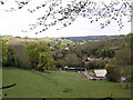
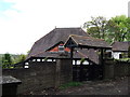
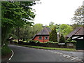
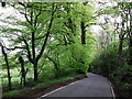
Nearby Images from Geograph Britain and Ireland:
©2012(licence)
©2012(licence)
©2012(licence)
©2012(licence)
©2014(licence)
The above images may not be of the site on this page, they are loaded from Geograph.
Please Submit an Image of this site or go out and take one for us!
Click here to see more info for this site
Nearby sites
Key: Red: member's photo, Blue: 3rd party photo, Yellow: other image, Green: no photo - please go there and take one, Grey: site destroyed
Download sites to:
KML (Google Earth)
GPX (GPS waypoints)
CSV (Garmin/Navman)
CSV (Excel)
To unlock full downloads you need to sign up as a Contributory Member. Otherwise downloads are limited to 50 sites.
Turn off the page maps and other distractions
Nearby sites listing. In the following links * = Image available
892m W 261° Spring Bottom* Holy Well or Sacred Spring (TQ321531)
1.3km S 185° North Park Farm* Ancient Village or Settlement (TQ329520)
2.5km SE 131° Godstone Tumulus* Artificial Mound (TQ349517)
3.2km NW 321° St Peter and St Paul's Church (Chaldon)* Ancient Cross (TQ3087455694)
3.2km SE 124° St Mary's Well (Godstone)* Holy Well or Sacred Spring (TQ357515)
3.3km ESE 124° Walker Miles Memorial* Modern Stone Circle etc (TQ358515)
4.0km SE 130° Diana's Well Holy Well or Sacred Spring (TQ361508)
4.0km SE 128° Leigh Place Stone* Natural Stone / Erratic / Other Natural Feature (TQ362509)
4.5km E 86° St. Thomas's Well (Godstone) Holy Well or Sacred Spring (TQ375537)
5.4km NNW 328° Farthing Downs* Barrow Cemetery (TQ300578)
5.9km W 266° Gatton Park, The Millennium Stones* Modern Stone Circle etc (TQ271527)
6.3km NW 306° Chipstead Well Holy Well or Sacred Spring (TQ278568)
6.4km NE 53° Nore Hill Bronze Age Enclosure Misc. Earthwork (TQ380573)
6.5km WSW 242° Whitepost Hill Spring Holy Well or Sacred Spring (TQ273501)
6.5km SW 227° Royal Earlswood Stones* Modern Stone Circle etc (TQ283487)
6.5km WSW 244° Waterslade Spring Holy Well or Sacred Spring (TQ272502)
6.7km WSW 238° Redhill Common* Round Barrow(s) (TQ274496)
7.3km N 356° Riddlesdown Newe Ditch* Misc. Earthwork (TQ3230460572)
7.4km WNW 287° St. Margaret's Well (Mugswell)* Holy Well or Sacred Spring (TQ258553)
7.9km SW 235° Earlswood Common Barrow Cemetery Barrow Cemetery (TQ266486)
9.7km WSW 254° Reigate Heath Barrows* Barrow Cemetery (TQ23725042)
10.0km N 6° Croham Hurst* Round Barrow(s) (TQ338632)
10.5km SSE 149° St. Margaret's Well (Lingfield)* Holy Well or Sacred Spring (TQ386444)
11.0km NW 314° Gally Hills Barrow Cemetery (TQ249607)
11.3km E 97° Squerries Park Camp Hillfort (TQ44285222)
View more nearby sites and additional images


 We would like to know more about this location. Please feel free to add a brief description and any relevant information in your own language.
 Wir möchten mehr über diese Stätte erfahren. Bitte zögern Sie nicht, eine kurze Beschreibung und relevante Informationen in Deutsch hinzuzufügen.
 Nous aimerions en savoir encore un peu sur les lieux. S'il vous plaît n'hesitez pas à ajouter une courte description et tous les renseignements pertinents dans votre propre langue.
 Quisieramos informarnos un poco más de las lugares. No dude en añadir una breve descripción y otros datos relevantes en su propio idioma.