<< Our Photo Pages >> Rogbergastenen - Carving in Sweden in Småland
Submitted by CharcoalBurner89 on Thursday, 21 September 2023 Page Views: 139
Early Medieval (Dark Age)Site Name: Rogbergastenen Alternative Name: Sm 121 / B 1027 / B 1030 / L 1203Country: Sweden
NOTE: This site is 6.676 km away from the location you searched for.
Landskap: Småland Type: Carving
Nearest Town: Jönköping Nearest Village: Rogberga
Latitude: 57.733370N Longitude: 14.281280E
Condition:
| 5 | Perfect |
| 4 | Almost Perfect |
| 3 | Reasonable but with some damage |
| 2 | Ruined but still recognisable as an ancient site |
| 1 | Pretty much destroyed, possibly visible as crop marks |
| 0 | No data. |
| -1 | Completely destroyed |
| 5 | Superb |
| 4 | Good |
| 3 | Ordinary |
| 2 | Not Good |
| 1 | Awful |
| 0 | No data. |
| 5 | Can be driven to, probably with disabled access |
| 4 | Short walk on a footpath |
| 3 | Requiring a bit more of a walk |
| 2 | A long walk |
| 1 | In the middle of nowhere, a nightmare to find |
| 0 | No data. |
| 5 | co-ordinates taken by GPS or official recorded co-ordinates |
| 4 | co-ordinates scaled from a detailed map |
| 3 | co-ordinates scaled from a bad map |
| 2 | co-ordinates of the nearest village |
| 1 | co-ordinates of the nearest town |
| 0 | no data |
Internal Links:
External Links:
")
- Transliteration: : ketil : resþi : kuml : [þ]usi : eftiʀ : le- · [muþ]ur[:]bruþur : sin :
- Transcription: Ketill reisti kuml þessi eptir Lei[k](?), móðurbróður sinn.
- Translation (Swedish): Kättil reste detta minnesmärke efter Lek(?), sin morbroder.
- Translation (English): Ketill raised these monuments in memory of Leikr(?), his mother's brother.
Year found: -
Dating: 725 - 1100 A.D.
You may be viewing yesterday's version of this page. To see the most up to date information please register for a free account.
")
Do not use the above information on other web sites or publications without permission of the contributor.
Nearby Images from Flickr
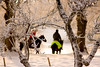
The above images may not be of the site on this page, but were taken nearby. They are loaded from Flickr so please click on them for image credits.
Click here to see more info for this site
Nearby sites
Click here to view sites on an interactive map of the areaKey: Red: member's photo, Blue: 3rd party photo, Yellow: other image, Green: no photo - please go there and take one, Grey: site destroyed
Download sites to:
KML (Google Earth)
GPX (GPS waypoints)
CSV (Garmin/Navman)
CSV (Excel)
To unlock full downloads you need to sign up as a Contributory Member. Otherwise downloads are limited to 50 sites.
Turn off the page maps and other distractions
Nearby sites listing. In the following links * = Image available
51.0km WNW 292° Dalumstenen (2)* Carving
51.0km WNW 292° Dalumstenen (1)* Carving
51.1km NNW 326° Valstad 8:1* Passage Grave
51.2km NNW 327° Valstad 9:1* Passage Grave
52.1km WNW 303° Domarring i Trädet* Stone Circle
52.2km WNW 303° Lillegårdenstenen* Carving
53.1km NW 307° Olsbrostenen* Carving
53.3km NE 51° Balancing stone Tranås Natural Stone / Erratic / Other Natural Feature
55.0km NW 309° Högstenen* Carving
56.4km NW 314° Vårkulma 14:2* Passage Grave
56.4km NW 314° Vårkulma 14:1* Passage Grave
57.0km NW 312° Vårkumlastenen* Carving
57.0km NW 312° Vårkulma Church Domarring* Stone Circle
59.4km NW 320° Karleby 35:1* Passage Grave
59.9km NW 309° Sörbystenen* Carving
60.2km NW 321° Karleby 57:1* Passage Grave
60.2km NW 321° Karleby 58:1* Passage Grave
60.3km NW 321° Karleby 59:1* Passage Grave
60.3km NW 311° Slutarpdösen* Burial Chamber or Dolmen
60.4km NW 321° Karleby 60:1* Passage Grave
60.9km NW 322° Karleby 76:1 Passage Grave
61.0km NW 317° Luttra 16:1* Passage Grave
61.0km NW 326° Åsle 23:1* Passage Grave
61.1km NW 317° Luttra 15:1* Passage Grave
61.3km NW 322° Karleby 82:1* Passage Grave
View more nearby sites and additional images


 We would like to know more about this location. Please feel free to add a brief description and any relevant information in your own language.
 Wir möchten mehr über diese Stätte erfahren. Bitte zögern Sie nicht, eine kurze Beschreibung und relevante Informationen in Deutsch hinzuzufügen.
 Nous aimerions en savoir encore un peu sur les lieux. S'il vous plaît n'hesitez pas à ajouter une courte description et tous les renseignements pertinents dans votre propre langue.
 Quisieramos informarnos un poco más de las lugares. No dude en añadir una breve descripción y otros datos relevantes en su propio idioma.