<< Text Pages >> Boath Long Cairn - Chambered Cairn in Scotland in Highlands
Submitted by vicky on Sunday, 22 December 2002 Page Views: 3695
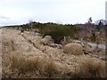
Neolithic and Bronze AgeSite Name: Boath Long CairnCountry: Scotland County: Highlands Type: Chambered Cairn
Nearest Town: Alness
Map Ref: NH581738 Landranger Map Number: 21
Latitude: 57.731456N Longitude: 4.38472W
Condition:
| 5 | Perfect |
| 4 | Almost Perfect |
| 3 | Reasonable but with some damage |
| 2 | Ruined but still recognisable as an ancient site |
| 1 | Pretty much destroyed, possibly visible as crop marks |
| 0 | No data. |
| -1 | Completely destroyed |
| 5 | Superb |
| 4 | Good |
| 3 | Ordinary |
| 2 | Not Good |
| 1 | Awful |
| 0 | No data. |
| 5 | Can be driven to, probably with disabled access |
| 4 | Short walk on a footpath |
| 3 | Requiring a bit more of a walk |
| 2 | A long walk |
| 1 | In the middle of nowhere, a nightmare to find |
| 0 | No data. |
| 5 | co-ordinates taken by GPS or official recorded co-ordinates |
| 4 | co-ordinates scaled from a detailed map |
| 3 | co-ordinates scaled from a bad map |
| 2 | co-ordinates of the nearest village |
| 1 | co-ordinates of the nearest town |
| 0 | no data |
Internal Links:
External Links:
Chambered Cairn in Highland
Known also as Carn Liatha, it is a horned long cairn of 60 x 16 m dimensions.
Read More at Canmore.
You may be viewing yesterday's version of this page. To see the most up to date information please register for a free account.
Do not use the above information on other web sites or publications without permission of the contributor.
Nearby Images from Geograph Britain and Ireland:
©2006(licence)
©2010(licence)
©2022(licence)
©2012(licence)
©2006(licence)
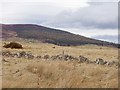
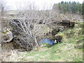
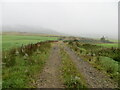
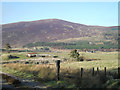
The above images may not be of the site on this page, they are loaded from Geograph.
Please Submit an Image of this site or go out and take one for us!
Click here to see more info for this site
Nearby sites
Key: Red: member's photo, Blue: 3rd party photo, Yellow: other image, Green: no photo - please go there and take one, Grey: site destroyed
Download sites to:
KML (Google Earth)
GPX (GPS waypoints)
CSV (Garmin/Navman)
CSV (Excel)
To unlock full downloads you need to sign up as a Contributory Member. Otherwise downloads are limited to 50 sites.
Turn off the page maps and other distractions
Nearby sites listing. In the following links * = Image available
274m NE 55° Boath Short Chambered Cairn (NH58337395)
300m S 178° Balnagrotchen Chambered Cairn (NH581735)
3.5km ENE 73° Carn Na Feinne Chambered Cairn (NH615747)
5.4km E 82° Carn Nam Fiann Chambered Cairn (NH63517441)
5.6km ENE 66° Baldoon Chambered Cairn (NH63317591)
6.6km E 85° Dalnavie Class I Pictish Symbol Stone (NH64737414)
6.8km E 84° Stittenham Cairn 1 Chambered Tomb (NH649743)
6.9km E 84° The Ardross Wolf Class I Pictish Stone* Class I Pictish Symbol Stone (NH650743)
7.2km E 85° Stittenham Cairn 2 Cairn (NH65367413)
7.3km S 172° Carn Liath (Upper Park) Chambered Cairn (NH589665)
7.6km S 181° Swordale Hill* Rock Art (NH5772066156)
7.6km E 100° Cnoc Navie Chambered Cairn (NH656722)
7.7km S 180° Swordale Chambered Cairn Chambered Cairn (NH57886614)
8.2km ESE 108° Mill craig Chambered Tomb (NH658710)
8.5km ESE 106° Nonakiln Class I Pictish Symbol Stone (NH66217124)
9.5km ESE 115° Carn Liath, Alness* Cairn (NH66626952)
10.2km E 89° Newmore Wood Rock Art (NH68327366)
10.4km SSW 205° Balnacrae* Chambered Cairn (NH533646)
11.0km ESE 114° Rosskeen* Class I Pictish Symbol Stone (NH6809969024)
11.7km E 81° King's Head Cairn Chambered Cairn (NH69777513)
11.9km E 80° Kinrive West Chambered Cairn (NH69937538)
12.2km S 187° Clachan Biorach Chambered Cairn (NH562617)
12.8km S 189° Cnoc Ravoch Chambered Cairn (NH557612)
13.0km SSE 149° St Martin's Well (Fortrose)* Holy Well or Sacred Spring (NH645625)
13.5km ENE 78° Scotsburn House Dun* Stone Fort or Dun (NH71487616)
View more nearby sites and additional images


 We would like to know more about this location. Please feel free to add a brief description and any relevant information in your own language.
 Wir möchten mehr über diese Stätte erfahren. Bitte zögern Sie nicht, eine kurze Beschreibung und relevante Informationen in Deutsch hinzuzufügen.
 Nous aimerions en savoir encore un peu sur les lieux. S'il vous plaît n'hesitez pas à ajouter une courte description et tous les renseignements pertinents dans votre propre langue.
 Quisieramos informarnos un poco más de las lugares. No dude en añadir una breve descripción y otros datos relevantes en su propio idioma.