<< Our Photo Pages >> Clach na h' Iobairte - Standing Stone (Menhir) in Scotland in Perth and Kinross
Submitted by BigSweetie on Friday, 26 March 2004 Page Views: 14493
Neolithic and Bronze AgeSite Name: Clach na h' Iobairte Alternative Name: Clach na h-Iobairte, The Chieftain; Stone of OfferingCountry: Scotland
NOTE: This site is 15.401 km away from the location you searched for.
County: Perth and Kinross Type: Standing Stone (Menhir)
Nearest Town: Pitlochry Nearest Village: Kinloch Rannoch
Map Ref: NN6170158973 Landranger Map Number: 42
Latitude: 56.701925N Longitude: 4.260359W
Condition:
| 5 | Perfect |
| 4 | Almost Perfect |
| 3 | Reasonable but with some damage |
| 2 | Ruined but still recognisable as an ancient site |
| 1 | Pretty much destroyed, possibly visible as crop marks |
| 0 | No data. |
| -1 | Completely destroyed |
| 5 | Superb |
| 4 | Good |
| 3 | Ordinary |
| 2 | Not Good |
| 1 | Awful |
| 0 | No data. |
| 5 | Can be driven to, probably with disabled access |
| 4 | Short walk on a footpath |
| 3 | Requiring a bit more of a walk |
| 2 | A long walk |
| 1 | In the middle of nowhere, a nightmare to find |
| 0 | No data. |
| 5 | co-ordinates taken by GPS or official recorded co-ordinates |
| 4 | co-ordinates scaled from a detailed map |
| 3 | co-ordinates scaled from a bad map |
| 2 | co-ordinates of the nearest village |
| 1 | co-ordinates of the nearest town |
| 0 | no data |
Internal Links:
External Links:
I have visited· I would like to visit
nicoladidsbury has visited here
")
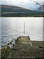
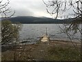
This stone is located by Loch Rannoch and is recorded as Canmore ID 24576, which says: "this is a standing stone on top of a burial cairn ..... Clach na h-Iobairte ('the stone of the offering') is situated in the S quadrant of a stony mound on a low natural knoll overlooking Loch Rannoch. The mound is rather amorphous but appears to measure about 10.0m in diameter; it has stone clearance upon it, together with a large boulder embedded in the N side, and two stone blocks with drill holes lie on the E. The standing stone, with its broad face roughly NE-SW and leaning to the SE, is unweathered. It measures 1.9m in height, 0.6m in width at the top, 0.3m at the base, and 0.2m thick. On its SE face there is what appears to be an incised inverted 'T'."
The Northern Antiquarian (TNA) also features a page for this stone, listing it's many different names: Chieftain’s Grave; Clach na h-Iobairte; Clach na h-Jobairte; Craiganour Stone; Craig-na-Odhar and Stone of Sacrifice. Their page for Clach na h’ Iobairte, Kinloch Rannoch, Perthshire gives directions on how to find the site, a brief archaeology and history and also contains photographs, an image of the 1867 OS-map and local folklore.
You may be viewing yesterday's version of this page. To see the most up to date information please register for a free account.
")
")
Do not use the above information on other web sites or publications without permission of the contributor.
kelpie has found this location on Google Street View:
Nearby Images from Geograph Britain and Ireland:
©2020(licence)
©2020(licence)
©2023(licence)
©2013(licence)
©2019(licence)
The above images may not be of the site on this page, they are loaded from Geograph.
Please Submit an Image of this site or go out and take one for us!
Click here to see more info for this site
Nearby sites
Key: Red: member's photo, Blue: 3rd party photo, Yellow: other image, Green: no photo - please go there and take one, Grey: site destroyed
Download sites to:
KML (Google Earth)
GPX (GPS waypoints)
CSV (Garmin/Navman)
CSV (Excel)
To unlock full downloads you need to sign up as a Contributory Member. Otherwise downloads are limited to 50 sites.
Turn off the page maps and other distractions
Nearby sites listing. In the following links * = Image available
3.7km E 89° Clach-a-Mharsain* Standing Stone (Menhir) (NN65385892)
5.4km E 99° Clach na Boile* Standing Stone (Menhir) (NN6698957985)
5.7km E 96° Seomar na Stainge Cairn (NN67365818)
9.4km E 95° Craigh na Dun* Modern Stone Circle etc (NN7105657815)
11.0km E 101° Allt Leathan Ancient Village or Settlement (NN72465659)
11.0km E 101° Allt Leathan Stone Standing Stone (Menhir) (NN72515659)
11.3km S 174° St Adamnan's Cross* Ancient Cross (NN62534768)
11.3km S 173° St Palladius' Footprint (Camusvrachan)* Natural Stone / Erratic / Other Natural Feature (NN6262647685)
12.3km SSE 155° Dericambus Standing Stone (Menhir) (NN66484757)
12.5km S 181° Glen Lyon - Praying Hands of Mary* Natural Stone / Erratic / Other Natural Feature (NN610465)
12.6km SSW 194° Kerrowmore Stone Circle (NN583468)
13.1km ENE 79° Upper Gaskan* Stone Circle (NN74666113)
14.6km SE 138° Coille Dhubh Standing Stones (NN711478)
15.8km E 96° Tombreck Standing Stone (Menhir) (NN77445693)
16.4km ENE 71° Kinaldy Standing Stone (Menhir) (NN774639)
16.7km SE 136° Bridge of Lyon long cairn* Long Barrow (NN72964655)
16.9km SE 135° Lyon Bridge Cairn* Cairn (NN73174657)
16.9km SE 133° Fortingall Modern Stone Circle* Modern Stone Circle etc (NN73754703)
17.0km SE 136° Bridge of Lyon Standing Stones* Standing Stones (NN73144641)
17.2km SE 132° Clach a' Phlaigh* Standing Stone (Menhir) (NN74064693)
17.3km SE 132° Fortingall church crosses* Ancient Cross (NN74204702)
17.4km SE 140° Cromrar 1* Rock Art (NN72474531)
17.4km SE 141° Cromrar 3 Rock Art (NN72184500)
17.5km SE 143° Clach-na-Cruich (Fearnan) Rock Art (NN7186844743)
17.5km SE 141° Fearnan Rock Art (NN72184497)
View more nearby sites and additional images


 We would like to know more about this location. Please feel free to add a brief description and any relevant information in your own language.
 Wir möchten mehr über diese Stätte erfahren. Bitte zögern Sie nicht, eine kurze Beschreibung und relevante Informationen in Deutsch hinzuzufügen.
 Nous aimerions en savoir encore un peu sur les lieux. S'il vous plaît n'hesitez pas à ajouter une courte description et tous les renseignements pertinents dans votre propre langue.
 Quisieramos informarnos un poco más de las lugares. No dude en añadir una breve descripción y otros datos relevantes en su propio idioma.