<< Text Pages >> Eliston West (Tilicoultry) - Cairn in Scotland in Clackmannanshire
Submitted by Anne T on Thursday, 12 October 2017 Page Views: 1059
Neolithic and Bronze AgeSite Name: Eliston West (Tilicoultry) Alternative Name: Eliston Hill (Tilicoultry)Country: Scotland
NOTE: This site is 2.399 km away from the location you searched for.
County: Clackmannanshire Type: Cairn
Nearest Town: Tilicoultry
Map Ref: NS92209924
Latitude: 56.173572N Longitude: 3.737882W
Condition:
| 5 | Perfect |
| 4 | Almost Perfect |
| 3 | Reasonable but with some damage |
| 2 | Ruined but still recognisable as an ancient site |
| 1 | Pretty much destroyed, possibly visible as crop marks |
| 0 | No data. |
| -1 | Completely destroyed |
| 5 | Superb |
| 4 | Good |
| 3 | Ordinary |
| 2 | Not Good |
| 1 | Awful |
| 0 | No data. |
| 5 | Can be driven to, probably with disabled access |
| 4 | Short walk on a footpath |
| 3 | Requiring a bit more of a walk |
| 2 | A long walk |
| 1 | In the middle of nowhere, a nightmare to find |
| 0 | No data. |
| 5 | co-ordinates taken by GPS or official recorded co-ordinates |
| 4 | co-ordinates scaled from a detailed map |
| 3 | co-ordinates scaled from a bad map |
| 2 | co-ordinates of the nearest village |
| 1 | co-ordinates of the nearest town |
| 0 | no data |
Be the first person to rate this site - see the 'Contribute!' box in the right hand menu.
Internal Links:
External Links:
Cairn in Clackmannanshire
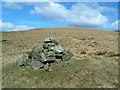
Canmore ID 48266 records this site as: "On the NW slope of Eliston Hill is a small turf-covered cairn measuring 8.0m x 6.5m and 1.4m high, with traces of a kerb around its base. There is a small scatter of stones on top of it - probably a shepherd's cairn."
The Northern Antiquarian (TNA) also feature a page for this site - see their entry for Elistoun West, Tillicoultry, Clackmannanshire, which has photographs, directions for reaching the site (described as "a helluva climb") and a brief archaeology & history.
Note: Do you have any photographs or more information to add?
You may be viewing yesterday's version of this page. To see the most up to date information please register for a free account.
Do not use the above information on other web sites or publications without permission of the contributor.
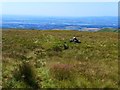
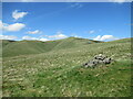
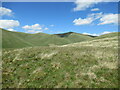
Nearby Images from Geograph Britain and Ireland:
©2017(licence)
©2022(licence)
©2006(licence)
©2022(licence)
©2007(licence)
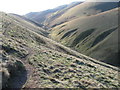
The above images may not be of the site on this page, they are loaded from Geograph.
Please Submit an Image of this site or go out and take one for us!
Click here to see more info for this site
Nearby sites
Key: Red: member's photo, Blue: 3rd party photo, Yellow: other image, Green: no photo - please go there and take one, Grey: site destroyed
Download sites to:
KML (Google Earth)
GPX (GPS waypoints)
CSV (Garmin/Navman)
CSV (Excel)
To unlock full downloads you need to sign up as a Contributory Member. Otherwise downloads are limited to 50 sites.
Turn off the page maps and other distractions
Nearby sites listing. In the following links * = Image available
1.7km S 172° Tillicoultry House Carving (Tillicoultry) Rock Art (NS92409752)
1.9km E 92° White Stane of Tam Baird (Dollar) Natural Stone / Erratic / Other Natural Feature (NS9413599110)
2.1km SSW 210° Lady's Well (Tillicoultry) Holy Well or Sacred Spring (NS91119749)
2.2km S 169° Cunninghar Stone Circle (NS92569708)
3.8km SSE 154° Balhearty Standing Stone (Menhir) (NS9378295816)
3.9km WSW 248° Ladies Well (Alva) Holy Well or Sacred Spring (NS88579788)
3.9km E 88° Castle Campbell (Dollar) Rock Art (NS96139928)
3.9km WSW 238° St Serf's Well (Alva) Holy Well or Sacred Spring (NS88819723)
4.0km ENE 75° Butter Well (Dollar) Holy Well or Sacred Spring (NN96100018)
4.1km WSW 244° Dwarf's Tomb (Alva) Burial Chamber or Dolmen (NS88489754)
4.2km ESE 106° Cairnpark (Dollar) Cairn (NS96189802)
4.4km E 91° Wizard's Stone (Dollar)* Natural Stone / Erratic / Other Natural Feature (NS96569904)
4.4km E 96° Moir's Well (Dollar) Holy Well or Sacred Spring (NS9653598711)
4.6km E 91° Deil's Cradle (Dollar)* Natural Stone / Erratic / Other Natural Feature (NS96869906)
5.3km ENE 65° Maiden's Well (Glendevon) Holy Well or Sacred Spring (NN97030139)
5.4km ENE 60° Garchel Burn (Glendevon) Ancient Village or Settlement (NN96960182)
5.7km WNW 282° Bengengie North Ancient Village or Settlement (NN8668000601)
5.8km S 176° Grassmainston Well (Clackmannan) Holy Well or Sacred Spring (NS9247893403)
6.1km E 81° Castleton (Dollar)* Standing Stone (Menhir) (NN9828400060)
6.7km NNE 26° Four Stanes (Glendevon) Stone Circle (NN9529405196)
6.8km SSW 192° Hawk Hill (Alloa) Stone Circle (NS906926)
6.9km SSW 196° Parkmill Cross (Alloa) Ancient Cross (NS9013392661)
7.1km SSW 204° Hawk Hill Cairn (Alloa) Cairn (NS89119282)
7.2km S 180° Hawk Hill Stone Circle (NS920920)
7.3km SW 236° Priest's Well (Tullibody) Holy Well or Sacred Spring (NS8606995324)
View more nearby sites and additional images


 We would like to know more about this location. Please feel free to add a brief description and any relevant information in your own language.
 Wir möchten mehr über diese Stätte erfahren. Bitte zögern Sie nicht, eine kurze Beschreibung und relevante Informationen in Deutsch hinzuzufügen.
 Nous aimerions en savoir encore un peu sur les lieux. S'il vous plaît n'hesitez pas à ajouter une courte description et tous les renseignements pertinents dans votre propre langue.
 Quisieramos informarnos un poco más de las lugares. No dude en añadir una breve descripción y otros datos relevantes en su propio idioma.