<< Our Photo Pages >> Girth Cross (Canongate) - Ancient Cross in Scotland in Midlothian
Submitted by Anne T on Wednesday, 09 October 2019 Page Views: 1836
Early Medieval (Dark Age)Site Name: Girth Cross (Canongate) Alternative Name: Old Girth Cross (Edinburgh); Abbey Cross (Canongate); South Cross (Canongate)Country: Scotland
NOTE: This site is 1.935 km away from the location you searched for.
County: Midlothian Type: Ancient Cross
Nearest Town: Edinburgh
Map Ref: NT2673973910
Latitude: 55.952610N Longitude: 3.174798W
Condition:
| 5 | Perfect |
| 4 | Almost Perfect |
| 3 | Reasonable but with some damage |
| 2 | Ruined but still recognisable as an ancient site |
| 1 | Pretty much destroyed, possibly visible as crop marks |
| 0 | No data. |
| -1 | Completely destroyed |
| 5 | Superb |
| 4 | Good |
| 3 | Ordinary |
| 2 | Not Good |
| 1 | Awful |
| 0 | No data. |
| 5 | Can be driven to, probably with disabled access |
| 4 | Short walk on a footpath |
| 3 | Requiring a bit more of a walk |
| 2 | A long walk |
| 1 | In the middle of nowhere, a nightmare to find |
| 0 | No data. |
| 5 | co-ordinates taken by GPS or official recorded co-ordinates |
| 4 | co-ordinates scaled from a detailed map |
| 3 | co-ordinates scaled from a bad map |
| 2 | co-ordinates of the nearest village |
| 1 | co-ordinates of the nearest town |
| 0 | no data |
Internal Links:
External Links:
I have visited· I would like to visit
Anne T visited on 1st Oct 2019 - their rating: Cond: -1 Amb: 3 Access: 5 Site of the Girth Cross, Canongate: Again, we picked this location up from the Treasure Trail, after Clue 15, there is a ‘Did you know?’ box which reads: “Where Canongate meets Abbeyhill look out for the circle of cobbles. This is the site of the ‘Old Girth Cross’ where proclamations and executions took place. In 1600 Lady Warriston was beheaded by guillotine for conspiring to murder her abusive husband”.
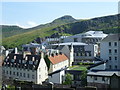
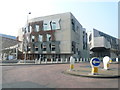
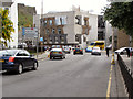
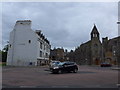
This site is at a very busy road junction, west of Holyrood Palace, and at the eastern end of Canongate, where Canongate meets Abbeyhill, Abbey Strand and Horse Wynd.
Not much to see really, apart from a circle of grey pavers
hevveh have visited here
 (PID:203796)")
The site of this now destroyed cross is to the west of Holyrood Palace, at the eastern end of Canongate, just west of the roundabout where Canongate meets Abbeyhill, Abbey Strand and Horse Wynd.
This cross is recorded as Canmore ID 52358, which tells us the cross marked the western limit of the Girth of Holyrood, "the greatest sanctuary in Scotland and the last to disappear". It was shown on a map of 1573 as "an ornamental shaft elevated on a flight of steps", and was known to be in existence until after 1767.
This is one of three crosses known to have been built along Canongate, the other two being St. John's Cross at the western end of Canongate, and the Canongate Mercat Cross, now some 290m to the west(see nearby sites below). The cross is understood to have been removed when the street was first paved, its site being marked by a circle of stones.
You may be viewing yesterday's version of this page. To see the most up to date information please register for a free account.
 (PID:203795)")
Do not use the above information on other web sites or publications without permission of the contributor.
Nearby Images from Geograph Britain and Ireland:
©2011(licence)
©2011(licence)
©2010(licence)
©2014(licence)

©2014(licence)
The above images may not be of the site on this page, they are loaded from Geograph.
Please Submit an Image of this site or go out and take one for us!
Click here to see more info for this site
Nearby sites
Key: Red: member's photo, Blue: 3rd party photo, Yellow: other image, Green: no photo - please go there and take one, Grey: site destroyed
Download sites to:
KML (Google Earth)
GPX (GPS waypoints)
CSV (Garmin/Navman)
CSV (Excel)
To unlock full downloads you need to sign up as a Contributory Member. Otherwise downloads are limited to 50 sites.
Turn off the page maps and other distractions
Nearby sites listing. In the following links * = Image available
284m WSW 249° Canongate Mercat Cross* Ancient Cross (NT2647273812)
440m ESE 116° St Margaret's Well (Edinburgh)* Holy Well or Sacred Spring (NT2713373712)
483m WSW 248° St John's Cross (Canongate)* Ancient Cross (NT2628873733)
700m SSE 157° Salisbury Crags* Promontory Fort / Cliff Castle (NT27007326)
824m ESE 108° St Anthony's Well (Edinburgh)* Holy Well or Sacred Spring (NT27527364)
1.1km SW 236° National Museum of Scotland (Early Christian Stones)* Ancient Cross (NT2583273324)
1.1km S 178° Slidey Stane (Holyrood Park)* Natural Stone / Erratic / Other Natural Feature (NT2676672765)
1.2km WSW 237° National Museum of Scotland* Museum (NT2574873290)
1.2km WSW 238° National Museum of Scotland (Pictish Stones)* Museum (NT2572173302)
1.2km SW 217° Edinburgh Runestone* Carving (NT2598972937)
1.4km SE 140° Arthur's Seat* Hillfort (NT27647282)
1.5km WSW 253° Stone of Scone* Marker Stone (NT253735)
1.5km WSW 247° Grassmarket modern menhir* Standing Stone (Menhir) (NT25337333)
1.6km SSE 152° Samson's Ribs* Promontory Fort / Cliff Castle (NT27457250)
1.6km WSW 245° The Portsburgh Stone* Natural Stone / Erratic / Other Natural Feature (NT25287327)
1.6km ESE 117° Dunsapie Crag* Hillfort (NT28177316)
1.7km W 259° St Margaret's Well (Edinburgh Castle)* Holy Well or Sacred Spring (NT2508273613)
1.7km ENE 70° St Triduana's Wellhouse* Holy Well or Sacred Spring (NT2833274468)
1.7km ESE 116° Holyrood Park Stone (Edinburgh) Natural Stone / Erratic / Other Natural Feature (NT28267313)
1.9km SE 129° Delf Well* Holy Well or Sacred Spring (NT282727)
2.2km S 189° Penny Well (Edinburgh)* Holy Well or Sacred Spring (NT26367177)
2.3km W 277° St Bernard's Well* Holy Well or Sacred Spring (NT2445174247)
2.3km W 273° St George's Well (Edinburgh)* Holy Well or Sacred Spring (NT2440174070)
3.2km SW 223° The Bore Stone* Marker Stone (NT2450871568)
3.3km SSE 167° Cat Stane (Inch)* Standing Stone (Menhir) (NT27457068)
View more nearby sites and additional images


 We would like to know more about this location. Please feel free to add a brief description and any relevant information in your own language.
 Wir möchten mehr über diese Stätte erfahren. Bitte zögern Sie nicht, eine kurze Beschreibung und relevante Informationen in Deutsch hinzuzufügen.
 Nous aimerions en savoir encore un peu sur les lieux. S'il vous plaît n'hesitez pas à ajouter une courte description et tous les renseignements pertinents dans votre propre langue.
 Quisieramos informarnos un poco más de las lugares. No dude en añadir una breve descripción y otros datos relevantes en su propio idioma.