<< Our Photo Pages >> Penny Well (Edinburgh) - Holy Well or Sacred Spring in Scotland in Midlothian
Submitted by Anne T on Wednesday, 03 January 2018 Page Views: 2077
Springs and Holy WellsSite Name: Penny Well (Edinburgh) Alternative Name: Pennywell (Edinburgh)Country: Scotland
NOTE: This site is 0.131 km away from the location you searched for.
County: Midlothian Type: Holy Well or Sacred Spring
Nearest Town: Edinburgh
Map Ref: NT26367177
Latitude: 55.933329N Longitude: 3.180281W
Condition:
| 5 | Perfect |
| 4 | Almost Perfect |
| 3 | Reasonable but with some damage |
| 2 | Ruined but still recognisable as an ancient site |
| 1 | Pretty much destroyed, possibly visible as crop marks |
| 0 | No data. |
| -1 | Completely destroyed |
| 5 | Superb |
| 4 | Good |
| 3 | Ordinary |
| 2 | Not Good |
| 1 | Awful |
| 0 | No data. |
| 5 | Can be driven to, probably with disabled access |
| 4 | Short walk on a footpath |
| 3 | Requiring a bit more of a walk |
| 2 | A long walk |
| 1 | In the middle of nowhere, a nightmare to find |
| 0 | No data. |
| 5 | co-ordinates taken by GPS or official recorded co-ordinates |
| 4 | co-ordinates scaled from a detailed map |
| 3 | co-ordinates scaled from a bad map |
| 2 | co-ordinates of the nearest village |
| 1 | co-ordinates of the nearest town |
| 0 | no data |
Be the first person to rate this site - see the 'Contribute!' box in the right hand menu.
Internal Links:
External Links:
 (PID:223733)")
The Northern Antiquarian (TNA) also features a page for this holy well - see their entry for Penny Well, Edinburgh, Midlothian, which gives directions for finding this site, together with a photograph from 1895, another from 1959, a brief archaeology & history, quoting from historical sources and local folklore.
Note: Have you visited this site? Do you have any photographs or information to add?
You may be viewing yesterday's version of this page. To see the most up to date information please register for a free account.
 (PID:223732)")
Do not use the above information on other web sites or publications without permission of the contributor.
Nearby Images from Geograph Britain and Ireland:
©2012(licence)
©2021(licence)
©2017(licence)
©2021(licence)
©2021(licence)
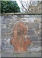
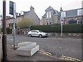
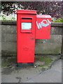
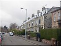
The above images may not be of the site on this page, they are loaded from Geograph.
Please Submit an Image of this site or go out and take one for us!
Click here to see more info for this site
Nearby sites
Key: Red: member's photo, Blue: 3rd party photo, Yellow: other image, Green: no photo - please go there and take one, Grey: site destroyed
Download sites to:
KML (Google Earth)
GPX (GPS waypoints)
CSV (Garmin/Navman)
CSV (Excel)
To unlock full downloads you need to sign up as a Contributory Member. Otherwise downloads are limited to 50 sites.
Turn off the page maps and other distractions
Nearby sites listing. In the following links * = Image available
1.1km NNE 21° Slidey Stane (Holyrood Park)* Natural Stone / Erratic / Other Natural Feature (NT2676672765)
1.2km NNW 341° Edinburgh Runestone* Carving (NT2598972937)
1.3km NE 55° Samson's Ribs* Promontory Fort / Cliff Castle (NT27457250)
1.5km SE 134° Cat Stane (Inch)* Standing Stone (Menhir) (NT27457068)
1.6km NNE 22° Salisbury Crags* Promontory Fort / Cliff Castle (NT27007326)
1.6km NNW 337° National Museum of Scotland* Museum (NT2574873290)
1.6km NNW 340° National Museum of Scotland (Early Christian Stones)* Ancient Cross (NT2583273324)
1.7km NE 50° Arthur's Seat* Hillfort (NT27647282)
1.7km NNW 336° National Museum of Scotland (Pictish Stones)* Museum (NT2572173302)
1.8km NW 323° The Portsburgh Stone* Natural Stone / Erratic / Other Natural Feature (NT25287327)
1.9km W 263° The Bore Stone* Marker Stone (NT2450871568)
1.9km NW 326° Grassmarket modern menhir* Standing Stone (Menhir) (NT25337333)
2.0km N 357° St John's Cross (Canongate)* Ancient Cross (NT2628873733)
2.0km NNW 328° Stone of Scone* Marker Stone (NT253735)
2.0km N 2° Canongate Mercat Cross* Ancient Cross (NT2647273812)
2.1km ENE 62° Delf Well* Holy Well or Sacred Spring (NT282727)
2.1km NNE 21° St Margaret's Well (Edinburgh)* Holy Well or Sacred Spring (NT2713373712)
2.2km N 9° Girth Cross (Canongate)* Ancient Cross (NT2673973910)
2.2km WSW 237° Hanging Stanes (Braid Road)* Marker Stone (NT24517061)
2.2km NNE 31° St Anthony's Well (Edinburgh)* Holy Well or Sacred Spring (NT27527364)
2.2km NW 324° St Margaret's Well (Edinburgh Castle)* Holy Well or Sacred Spring (NT2508273613)
2.3km NE 51° Dunsapie Crag* Hillfort (NT28177316)
2.3km ESE 122° Ravenswood Avenue* Standing Stone (Menhir) (NT2828270502)
2.3km NE 53° Holyrood Park Stone (Edinburgh) Natural Stone / Erratic / Other Natural Feature (NT28267313)
3.0km NW 319° St George's Well (Edinburgh)* Holy Well or Sacred Spring (NT2440174070)
View more nearby sites and additional images


 We would like to know more about this location. Please feel free to add a brief description and any relevant information in your own language.
 Wir möchten mehr über diese Stätte erfahren. Bitte zögern Sie nicht, eine kurze Beschreibung und relevante Informationen in Deutsch hinzuzufügen.
 Nous aimerions en savoir encore un peu sur les lieux. S'il vous plaît n'hesitez pas à ajouter une courte description et tous les renseignements pertinents dans votre propre langue.
 Quisieramos informarnos un poco más de las lugares. No dude en añadir una breve descripción y otros datos relevantes en su propio idioma.