<< Our Photo Pages >> Yelabuga settlement - Ancient Village or Settlement in Russia
Submitted by AlexAssa on Sunday, 06 August 2017 Page Views: 1506
Multi-periodSite Name: Yelabuga settlement Alternative Name: Елабужское горо&Country: Russia
NOTE: This site is 78.809 km away from the location you searched for.
Type: Ancient Village or Settlement
Nearest Town: Naberezhnye Chelny Nearest Village: Yelabuga
Latitude: 55.746435N Longitude: 52.032368E
Condition:
| 5 | Perfect |
| 4 | Almost Perfect |
| 3 | Reasonable but with some damage |
| 2 | Ruined but still recognisable as an ancient site |
| 1 | Pretty much destroyed, possibly visible as crop marks |
| 0 | No data. |
| -1 | Completely destroyed |
| 5 | Superb |
| 4 | Good |
| 3 | Ordinary |
| 2 | Not Good |
| 1 | Awful |
| 0 | No data. |
| 5 | Can be driven to, probably with disabled access |
| 4 | Short walk on a footpath |
| 3 | Requiring a bit more of a walk |
| 2 | A long walk |
| 1 | In the middle of nowhere, a nightmare to find |
| 0 | No data. |
| 5 | co-ordinates taken by GPS or official recorded co-ordinates |
| 4 | co-ordinates scaled from a detailed map |
| 3 | co-ordinates scaled from a bad map |
| 2 | co-ordinates of the nearest village |
| 1 | co-ordinates of the nearest town |
| 0 | no data |
Internal Links:
External Links:
")
Source: megalithica.ru
You may be viewing yesterday's version of this page. To see the most up to date information please register for a free account.
Do not use the above information on other web sites or publications without permission of the contributor.
Nearby Images from Flickr
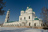

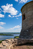
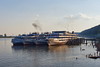
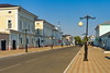
The above images may not be of the site on this page, but were taken nearby. They are loaded from Flickr so please click on them for image credits.
Click here to see more info for this site
Nearby sites
Click here to view sites on an interactive map of the areaKey: Red: member's photo, Blue: 3rd party photo, Yellow: other image, Green: no photo - please go there and take one, Grey: site destroyed
Download sites to:
KML (Google Earth)
GPX (GPS waypoints)
CSV (Garmin/Navman)
CSV (Excel)
To unlock full downloads you need to sign up as a Contributory Member. Otherwise downloads are limited to 50 sites.
Turn off the page maps and other distractions
Nearby sites listing. In the following links * = Image available
213.5km WNW 291° Karman-Kuryk* Ancient Village or Settlement
270.5km N 9° Idnakar* Ancient Village or Settlement
274.2km SSW 203° Volga historical wall* Ancient Village or Settlement
319.5km SE 126° Baishevskie Barrows Ring Cairn
461.3km E 98° Zyuratkul Elk* Hill Figure or Geoglyph
484.5km SSE 154° Orenburg* Round Barrow(s)
488.5km ESE 116° The oldest settlement Mysovaya - Urta-Tube* Ancient Village or Settlement
508.3km E 94° Isle of Vera* Standing Stones
509.2km SSE 163° Philippovskiy Kurgan Complex* Artificial Mound
517.0km WNW 282° Georgiev stone* Carving
538.7km WNW 284° Gorodets Museum of Regional Studies* Museum
549.1km WNW 290° Seraphim Big Stone 4* Natural Stone / Erratic / Other Natural Feature
555.5km NE 50° Balancing stone Kachkanar* Natural Stone / Erratic / Other Natural Feature
558.6km SE 124° Barrow Cemetary near Kizil'skoye Barrow Cemetery
577.6km W 267° Thunder stone (Nizhny Novgorod)* Natural Stone / Erratic / Other Natural Feature
579.8km NNE 25° Cherdyn Hillfort* Hillfort
598.7km ESE 122° Arkaim Ancient Village or Settlement
642.8km ESE 121° Sintashta* Ancient Village or Settlement
712.9km NW 320° Tiunovskoe sanctuary* Carving
718.0km W 279° Sungir Ancient Village or Settlement
736.3km WNW 282° Irmes* Ancient Village or Settlement
752.8km W 263° Hillfort Old Rezan'* Hillfort
776.4km WNW 290° Timerevsky complex stone sanctuary* Stone Circle
790.2km WNW 287° Stone Dunilovo* Carving
790.8km W 273° Serpentine stone* Natural Stone / Erratic / Other Natural Feature
View more nearby sites and additional images


 We would like to know more about this location. Please feel free to add a brief description and any relevant information in your own language.
 Wir möchten mehr über diese Stätte erfahren. Bitte zögern Sie nicht, eine kurze Beschreibung und relevante Informationen in Deutsch hinzuzufügen.
 Nous aimerions en savoir encore un peu sur les lieux. S'il vous plaît n'hesitez pas à ajouter une courte description et tous les renseignements pertinents dans votre propre langue.
 Quisieramos informarnos un poco más de las lugares. No dude en añadir una breve descripción y otros datos relevantes en su propio idioma.