<< Text Pages >> Moneylaws Castle Hill - Ancient Village or Settlement in England in Northumberland
Submitted by SolarMegalith on Friday, 13 May 2011 Page Views: 4890
Multi-periodSite Name: Moneylaws Castle HillCountry: England
NOTE: This site is 5.3 km away from the location you searched for.
County: Northumberland Type: Ancient Village or Settlement
Nearest Village: Downham
Map Ref: NT87213474
Latitude: 55.606098N Longitude: 2.204568W
Condition:
| 5 | Perfect |
| 4 | Almost Perfect |
| 3 | Reasonable but with some damage |
| 2 | Ruined but still recognisable as an ancient site |
| 1 | Pretty much destroyed, possibly visible as crop marks |
| 0 | No data. |
| -1 | Completely destroyed |
| 5 | Superb |
| 4 | Good |
| 3 | Ordinary |
| 2 | Not Good |
| 1 | Awful |
| 0 | No data. |
| 5 | Can be driven to, probably with disabled access |
| 4 | Short walk on a footpath |
| 3 | Requiring a bit more of a walk |
| 2 | A long walk |
| 1 | In the middle of nowhere, a nightmare to find |
| 0 | No data. |
| 5 | co-ordinates taken by GPS or official recorded co-ordinates |
| 4 | co-ordinates scaled from a detailed map |
| 3 | co-ordinates scaled from a bad map |
| 2 | co-ordinates of the nearest village |
| 1 | co-ordinates of the nearest town |
| 0 | no data |
Internal Links:
External Links:
Misc. Earthwork in Northumberland
Remains of an Iron Age univallate enclosure.
Read More at PastScape.
You may be viewing yesterday's version of this page. To see the most up to date information please register for a free account.
Do not use the above information on other web sites or publications without permission of the contributor.
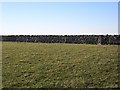
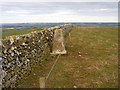
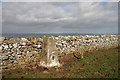
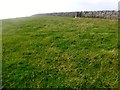
Nearby Images from Geograph Britain and Ireland:
©2013(licence)
©2006(licence)
©2011(licence)
©2015(licence)
©2013(licence)
The above images may not be of the site on this page, they are loaded from Geograph.
Please Submit an Image of this site or go out and take one for us!
Click here to see more info for this site
Nearby sites
Key: Red: member's photo, Blue: 3rd party photo, Yellow: other image, Green: no photo - please go there and take one, Grey: site destroyed
Download sites to:
KML (Google Earth)
GPX (GPS waypoints)
CSV (Garmin/Navman)
CSV (Excel)
To unlock full downloads you need to sign up as a Contributory Member. Otherwise downloads are limited to 50 sites.
Turn off the page maps and other distractions
Nearby sites listing. In the following links * = Image available
3.0km NE 52° Branxton Hill Settlement Hillfort (NT896366)
3.6km SW 217° Pawston Hill Camp Hillfort (NT8505031847)
3.7km S 180° Longknowe (Kilham)* Ancient Village or Settlement (NT8716831040)
3.9km NNE 18° The King's Stone* Standing Stone (Menhir) (NT88423845)
4.8km SSE 165° Staw Hill Hillfort (NT884301)
4.9km S 189° Elsdonburn Shank Shielings (Kilham)* Ancient Village or Settlement (NT8641429858)
5.2km E 86° Flodden Camp Hillfort (NT92373510)
5.3km S 170° Mid Hill Ancient Village or Settlement (NT881295)
5.4km SW 225° Bowmont Hill Hillfort (NT834309)
5.7km S 186° Elsdonburn Shank (Kilham)* Ancient Village or Settlement (NT86572912)
5.8km E 82° Milfield North* Henge (NT930355)
5.9km S 185° Ring Chesters* Hillfort (NT8670528905)
6.0km SSE 164° Hethpool 1 & 2 (Ewe Hill) Rock Art (NT8887028990)
6.1km E 90° Whitton Hill Timber Circle (NT933347)
6.1km SE 137° St. Gregory's The Great (Kirknewton)* Sculptured Stone (NT9134630251)
6.2km E 89° Milfield North Timber Circle (NT934348)
6.2km E 91° Milfield South Henge (NT934346)
6.4km SE 144° West Hill Camp* Hillfort (NT9096029518)
6.6km SW 217° Venchen Farm Cottages (Town Yetholm)* Standing Stone (Menhir) (NT8319929486)
6.6km SE 138° St Gregory's Hill* Hillfort (NT9161329805)
6.7km SSW 192° Coldsmouth Hill Ring Cairns* Cist (NT858282)
6.8km SSE 168° Little Hetha Hillfort (NT886281)
6.8km SE 144° West Hill, Kirknewton* Rock Art (NT9125329199)
6.9km E 99° Milfield Reconstructed Henge at Maelmin Heritage Centre* Henge (NT9400033631)
6.9km SE 144° Torlee House, Kirknewton Rock Art (NT9127029190)
View more nearby sites and additional images


 We would like to know more about this location. Please feel free to add a brief description and any relevant information in your own language.
 Wir möchten mehr über diese Stätte erfahren. Bitte zögern Sie nicht, eine kurze Beschreibung und relevante Informationen in Deutsch hinzuzufügen.
 Nous aimerions en savoir encore un peu sur les lieux. S'il vous plaît n'hesitez pas à ajouter une courte description et tous les renseignements pertinents dans votre propre langue.
 Quisieramos informarnos un poco más de las lugares. No dude en añadir una breve descripción y otros datos relevantes en su propio idioma.