<< Our Photo Pages >> O'Donnell's stones - Marker Stone in Ireland (Republic of) in Co. Donegal
Submitted by JAGamble on Friday, 24 February 2023 Page Views: 361
Date UncertainSite Name: O'Donnell's stones Alternative Name: Balloor standing stonesCountry: Ireland (Republic of)
NOTE: This site is 34.996 km away from the location you searched for.
County: Co. Donegal Type: Marker Stone
Nearest Town: Londonderry
Map Ref: C22084687
Latitude: 55.268286N Longitude: 7.653413W
Condition:
| 5 | Perfect |
| 4 | Almost Perfect |
| 3 | Reasonable but with some damage |
| 2 | Ruined but still recognisable as an ancient site |
| 1 | Pretty much destroyed, possibly visible as crop marks |
| 0 | No data. |
| -1 | Completely destroyed |
| 5 | Superb |
| 4 | Good |
| 3 | Ordinary |
| 2 | Not Good |
| 1 | Awful |
| 0 | No data. |
| 5 | Can be driven to, probably with disabled access |
| 4 | Short walk on a footpath |
| 3 | Requiring a bit more of a walk |
| 2 | A long walk |
| 1 | In the middle of nowhere, a nightmare to find |
| 0 | No data. |
| 5 | co-ordinates taken by GPS or official recorded co-ordinates |
| 4 | co-ordinates scaled from a detailed map |
| 3 | co-ordinates scaled from a bad map |
| 2 | co-ordinates of the nearest village |
| 1 | co-ordinates of the nearest town |
| 0 | no data |
Internal Links:
External Links:
")
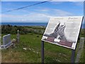
A survey of this site claims it to be a burial ground, but I found no information about whether the burials are contemporary or prehistoric. Although the presence of a modern stone cross may suggest that the burials are more recent.
You may be viewing yesterday's version of this page. To see the most up to date information please register for a free account.
")
")
")
Do not use the above information on other web sites or publications without permission of the contributor.
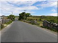
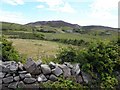
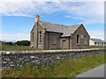
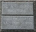
Nearby Images from Geograph Britain and Ireland:
©2010(licence)
©2010(licence)
©2010(licence)
©2010(licence)
©2010(licence)
The above images may not be of the site on this page, they are loaded from Geograph.
Please Submit an Image of this site or go out and take one for us!
Click here to see more info for this site
Nearby sites
Click here to view sites on an interactive map of the areaKey: Red: member's photo, Blue: 3rd party photo, Yellow: other image, Green: no photo - please go there and take one, Grey: site destroyed
Download sites to:
KML (Google Earth)
GPX (GPS waypoints)
CSV (Garmin/Navman)
CSV (Excel)
To unlock full downloads you need to sign up as a Contributory Member. Otherwise downloads are limited to 50 sites.
Turn off the page maps and other distractions
Nearby sites listing. In the following links * = Image available
5.1km SW 229° Ballyhiernan standing stone* Standing Stone (Menhir) (C18254350)
6.7km SW 233° Cashel Glebe unclassified tomb* Burial Chamber or Dolmen (C16744274)
12.3km SW 235° Mevagh Rock Art* Rock Art (C121397)
14.8km SSE 156° Killycolman Stone Row / Alignment (C282334)
15.4km E 93° Clonmany Souterrain Souterrain (Fogou, Earth House)
15.8km SSW 198° Carmoney* Chambered Tomb (C172318)
16.5km S 181° Gortnavern* Portal Tomb (C218304)
17.4km E 101° Meenadoran Stones Standing Stones (C392437)
19.7km E 86° Rashenny Stone Row Stone Row / Alignment (C41774820)
20.0km E 88° Rashenny Tomb* Chambered Tomb (C42174751)
20.7km E 82° Magheranaul Rock Carvings* Rock Art (C426500)
20.7km SW 216° Carlan Upper Stone Row / Alignment (C100300)
21.4km E 82° Magheranaul Wedge Tomb Wedge Tomb (C434498)
21.8km WSW 248° Muntermellan* Portal Tomb (C0180138771)
21.9km SW 236° Ballymore Lower* Chambered Tomb (C039345)
22.0km SW 236° Knocknafaugher Stone Row / Alignment (C039344)
22.2km SSW 196° Drumard* Chambered Tomb (C159255)
22.8km SSW 206° Barnes Lower NE Row Stone Row / Alignment (C122263)
23.0km SSE 150° St Mura's Cross (Fahan)* Early Christian Sculptured Stone (C3360426970)
23.1km S 171° Ballykenny Stone Circle (C257240)
24.0km SSW 192° Portleon Stone Row / Alignment (C172233)
24.7km WSW 241° Greenhill Donegal * Chambered Tomb (C005348)
25.1km SSW 207° Barnes Lower Standing Stones* Standing Stones (C1077024449)
25.2km SSE 157° Carnaghan Portal Tomb (C320237)
30.3km ESE 106° Lough Inn Circle* Modern Stone Circle etc
View more nearby sites and additional images


 We would like to know more about this location. Please feel free to add a brief description and any relevant information in your own language.
 Wir möchten mehr über diese Stätte erfahren. Bitte zögern Sie nicht, eine kurze Beschreibung und relevante Informationen in Deutsch hinzuzufügen.
 Nous aimerions en savoir encore un peu sur les lieux. S'il vous plaît n'hesitez pas à ajouter une courte description et tous les renseignements pertinents dans votre propre langue.
 Quisieramos informarnos un poco más de las lugares. No dude en añadir una breve descripción y otros datos relevantes en su propio idioma.