<< Text Pages >> Westerkirk - Stone Circle in Scotland in Dumfries and Galloway
Submitted by enkidu41 on Sunday, 14 July 2002 Page Views: 8568
Neolithic and Bronze AgeSite Name: WesterkirkCountry: Scotland
NOTE: This site is 0.281 km away from the location you searched for.
County: Dumfries and Galloway Type: Stone Circle
Map Ref: NY3190 Landranger Map Number: 79
Latitude: 55.199423N Longitude: 3.085571W
Condition:
| 5 | Perfect |
| 4 | Almost Perfect |
| 3 | Reasonable but with some damage |
| 2 | Ruined but still recognisable as an ancient site |
| 1 | Pretty much destroyed, possibly visible as crop marks |
| 0 | No data. |
| -1 | Completely destroyed |
| 5 | Superb |
| 4 | Good |
| 3 | Ordinary |
| 2 | Not Good |
| 1 | Awful |
| 0 | No data. |
| 5 | Can be driven to, probably with disabled access |
| 4 | Short walk on a footpath |
| 3 | Requiring a bit more of a walk |
| 2 | A long walk |
| 1 | In the middle of nowhere, a nightmare to find |
| 0 | No data. |
| 5 | co-ordinates taken by GPS or official recorded co-ordinates |
| 4 | co-ordinates scaled from a detailed map |
| 3 | co-ordinates scaled from a bad map |
| 2 | co-ordinates of the nearest village |
| 1 | co-ordinates of the nearest town |
| 0 | no data |
Internal Links:
External Links:
Probable destroyed stone circle in Dumfriesshire. In the 1841 New Statistical Account for Westkirk Parish it was recorded that "there are several whinstones placed erect in the ground which have every appearance of the remains of a druidical temple". By 1912 all traces of this circle had disappeared.
Note: NGR variously given as NY3190 and NY2991.
You may be viewing yesterday's version of this page. To see the most up to date information please register for a free account.
Do not use the above information on other web sites or publications without permission of the contributor.
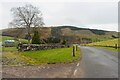
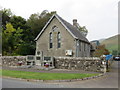
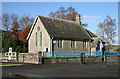
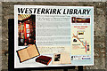
Nearby Images from Geograph Britain and Ireland:
©2023(licence)

©2008(licence)
©2014(licence)
©2008(licence)
©2008(licence)
The above images may not be of the site on this page, they are loaded from Geograph.
Please Submit an Image of this site or go out and take one for us!
Click here to see more info for this site
Nearby sites
Key: Red: member's photo, Blue: 3rd party photo, Yellow: other image, Green: no photo - please go there and take one, Grey: site destroyed
Download sites to:
KML (Google Earth)
GPX (GPS waypoints)
CSV (Garmin/Navman)
CSV (Excel)
To unlock full downloads you need to sign up as a Contributory Member. Otherwise downloads are limited to 50 sites.
Turn off the page maps and other distractions
Nearby sites listing. In the following links * = Image available
598m W 269° Boonies Ancient Village or Settlement (NY304900)
1.7km SSW 197° Shaw Hill (Westerkirk) Hillfort (NY30458834)
2.1km NW 304° Bogle Walls* Hillfort (NY29249124)
3.4km ESE 122° Little Hill (Craig)* Hillfort (NY3383088160)
4.0km WNW 291° White Birren* Hillfort (NY27329148)
4.6km WNW 298° Green Hill (Lyneholm)* Misc. Earthwork (NY26939223)
4.8km ESE 117° Barntalloch (Langholm)* Misc. Earthwork (NY35258776)
5.3km WNW 301° Bank Head Hill Ancient Village or Settlement (NY2648992760)
5.4km W 275° Bailiehill Fort* Hillfort (NY2558090520)
6.0km WNW 301° King Shaw's Grave* Cairn (NY25939320)
6.6km WNW 289° The Knowe* Ancient Village or Settlement (NY24799226)
7.1km ENE 67° Grey Wether Meikledale Standing Stone (Menhir) (NY3761692734)
7.3km WNW 297° Over Rig* Misc. Earthwork (NY2455693475)
7.4km WNW 292° Castle O'er Fort* Hillfort (NY2419092850)
7.8km SE 134° Langholm Market Cross* Ancient Cross (NY36488447)
8.2km NW 311° Bessie's Hill Settlement Ancient Village or Settlement (NY249955)
8.2km NW 311° Bessie's Hill Fort* Hillfort (NY2490095540)
8.3km NW 317° Girdle Stanes* Stone Circle (NY2535196153)
8.4km NW 321° Loupin' Stanes SE* Stone Row / Alignment (NY25729660)
8.5km NW 321° Loupin' Stanes NW* Stone Circle (NY25709663)
8.8km WSW 256° Whitcastles* Stone Circle (NY22408806)
8.8km W 259° Kirkslight Rig Stone Circle (NY223885)
9.5km SW 228° Newhall Hill (Paddockhole)* Ancient Village or Settlement (NY23808372)
9.9km SSE 167° Bloch Well (Langholm)* Holy Well or Sacred Spring (NY33018034)
11.8km SW 231° Whiteholme Rig* Stone Circle (NY21718269)
View more nearby sites and additional images


 We would like to know more about this location. Please feel free to add a brief description and any relevant information in your own language.
 Wir möchten mehr über diese Stätte erfahren. Bitte zögern Sie nicht, eine kurze Beschreibung und relevante Informationen in Deutsch hinzuzufügen.
 Nous aimerions en savoir encore un peu sur les lieux. S'il vous plaît n'hesitez pas à ajouter une courte description et tous les renseignements pertinents dans votre propre langue.
 Quisieramos informarnos un poco más de las lugares. No dude en añadir una breve descripción y otros datos relevantes en su propio idioma.