<< Text Pages >> Bebside Road Henge - Henge in England in Northumberland
Submitted by Runemage on Monday, 14 July 2014 Page Views: 3405
Neolithic and Bronze AgeSite Name: Bebside Road HengeCountry: England County: Northumberland Type: Henge
Map Ref: NZ277812
Latitude: 55.124412N Longitude: 1.56718W
Condition:
| 5 | Perfect |
| 4 | Almost Perfect |
| 3 | Reasonable but with some damage |
| 2 | Ruined but still recognisable as an ancient site |
| 1 | Pretty much destroyed, possibly visible as crop marks |
| 0 | No data. |
| -1 | Completely destroyed |
| 5 | Superb |
| 4 | Good |
| 3 | Ordinary |
| 2 | Not Good |
| 1 | Awful |
| 0 | No data. |
| 5 | Can be driven to, probably with disabled access |
| 4 | Short walk on a footpath |
| 3 | Requiring a bit more of a walk |
| 2 | A long walk |
| 1 | In the middle of nowhere, a nightmare to find |
| 0 | No data. |
| 5 | co-ordinates taken by GPS or official recorded co-ordinates |
| 4 | co-ordinates scaled from a detailed map |
| 3 | co-ordinates scaled from a bad map |
| 2 | co-ordinates of the nearest village |
| 1 | co-ordinates of the nearest town |
| 0 | no data |
Internal Links:
External Links:
Henge and Curvilinear Enclosure in Northumberland. This site, unknown for a very long time, is currently in an area of controversy. It appears to have been documented in the 90's as a henge visible as cropmarks but that documentation was not made publically available until Sally Pattison uncovered it recently in her quest for more information about modern day plans to carry out open cast coal mining in the area.
This is from the documentation in a previous hearing concerning that area in the 90's.
"I consider that the Neolithic Henge and Curvilinear Enclosure or Crop Mark at the N. end of the (appeal) site would normally be regarded as an ancient monument. Also I would have expected from the brief description that the monument would be of more local significance.
The adjustments made to the proposals to accomodate this monument were just to avoid its physical damage, and I consider that both mounds S1 and M1 (development bunds) would plainly intrude on its setting"
Further details are available direct from www.savebebside.com
Sally has also set up a petition to save the henge from any future damage
You may be viewing yesterday's version of this page. To see the most up to date information please register for a free account.
Do not use the above information on other web sites or publications without permission of the contributor.
Nearby Images from Geograph Britain and Ireland:
©2012(licence)
©2008(licence)
©2016(licence)
©2006(licence)
©2012(licence)
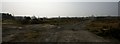
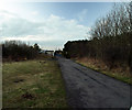
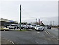
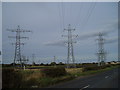
The above images may not be of the site on this page, they are loaded from Geograph.
Please Submit an Image of this site or go out and take one for us!
Click here to see more info for this site
Nearby sites
Key: Red: member's photo, Blue: 3rd party photo, Yellow: other image, Green: no photo - please go there and take one, Grey: site destroyed
Download sites to:
KML (Google Earth)
GPX (GPS waypoints)
CSV (Garmin/Navman)
CSV (Excel)
To unlock full downloads you need to sign up as a Contributory Member. Otherwise downloads are limited to 50 sites.
Turn off the page maps and other distractions
Nearby sites listing. In the following links * = Image available
1.8km WNW 291° St Cuthbert's Church (Bedlington)* Sculptured Stone (NZ2605081813)
1.9km WNW 293° Bedlington Market Cross* Ancient Cross (NZ2594981924)
5.6km SW 224° Northumberlandia* Modern Stone Circle etc (NZ2384777182)
6.6km NW 326° St Andrew's Church (Bothal)* Ancient Cross (NZ2398986621)
7.9km NNE 31° St Bartholomew's Church (Newbiggin by the Sea)* Ancient Cross (NZ3178588024)
8.0km NNE 18° Woodhorn Cross* Ancient Cross (NZ3014288845)
8.4km SE 131° Old Hartley Blue Stone* Marker Stone (NZ341757)
8.6km SE 132° Old Hartley Standing Stone* Standing Stone (Menhir) (NZ341755)
9.7km SW 224° Gardener's house crop mark, Dinnington Ancient Village or Settlement (NZ20977420)
10.4km SSW 204° Hazlerigg cropmark (North) Ancient Village or Settlement (NZ23467172)
10.7km SSW 204° Hazlerigg cropmark (South) Ancient Village or Settlement (NZ23327140)
10.8km SSE 167° Holy Stone (North Tyneside)* Ancient Cross (NZ30137066)
11.5km WNW 295° St Cuthbert's Well (Mitford)* Holy Well or Sacred Spring (NZ1720685990)
12.0km NNW 338° Ulgham Cross* Ancient Cross (NZ2321892308)
13.8km SW 234° St Mary The Virgin (Ponteland)* Ancient Cross (NZ1658872956)
14.8km S 188° St. Mary's Well (Jesmond)* Holy Well or Sacred Spring (NZ2584366508)
15.7km S 187° Villa Reale cist, Jesmond* Cist (NZ26006562)
15.8km S 191° Exhibition Park Circle* Modern Stone Circle etc (NZ2476265651)
16.3km S 191° The Ponteland Boulder* Rock Art (NZ24816518)
16.3km S 190° Great North Museum* Museum (NZ2485565168)
16.3km S 190° Great North Museum (Rock Art)* Museum (NZ2485365162)
16.3km S 190° Great North Museum (Anglo Saxon Stones)* Museum (NZ2485065160)
16.4km S 191° The Museum of Antiquities* Museum (NZ246651)
16.9km SSE 159° Bede's World (Jarrow)* Ancient Cross (NZ33756542)
17.0km SW 223° Callerton Lane End cropmark Ancient Village or Settlement (NZ16106875)
View more nearby sites and additional images


 We would like to know more about this location. Please feel free to add a brief description and any relevant information in your own language.
 Wir möchten mehr über diese Stätte erfahren. Bitte zögern Sie nicht, eine kurze Beschreibung und relevante Informationen in Deutsch hinzuzufügen.
 Nous aimerions en savoir encore un peu sur les lieux. S'il vous plaît n'hesitez pas à ajouter une courte description et tous les renseignements pertinents dans votre propre langue.
 Quisieramos informarnos un poco más de las lugares. No dude en añadir una breve descripción y otros datos relevantes en su propio idioma.