<< Text Pages >> Gardener's house crop mark, Dinnington - Ancient Village or Settlement in England in Tyne and Wear
Submitted by durhamnature on Wednesday, 12 September 2012 Page Views: 2714
Multi-periodSite Name: Gardener''s house crop mark, DinningtonCountry: England
NOTE: This site is 0.811 km away from the location you searched for.
County: Tyne and Wear Type: Ancient Village or Settlement
Nearest Town: Newcastle
Map Ref: NZ20977420
Latitude: 55.061840N Longitude: 1.673222W
Condition:
| 5 | Perfect |
| 4 | Almost Perfect |
| 3 | Reasonable but with some damage |
| 2 | Ruined but still recognisable as an ancient site |
| 1 | Pretty much destroyed, possibly visible as crop marks |
| 0 | No data. |
| -1 | Completely destroyed |
| 5 | Superb |
| 4 | Good |
| 3 | Ordinary |
| 2 | Not Good |
| 1 | Awful |
| 0 | No data. |
| 5 | Can be driven to, probably with disabled access |
| 4 | Short walk on a footpath |
| 3 | Requiring a bit more of a walk |
| 2 | A long walk |
| 1 | In the middle of nowhere, a nightmare to find |
| 0 | No data. |
| 5 | co-ordinates taken by GPS or official recorded co-ordinates |
| 4 | co-ordinates scaled from a detailed map |
| 3 | co-ordinates scaled from a bad map |
| 2 | co-ordinates of the nearest village |
| 1 | co-ordinates of the nearest town |
| 0 | no data |
Internal Links:
External Links:
Ancient Village or Settlement in Tyne and Wear
Tyne and Wear HER 176, Scheduled Monument. Photo in Miket, page 121.
A rectilinear enclosure with internal features including a possible hut circle and a single entrance visible on aerial photographs as a crop mark, with a ring ditch just west of the site. Fainter crop-marks nearby suggest that this site may have had a more complex pattern of occupation. Likely to be of late Iron Age or Romano-British date.
Currently arable.
Text compiled from Miket and HER.
You may be viewing yesterday's version of this page. To see the most up to date information please register for a free account.
Do not use the above information on other web sites or publications without permission of the contributor.
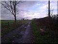
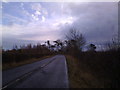
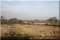
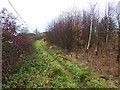
Nearby Images from Geograph Britain and Ireland:
©2012(licence)
©2012(licence)
©2009(licence)
©2013(licence)
©2016(licence)
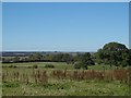
The above images may not be of the site on this page, they are loaded from Geograph.
Please Submit an Image of this site or go out and take one for us!
Click here to see more info for this site
Nearby sites
Key: Red: member's photo, Blue: 3rd party photo, Yellow: other image, Green: no photo - please go there and take one, Grey: site destroyed
Download sites to:
KML (Google Earth)
GPX (GPS waypoints)
CSV (Garmin/Navman)
CSV (Excel)
To unlock full downloads you need to sign up as a Contributory Member. Otherwise downloads are limited to 50 sites.
Turn off the page maps and other distractions
Nearby sites listing. In the following links * = Image available
3.5km SE 135° Hazlerigg cropmark (North) Ancient Village or Settlement (NZ23467172)
3.6km SE 140° Hazlerigg cropmark (South) Ancient Village or Settlement (NZ23327140)
4.1km NE 44° Northumberlandia* Modern Stone Circle etc (NZ2384777182)
4.5km WSW 254° St Mary The Virgin (Ponteland)* Ancient Cross (NZ1658872956)
7.3km SW 222° Callerton Lane End cropmark Ancient Village or Settlement (NZ16106875)
7.9km SW 219° Dewley Burn Artificial Mound (NZ1601868016)
9.1km SSE 148° St. Mary's Well (Jesmond)* Holy Well or Sacred Spring (NZ2584366508)
9.1km NE 34° St Cuthbert's Church (Bedlington)* Sculptured Stone (NZ2605081813)
9.2km NNE 33° Bedlington Market Cross* Ancient Cross (NZ2594981924)
9.3km SSE 156° Exhibition Park Circle* Modern Stone Circle etc (NZ2476265651)
9.7km NE 44° Bebside Road Henge Henge (NZ277812)
9.7km SW 219° Throckley Bank Top Rock Art (NZ1482866677)
9.7km SW 219° Throckley Bank Portable Rock Art (NZ1482066670)
9.8km SSE 159° The Museum of Antiquities* Museum (NZ246651)
9.8km SSE 157° The Ponteland Boulder* Rock Art (NZ24816518)
9.8km ESE 111° Holy Stone (North Tyneside)* Ancient Cross (NZ30137066)
9.8km SSE 157° Great North Museum* Museum (NZ2485565168)
9.8km SSE 157° Great North Museum (Rock Art)* Museum (NZ2485365162)
9.8km SSE 157° Great North Museum (Anglo Saxon Stones)* Museum (NZ2485065160)
9.9km SSE 150° Villa Reale cist, Jesmond* Cist (NZ26006562)
10.3km SW 226° Hadrian's Wall (Heddon on the Wall)* Misc. Earthwork (NZ13616693)
10.4km S 172° Elswick Road Cist Cist (NZ225639)
10.4km SSE 160° St Andrew's Church (Gallowgate)* Early Christian Sculptured Stone (NZ2453564409)
10.5km SW 226° St Andrew's Church (Heddon on the Wall)* Ancient Cross (NZ1338666892)
10.6km SSE 160° White Cross (Newcastle)* Ancient Cross (NZ24586426)
View more nearby sites and additional images


 We would like to know more about this location. Please feel free to add a brief description and any relevant information in your own language.
 Wir möchten mehr über diese Stätte erfahren. Bitte zögern Sie nicht, eine kurze Beschreibung und relevante Informationen in Deutsch hinzuzufügen.
 Nous aimerions en savoir encore un peu sur les lieux. S'il vous plaît n'hesitez pas à ajouter une courte description et tous les renseignements pertinents dans votre propre langue.
 Quisieramos informarnos un poco más de las lugares. No dude en añadir una breve descripción y otros datos relevantes en su propio idioma.