<< Our Photo Pages >> Craigs Lower Passage Grave - Passage Grave in Ireland (Northern) in Co. Antrim
Submitted by DrewParsons on Friday, 02 July 2010 Page Views: 9199
Neolithic and Bronze AgeSite Name: Craigs Lower Passage GraveCountry: Ireland (Northern)
NOTE: This site is 4.186 km away from the location you searched for.
County: Co. Antrim Type: Passage Grave
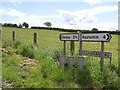
Nearest Town: Ballymoney Nearest Village: Craigs
Map Ref: C9739617278
Latitude: 54.993462N Longitude: 6.47904W
Condition:
| 5 | Perfect |
| 4 | Almost Perfect |
| 3 | Reasonable but with some damage |
| 2 | Ruined but still recognisable as an ancient site |
| 1 | Pretty much destroyed, possibly visible as crop marks |
| 0 | No data. |
| -1 | Completely destroyed |
| 5 | Superb |
| 4 | Good |
| 3 | Ordinary |
| 2 | Not Good |
| 1 | Awful |
| 0 | No data. |
| 5 | Can be driven to, probably with disabled access |
| 4 | Short walk on a footpath |
| 3 | Requiring a bit more of a walk |
| 2 | A long walk |
| 1 | In the middle of nowhere, a nightmare to find |
| 0 | No data. |
| 5 | co-ordinates taken by GPS or official recorded co-ordinates |
| 4 | co-ordinates scaled from a detailed map |
| 3 | co-ordinates scaled from a bad map |
| 2 | co-ordinates of the nearest village |
| 1 | co-ordinates of the nearest town |
| 0 | no data |
Internal Links:
External Links:
I have visited· I would like to visit
Stone Free visited on 2nd Nov 2014 - their rating: Cond: 3 Amb: 4 Access: 5
DrewParsons have visited here
")
A lovely, small passage tomb located to the west side of the Mullan Road south east of Finvoy. The dolmen is set in a field a few metres from the road with easy access and an information board right by it. With seven orthostats and a repaired capstone it is a lovely site.
It was excavated in the mid 19th century when it appears to have lost its mound. The capstone was repaired in 1985 after a lightening strike 9 years prior to that.
You may be viewing yesterday's version of this page. To see the most up to date information please register for a free account.
")
")
")
Do not use the above information on other web sites or publications without permission of the contributor.
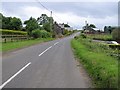
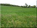
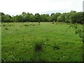
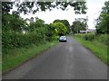
Nearby Images from Geograph Britain and Ireland:
©2008(licence)
©2008(licence)
©2008(licence)
©2008(licence)
©2008(licence)
The above images may not be of the site on this page, they are loaded from Geograph.
Please Submit an Image of this site or go out and take one for us!
Click here to see more info for this site
Nearby sites
Click here to view sites on an interactive map of the areaKey: Red: member's photo, Blue: 3rd party photo, Yellow: other image, Green: no photo - please go there and take one, Grey: site destroyed
Download sites to:
KML (Google Earth)
GPX (GPS waypoints)
CSV (Garmin/Navman)
CSV (Excel)
To unlock full downloads you need to sign up as a Contributory Member. Otherwise downloads are limited to 50 sites.
Turn off the page maps and other distractions
Nearby sites listing. In the following links * = Image available
460m ENE 62° The Broad Stone (Craigs)* Court Tomb (C978175)
823m NNE 16° Craigs Standing Stone 1* Standing Stone (Menhir) (NW139765)
952m NNE 19° Craigs Standing Stone 2* Standing Stone (Menhir) (NW140766)
1.1km NNE 22° Craigs Standing Stone Hill* Standing Stone (Menhir) (NW141767)
4.9km E 79° Ballymacaldrack* Court Tomb (D02161830)
8.5km W 266° Moneydig* Passage Grave
9.1km NNE 25° Lisboy* Standing Stone (Menhir) (NW180837)
9.4km NE 54° Knockahollet motte and Bailey* Hillfort (NW2160380827)
10.7km NNE 24° Drumaqueran Carved Cross* Ancient Cross (NW1867185144)
12.3km ENE 61° Black Lough Standing Stone 2* Standing Stone (Menhir) (D0809823469)
12.4km ENE 60° Black Lough Standing Stone 3* Standing Stone (Menhir) (D0803123693)
12.5km ENE 63° Black Lough Standing Stone 1* Standing Stone (Menhir) (D0842323282)
13.0km NNE 18° Stranocum Fort* Hillfort (NW184878)
13.4km NE 55° Tully N* Standing Stones (D082252)
13.6km W 263° Garvagh Pyramid* Modern Stone Circle etc
13.8km NE 56° Loughguile Standing Stone* Standing Stone (Menhir) (NW2555282739)
14.1km WNW 296° Grey Stone (Crevolea)* Portal Tomb (NW014828)
14.2km E 91° Standing Stone (Scotchomerbane)* Standing Stone (Menhir) (NW278746)
14.6km S 175° Slievenagh* Stone Circle (C9895602726)
15.2km WSW 252° Cuilbane Stone Circle (C8304812206)
15.3km WSW 252° Tamney Cromlech* Stone Circle (NV988719)
15.4km E 95° Standing Stone (Skerry West)* Standing Stone (Menhir) (NW289735)
15.4km WSW 247° Calleen Braigs Standing Stones (C8333010950)
15.5km NNE 19° Carnfeogue Standing Stone* Standing Stone (Menhir) (NW197900)
15.5km NW 320° Camus Cross (Co. Derry)* Ancient Cross (C871289)
View more nearby sites and additional images


 We would like to know more about this location. Please feel free to add a brief description and any relevant information in your own language.
 Wir möchten mehr über diese Stätte erfahren. Bitte zögern Sie nicht, eine kurze Beschreibung und relevante Informationen in Deutsch hinzuzufügen.
 Nous aimerions en savoir encore un peu sur les lieux. S'il vous plaît n'hesitez pas à ajouter une courte description et tous les renseignements pertinents dans votre propre langue.
 Quisieramos informarnos un poco más de las lugares. No dude en añadir una breve descripción y otros datos relevantes en su propio idioma.