<< Text Pages >> Stella enclosure - Ancient Village or Settlement in England in Tyne and Wear
Submitted by durhamnature on Sunday, 19 August 2012 Page Views: 2490
Multi-periodSite Name: Stella enclosureCountry: England
NOTE: This site is 0.513 km away from the location you searched for.
County: Tyne and Wear Type: Ancient Village or Settlement
Nearest Town: Blaydon Nearest Village: Stella
Map Ref: NZ168638
Latitude: 54.968543N Longitude: 1.739115W
Condition:
| 5 | Perfect |
| 4 | Almost Perfect |
| 3 | Reasonable but with some damage |
| 2 | Ruined but still recognisable as an ancient site |
| 1 | Pretty much destroyed, possibly visible as crop marks |
| 0 | No data. |
| -1 | Completely destroyed |
| 5 | Superb |
| 4 | Good |
| 3 | Ordinary |
| 2 | Not Good |
| 1 | Awful |
| 0 | No data. |
| 5 | Can be driven to, probably with disabled access |
| 4 | Short walk on a footpath |
| 3 | Requiring a bit more of a walk |
| 2 | A long walk |
| 1 | In the middle of nowhere, a nightmare to find |
| 0 | No data. |
| 5 | co-ordinates taken by GPS or official recorded co-ordinates |
| 4 | co-ordinates scaled from a detailed map |
| 3 | co-ordinates scaled from a bad map |
| 2 | co-ordinates of the nearest village |
| 1 | co-ordinates of the nearest town |
| 0 | no data |
Internal Links:
External Links:
Ancient Village or Settlement in Tyne and Wear
Tyne and Wear HER 637
Crop mark of part of a rectilinear enclosure with widely-spaced double ditches.
Aerials show linear features, not easily interpreted.
You may be viewing yesterday's version of this page. To see the most up to date information please register for a free account.
Do not use the above information on other web sites or publications without permission of the contributor.
Nearby Images from Geograph Britain and Ireland:
©2024(licence)
©2024(licence)
©2005(licence)
©2024(licence)
©2012(licence)
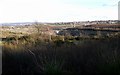
The above images may not be of the site on this page, they are loaded from Geograph.
Please Submit an Image of this site or go out and take one for us!
Click here to see more info for this site
Nearby sites
Key: Red: member's photo, Blue: 3rd party photo, Yellow: other image, Green: no photo - please go there and take one, Grey: site destroyed
Download sites to:
KML (Google Earth)
GPX (GPS waypoints)
CSV (Garmin/Navman)
CSV (Excel)
To unlock full downloads you need to sign up as a Contributory Member. Otherwise downloads are limited to 50 sites.
Turn off the page maps and other distractions
Nearby sites listing. In the following links * = Image available
892m ESE 117° Summerhill Cists* Cist (NZ176634)
1.9km WNW 303° Ryton Motte or Tumulus* Artificial Mound (NZ15176483)
2.0km W 281° Ryton 1 Rock Art (NZ1480064170)
2.1km W 262° The Ryton Stone Rock Art (NZ1475063500)
2.3km W 263° Ryton 2 Rock Art (NZ1450063500)
2.7km WNW 289° Ryton 3 Rock Art (NZ1420064700)
2.8km SW 222° Holy Well, Greenside* Holy Well or Sacred Spring (NZ14936170)
3.1km SE 129° Axwell Park Barrow* Round Barrow(s) (NZ19196188)
3.5km NW 326° Throckley Bank Portable Rock Art (NZ1482066670)
3.5km NW 326° Throckley Bank Top Rock Art (NZ1482866677)
3.6km SSE 153° Copers Wood earthwork, Winlaton Mill* Ancient Village or Settlement (NZ18456061)
3.6km SE 139° Dam Head enclosure Ancient Village or Settlement (NZ192611)
3.9km WNW 282° Simmery Hill Cist, Clara Vale* Cist (NZ13026462)
4.1km WSW 247° White Well, Greenside* Holy Well or Sacred Spring (NZ13036222)
4.3km SSE 153° Hollinside Farm 1 Rock Art (NZ1875260003)
4.3km N 350° Dewley Burn Artificial Mound (NZ1601868016)
4.3km W 262° Bradley Hall Dene Barrow Round Barrow(s) (NZ12536317)
4.5km NW 315° Hadrian's Wall (Heddon on the Wall)* Misc. Earthwork (NZ13616693)
4.6km W 264° Bradley Hall Ice House Barrow Round Barrow(s) (NZ12236333)
4.6km NW 312° St Andrew's Church (Heddon on the Wall)* Ancient Cross (NZ1338666892)
4.9km S 171° Lady Well, Gibside* Holy Well or Sacred Spring (NZ17575895)
5.0km N 352° Callerton Lane End cropmark Ancient Village or Settlement (NZ16106875)
5.1km S 172° Gibside Mound* Artificial Mound (NZ17515877)
5.3km WNW 302° Houghton Camp, Heddon on the Hill* Ancient Village or Settlement (NZ12246657)
5.7km E 89° Elswick Road Cist Cist (NZ225639)
View more nearby sites and additional images


 We would like to know more about this location. Please feel free to add a brief description and any relevant information in your own language.
 Wir möchten mehr über diese Stätte erfahren. Bitte zögern Sie nicht, eine kurze Beschreibung und relevante Informationen in Deutsch hinzuzufügen.
 Nous aimerions en savoir encore un peu sur les lieux. S'il vous plaît n'hesitez pas à ajouter une courte description et tous les renseignements pertinents dans votre propre langue.
 Quisieramos informarnos un poco más de las lugares. No dude en añadir una breve descripción y otros datos relevantes en su propio idioma.