<< Text Pages >> Stainton West - Ancient Mine, Quarry or other Industry in England in Cumbria
Submitted by Andy B on Thursday, 11 October 2018 Page Views: 1722
Multi-periodSite Name: Stainton WestCountry: England
NOTE: This site is 1.914 km away from the location you searched for.
County: Cumbria Type: Ancient Mine, Quarry or other Industry
Nearest Town: Carlisle
Map Ref: NY3759457137
Latitude: 54.905035N Longitude: 2.974792W
Condition:
| 5 | Perfect |
| 4 | Almost Perfect |
| 3 | Reasonable but with some damage |
| 2 | Ruined but still recognisable as an ancient site |
| 1 | Pretty much destroyed, possibly visible as crop marks |
| 0 | No data. |
| -1 | Completely destroyed |
| 5 | Superb |
| 4 | Good |
| 3 | Ordinary |
| 2 | Not Good |
| 1 | Awful |
| 0 | No data. |
| 5 | Can be driven to, probably with disabled access |
| 4 | Short walk on a footpath |
| 3 | Requiring a bit more of a walk |
| 2 | A long walk |
| 1 | In the middle of nowhere, a nightmare to find |
| 0 | No data. |
| 5 | co-ordinates taken by GPS or official recorded co-ordinates |
| 4 | co-ordinates scaled from a detailed map |
| 3 | co-ordinates scaled from a bad map |
| 2 | co-ordinates of the nearest village |
| 1 | co-ordinates of the nearest town |
| 0 | no data |
Internal Links:
External Links:
The Stainton West site, lying 2km north-west of Carlisle (NGR NY 37594 57137), comprised features and lithic scatters associated with a complex sequence of deposits within a palaeochannel, perched on an early Holocene terrace, above the present floodplain of the River Eden. The site was discovered by Oxford Archaeology North during construction work associated with building a new road and bridge over the Eden.
The earliest radiocarbon date from the terrace as a whole, a single assay of 8720–8450 cal BC (9320±40BP; SUERC-33917), is from residual charcoal within the primary fill of the ditch of a probable henge monument, approximately 150m to the north of the aforementioned channel. It is possible that this carbon indicates burning of vegetation or other activity by humans at thisearly time, although there was no clearly contemporary cultural material in close association with it.
In 2008-9, Oxford Archaeology North undertook the excavation of internationally significant prehistoric remains at Stainton West, near to Carlisle. There, archaeological features and a huge (>300,000 pieces), in situ, lithic assemblage, survived on a buried land surface adjacent to a palaeochannel of the River Eden. This appears to have been a ‘persistent place’, with human activity spanning c 6000-1400 cal BC. Hunter-gatherers made camp there from the beginning of this time and an extensive encampment, probably a place of seasonal aggregation, was occupied over several centuries in the mid-fifth millennium cal BC. In the Neolithic period and Bronze Age, the site seems to have played a rather different role, probably hosting votive activities rather than being a place of settlement.
More here: Stainton West by Fraser Brown, Oxford Archaeology North (PDF)
You may be viewing yesterday's version of this page. To see the most up to date information please register for a free account.
Do not use the above information on other web sites or publications without permission of the contributor.
Nearby Images from Geograph Britain and Ireland:
©2023(licence)
©2012(licence)
©2013(licence)
©2013(licence)
©2021(licence)
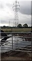
The above images may not be of the site on this page, they are loaded from Geograph.
Please Submit an Image of this site or go out and take one for us!
Click here to see more info for this site
Nearby sites
Key: Red: member's photo, Blue: 3rd party photo, Yellow: other image, Green: no photo - please go there and take one, Grey: site destroyed
Download sites to:
KML (Google Earth)
GPX (GPS waypoints)
CSV (Garmin/Navman)
CSV (Excel)
To unlock full downloads you need to sign up as a Contributory Member. Otherwise downloads are limited to 50 sites.
Turn off the page maps and other distractions
Nearby sites listing. In the following links * = Image available
2.1km ESE 102° Roman Bridge Remains (Bitts Park)* Ancient Trackway (NY3961056670)
2.2km E 98° Hyssop Holme Well (Carlisle)* Holy Well or Sacred Spring (NY3974856801)
2.4km ESE 114° Tullie House Museum* Museum (NY3978556106)
2.6km ESE 117° Carlisle Anglo Saxon Crosses* Ancient Cross (NY39885595)
2.6km WNW 301° St Andrew's Well (Kirkandrews-on-Eden)* Holy Well or Sacred Spring (NY35395851)
2.8km ESE 115° Carlisle Cross* Ancient Cross (NY4008455931)
2.8km E 90° Homeacres Holy Well (Stanwix)* Holy Well or Sacred Spring (NY40415709)
3.5km NW 307° St Mary's Motte (Beaumont)* Misc. Earthwork (NY3480459296)
4.8km NNW 338° Rockcliffe (Cumbria)* Ancient Cross (NY35896162)
6.3km NW 306° King Edward's Monument* Cairn (NY3257460920)
6.6km SSE 158° Tarn plantation* Stone Circle (NY4051)
6.9km SE 137° St Ninian's Well (Brisco)* Holy Well or Sacred Spring (NY42265201)
7.2km S 184° Chapel Flat Stone Circle (NY370500)
9.4km ESE 103° St Cuthbert's Holy Well* Holy Well or Sacred Spring (NY46735496)
9.5km ESE 106° Wetheral Village Cross* Ancient Cross (NY4665954370)
9.6km ESE 106° Anglo Saxon Cross Base, Wetheral Parish Church* Ancient Cross (NY46835436)
9.9km W 267° Finglandrigg Spa Well (Chalybeate)* Holy Well or Sacred Spring (NY2770956749)
10.0km E 83° Cardinal Well (Irthington) Holy Well or Sacred Spring (NY4755058220)
10.1km SE 143° St Mary's Well (Wreay)* Holy Well or Sacred Spring (NY4352548921)
10.5km SSW 199° St Michael's Well (Shawk)* Holy Well or Sacred Spring (NY3395047280)
10.5km N 1° Arthuret Church cross* Ancient Cross (NY37936766)
10.6km WSW 249° Fairy Well (Aikton)* Holy Well or Sacred Spring (NY27635340)
10.6km N 1° St Michael's Holy Well* Holy Well or Sacred Spring (NY3789967755)
10.7km SSW 200° Shawk Quarries Holy Well (Dalston) Holy Well or Sacred Spring (NY3380047100)
10.9km NW 324° Lochmaben Stane* Standing Stone (Menhir) (NY3123665983)
View more nearby sites and additional images


 We would like to know more about this location. Please feel free to add a brief description and any relevant information in your own language.
 Wir möchten mehr über diese Stätte erfahren. Bitte zögern Sie nicht, eine kurze Beschreibung und relevante Informationen in Deutsch hinzuzufügen.
 Nous aimerions en savoir encore un peu sur les lieux. S'il vous plaît n'hesitez pas à ajouter une courte description et tous les renseignements pertinents dans votre propre langue.
 Quisieramos informarnos un poco más de las lugares. No dude en añadir una breve descripción y otros datos relevantes en su propio idioma.