<< Text Pages >> Lintzford Wood Enclosure - Ancient Village or Settlement in England in Tyne and Wear
Submitted by durhamnature on Thursday, 23 August 2012 Page Views: 3366
Multi-periodSite Name: Lintzford Wood EnclosureCountry: England
NOTE: This site is 3.906 km away from the location you searched for.
County: Tyne and Wear Type: Ancient Village or Settlement
Nearest Town: Blaydon Nearest Village: Rowlands Gill
Map Ref: NZ148574
Latitude: 54.911094N Longitude: 1.770682W
Condition:
| 5 | Perfect |
| 4 | Almost Perfect |
| 3 | Reasonable but with some damage |
| 2 | Ruined but still recognisable as an ancient site |
| 1 | Pretty much destroyed, possibly visible as crop marks |
| 0 | No data. |
| -1 | Completely destroyed |
| 5 | Superb |
| 4 | Good |
| 3 | Ordinary |
| 2 | Not Good |
| 1 | Awful |
| 0 | No data. |
| 5 | Can be driven to, probably with disabled access |
| 4 | Short walk on a footpath |
| 3 | Requiring a bit more of a walk |
| 2 | A long walk |
| 1 | In the middle of nowhere, a nightmare to find |
| 0 | No data. |
| 5 | co-ordinates taken by GPS or official recorded co-ordinates |
| 4 | co-ordinates scaled from a detailed map |
| 3 | co-ordinates scaled from a bad map |
| 2 | co-ordinates of the nearest village |
| 1 | co-ordinates of the nearest town |
| 0 | no data |
Internal Links:
External Links:
Ancient Village or Settlement in Tyne and Wear
Tyne and Wear HER 639
Sub-rectangular enclosure, with surrounding ditch and possible internal hut circle.
The site would have controlled the important ford over the River Derwent, and the resources of the river, marshes and the large area of woodland now called Chopwell Wood.
This site has become increasing marshy in recent years, and the crop-marks are less clear.
You may be viewing yesterday's version of this page. To see the most up to date information please register for a free account.
Do not use the above information on other web sites or publications without permission of the contributor.
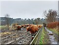
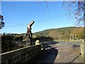
Nearby Images from Geograph Britain and Ireland:

©2019(licence)

©2024(licence)

©2011(licence)
©2024(licence)
©2019(licence)
The above images may not be of the site on this page, they are loaded from Geograph.
Please Submit an Image of this site or go out and take one for us!
Click here to see more info for this site
Nearby sites
Key: Red: member's photo, Blue: 3rd party photo, Yellow: other image, Green: no photo - please go there and take one, Grey: site destroyed
Download sites to:
KML (Google Earth)
GPX (GPS waypoints)
CSV (Garmin/Navman)
CSV (Excel)
To unlock full downloads you need to sign up as a Contributory Member. Otherwise downloads are limited to 50 sites.
Turn off the page maps and other distractions
Nearby sites listing. In the following links * = Image available
2.6km NW 306° Ceoppa's Barrow* Round Barrow(s) (NZ1270258908)
3.0km ENE 63° Gibside Mound* Artificial Mound (NZ17515877)
3.2km ENE 61° Lady Well, Gibside* Holy Well or Sacred Spring (NZ17575895)
4.3km N 2° Holy Well, Greenside* Holy Well or Sacred Spring (NZ14936170)
4.7km ENE 57° Hollinside Farm 1 Rock Art (NZ1875260003)
4.9km NE 49° Copers Wood earthwork, Winlaton Mill* Ancient Village or Settlement (NZ18456061)
5.1km NNW 340° White Well, Greenside* Holy Well or Sacred Spring (NZ13036222)
5.2km NW 320° North View enclosure* Ancient Village or Settlement (NZ114614)
5.7km NE 50° Dam Head enclosure Ancient Village or Settlement (NZ192611)
6.1km N 360° The Ryton Stone Rock Art (NZ1475063500)
6.1km N 357° Ryton 2 Rock Art (NZ1450063500)
6.2km NNW 339° Bradley Hall Dene Barrow Round Barrow(s) (NZ12536317)
6.3km NE 45° Axwell Park Barrow* Round Barrow(s) (NZ19196188)
6.5km NNW 337° Bradley Hall Ice House Barrow Round Barrow(s) (NZ12236333)
6.6km NNE 25° Summerhill Cists* Cist (NZ176634)
6.7km NNE 18° Stella enclosure Ancient Village or Settlement (NZ168638)
6.8km N 0° Ryton 1 Rock Art (NZ1480064170)
7.1km ENE 67° Marshall Lands enclosure Ancient Village or Settlement (NZ213602)
7.3km N 355° Ryton 3 Rock Art (NZ1420064700)
7.4km NNW 346° Simmery Hill Cist, Clara Vale* Cist (NZ13026462)
7.4km N 3° Ryton Motte or Tumulus* Artificial Mound (NZ15176483)
8.2km NW 317° Prudhoe Castle* Rock Art (NZ09186342)
8.5km E 79° Ravensworth enclosure Ancient Village or Settlement (NZ232590)
8.9km NW 315° Ovingham Cross* Ancient Cross (NZ08506370)
9.2km W 274° Castle Hill (Whittonstall)* Ancient Village or Settlement (NZ05585801)
View more nearby sites and additional images


 We would like to know more about this location. Please feel free to add a brief description and any relevant information in your own language.
 Wir möchten mehr über diese Stätte erfahren. Bitte zögern Sie nicht, eine kurze Beschreibung und relevante Informationen in Deutsch hinzuzufügen.
 Nous aimerions en savoir encore un peu sur les lieux. S'il vous plaît n'hesitez pas à ajouter une courte description et tous les renseignements pertinents dans votre propre langue.
 Quisieramos informarnos un poco más de las lugares. No dude en añadir una breve descripción y otros datos relevantes en su propio idioma.