<< Text Pages >> The Ull Stone - Natural Stone / Erratic / Other Natural Feature in England in Cumbria
Submitted by Anonymous on Saturday, 01 May 2021 Page Views: 772
Natural PlacesSite Name: The Ull Stone Alternative Name: UllsteininCountry: England
NOTE: This site is 1.277 km away from the location you searched for.
County: Cumbria Type: Natural Stone / Erratic / Other Natural Feature
Map Ref: NY455081
Latitude: 54.465333N Longitude: 2.842332W
Condition:
| 5 | Perfect |
| 4 | Almost Perfect |
| 3 | Reasonable but with some damage |
| 2 | Ruined but still recognisable as an ancient site |
| 1 | Pretty much destroyed, possibly visible as crop marks |
| 0 | No data. |
| -1 | Completely destroyed |
| 5 | Superb |
| 4 | Good |
| 3 | Ordinary |
| 2 | Not Good |
| 1 | Awful |
| 0 | No data. |
| 5 | Can be driven to, probably with disabled access |
| 4 | Short walk on a footpath |
| 3 | Requiring a bit more of a walk |
| 2 | A long walk |
| 1 | In the middle of nowhere, a nightmare to find |
| 0 | No data. |
| 5 | co-ordinates taken by GPS or official recorded co-ordinates |
| 4 | co-ordinates scaled from a detailed map |
| 3 | co-ordinates scaled from a bad map |
| 2 | co-ordinates of the nearest village |
| 1 | co-ordinates of the nearest town |
| 0 | no data |
Internal Links:
External Links:
Large erratic, named The Ull Stone. Presumably the name and site has some special significance, perhaps ancient. Ull is a name frequently found in North West England, sometimes the etymology is thought to mean 'wolf', from Norse ulfr, but in many cases the etymology suggests Ullr, the name of a Nordic deity.
According to some sources, Ullr was an earlier Norse God associated with agriculture, and it seems that Ullr was an important deity in England as much as in Scandinavia.
This erratic is very impressive in appearance, and worth the walk, even though the walk is rather long one.
The alternative name Ullsteinin is what the original Norse pronunciation likely was, pronounced "Ull-stayn-n".
You may be viewing yesterday's version of this page. To see the most up to date information please register for a free account.
Do not use the above information on other web sites or publications without permission of the contributor.
Nearby Images from Geograph Britain and Ireland:
©2015(licence)
©2010(licence)
©2012(licence)
©2010(licence)
©2013(licence)
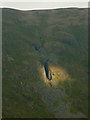
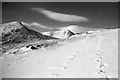
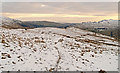
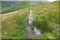
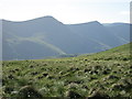
The above images may not be of the site on this page, they are loaded from Geograph.
Please Submit an Image of this site or go out and take one for us!
Click here to see more info for this site
Nearby sites
Key: Red: member's photo, Blue: 3rd party photo, Yellow: other image, Green: no photo - please go there and take one, Grey: site destroyed
Download sites to:
KML (Google Earth)
GPX (GPS waypoints)
CSV (Garmin/Navman)
CSV (Excel)
To unlock full downloads you need to sign up as a Contributory Member. Otherwise downloads are limited to 50 sites.
Turn off the page maps and other distractions
Nearby sites listing. In the following links * = Image available
2.7km NW 311° High Street Roman Road Ancient Trackway (NY43470988)
2.8km W 263° Troutbeck Park Round Cairn 4* Round Cairn (NY4274707790)
2.8km W 262° Troutbeck Park Round Cairn 3* Round Cairn (NY4273707734)
3.0km W 260° Troutbeck Park Round Cairn 2* Round Cairn (NY4250707632)
3.0km W 260° Troutbeck Park Round Cairn 1* Round Cairn (NY4248407616)
4.4km WSW 240° Hird Wood* Stone Circle (NY41630589)
4.9km NNE 16° Castle Crag Hillfort* Hillfort (NY4692412763)
5.3km W 275° The Kirkstone* Natural Stone / Erratic / Other Natural Feature (NY402086)
6.7km WNW 301° Dovedale enclosure* Ancient Village or Settlement (NY398116)
7.3km SSW 193° Hughill* Ancient Village or Settlement (NY4373900980)
8.5km E 82° Gray Bull* Natural Stone / Erratic / Other Natural Feature (NY5396209201)
8.5km WSW 247° The Armitt* Museum (NY376048)
8.6km NW 323° Beckstones Rock Art Ring Cairn (NY404150)
8.6km NW 322° Beckstones* Rock Art (NY403150)
8.7km NNE 19° Four Stones Cairn 3 Cairn (NY484163)
8.8km NNE 22° Four Stones Hill Standing Stones* Standing Stones (NY48951620)
8.8km WSW 256° Rydal Hall Cup Marks Rock Art (NY369061)
8.9km NNE 20° Four Stones Cairn 2 Cairn (NY486165)
9.0km NNE 23° Four Stones Hill Round Cairn* Round Cairn (NY4915016348)
9.3km NNE 21° Four Stones Cairn 1 Cairn (NY490167)
9.3km E 84° To Stone or to'ther* Natural Stone / Erratic / Other Natural Feature (NY5479208955)
9.4km SSW 197° Bannerrigg Possible Standing Stone* Standing Stone (Menhir) (SD426992)
9.4km NNE 29° Burnbanks Cairn* Cairn (NY502163)
9.5km WSW 240° Ambleside Roman Fort* Ancient Village or Settlement (NY37260339)
9.5km NE 55° White Raise Round Cairn B* Round Cairn (NY5342913450)
View more nearby sites and additional images


 We would like to know more about this location. Please feel free to add a brief description and any relevant information in your own language.
 Wir möchten mehr über diese Stätte erfahren. Bitte zögern Sie nicht, eine kurze Beschreibung und relevante Informationen in Deutsch hinzuzufügen.
 Nous aimerions en savoir encore un peu sur les lieux. S'il vous plaît n'hesitez pas à ajouter une courte description et tous les renseignements pertinents dans votre propre langue.
 Quisieramos informarnos un poco más de las lugares. No dude en añadir una breve descripción y otros datos relevantes en su propio idioma.