<< Our Photo Pages >> Lower Lough Erne Crannogs - Crannog in Ireland (Northern) in Co. Fermanagh
Submitted by jeffrep on Sunday, 09 August 2009 Page Views: 7969
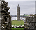
Iron Age and Later PrehistorySite Name: Lower Lough Erne CrannogsCountry: Ireland (Northern) County: Co. Fermanagh Type: Crannog
Nearest Town: Enniskillen
Map Ref: H224469
Latitude: 54.370280N Longitude: 7.656102W
Condition:
| 5 | Perfect |
| 4 | Almost Perfect |
| 3 | Reasonable but with some damage |
| 2 | Ruined but still recognisable as an ancient site |
| 1 | Pretty much destroyed, possibly visible as crop marks |
| 0 | No data. |
| -1 | Completely destroyed |
| 5 | Superb |
| 4 | Good |
| 3 | Ordinary |
| 2 | Not Good |
| 1 | Awful |
| 0 | No data. |
| 5 | Can be driven to, probably with disabled access |
| 4 | Short walk on a footpath |
| 3 | Requiring a bit more of a walk |
| 2 | A long walk |
| 1 | In the middle of nowhere, a nightmare to find |
| 0 | No data. |
| 5 | co-ordinates taken by GPS or official recorded co-ordinates |
| 4 | co-ordinates scaled from a detailed map |
| 3 | co-ordinates scaled from a bad map |
| 2 | co-ordinates of the nearest village |
| 1 | co-ordinates of the nearest town |
| 0 | no data |
Internal Links:
External Links:
I have visited· I would like to visit
jeffrep visited on 26th Apr 2009 - their rating: Cond: 4 Amb: 4
")
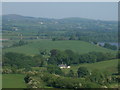
Today, crannogs typically appear as small, circular islands, 30 to 100 feet in diameter, and covered in trees and bushes because they are isolated from browsing livestock.
You may be viewing yesterday's version of this page. To see the most up to date information please register for a free account.
")
")
")
Do not use the above information on other web sites or publications without permission of the contributor.
Nearby Images from Geograph Britain and Ireland:
©2009(licence)
©2009(licence)
©2009(licence)
©2009(licence)
©2015(licence)
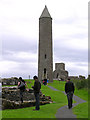
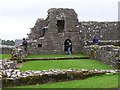
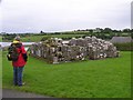
The above images may not be of the site on this page, they are loaded from Geograph.
Please Submit an Image of this site or go out and take one for us!
Click here to see more info for this site
Nearby sites
Click here to view sites on an interactive map of the areaKey: Red: member's photo, Blue: 3rd party photo, Yellow: other image, Green: no photo - please go there and take one, Grey: site destroyed
Download sites to:
KML (Google Earth)
GPX (GPS waypoints)
CSV (Garmin/Navman)
CSV (Excel)
To unlock full downloads you need to sign up as a Contributory Member. Otherwise downloads are limited to 50 sites.
Turn off the page maps and other distractions
Nearby sites listing. In the following links * = Image available
2.9km SE 124° Cherrymount Crannog* Crannog (H2478045300)
4.6km ENE 67° Breagho* Burial Chamber or Dolmen (H266487)
7.3km NNW 345° Killadeas Standing Stones (H205540)
7.7km ESE 105° Cavancarragh Multiple Stone Rows / Avenue (H299449)
7.7km ESE 105° Cavancarragh* Stone Circle (H299449)
8.1km W 269° Ross Lough Crannog (H14294677)
8.6km N 1° Cantytrindle Stone Row / Alignment (H225555)
8.6km E 96° Killee Stone Circle (H310460)
8.6km E 96° Mullyknock Stone Circle (H3146)
8.8km ESE 112° Mount drum 2* Wedge Tomb (H306436)
8.8km ESE 114° Mountdrum 3* Stone Circle (H305433)
8.9km ESE 113° Cavancarragh* Stone Row / Alignment (H306435)
9.0km ESE 115° Mount drum archaeological site* Stone Circle (H306431)
10.2km E 92° Ratoran Stone Row / Alignment
10.3km WSW 255° Reyfad Stones Stone Row / Alignment (H124442)
10.5km NE 54° Derryallen Stone Row / Alignment
10.6km E 95° Ratoran Stone Circle (H330460)
12.4km SSW 196° Greenan Stone Circle (H190350)
13.2km WSW 255° Aghanaglack Court Tomb (H096435)
14.0km NNW 340° White Island (Lower Lough Erne) Sculptured Stone (H175600)
14.5km ENE 66° Brougher Stone Circle (H356529)
14.5km ENE 66° Brougher Stone Row / Alignment (H356529)
14.5km ENE 72° Drumacken Stone Row / Alignment (H362515)
15.1km WNW 284° Rossinure More Court Tomb (H07715039)
15.2km NE 47° Castlemervyn* Stone Circle (H336573)
View more nearby sites and additional images


 We would like to know more about this location. Please feel free to add a brief description and any relevant information in your own language.
 Wir möchten mehr über diese Stätte erfahren. Bitte zögern Sie nicht, eine kurze Beschreibung und relevante Informationen in Deutsch hinzuzufügen.
 Nous aimerions en savoir encore un peu sur les lieux. S'il vous plaît n'hesitez pas à ajouter une courte description et tous les renseignements pertinents dans votre propre langue.
 Quisieramos informarnos un poco más de las lugares. No dude en añadir una breve descripción y otros datos relevantes en su propio idioma.